About Me

My photo
When? Started: 1993 Who? Started with staff and friends from U H S, Chester. Organiser: Martyn Harris We walk every Wednesday and Saturdays, New Years day and May Day. How many walk? Walks take place as long as there are at least 2 wanting to walk on that day. More walk on a Wednesday than on a Saturday. Most ever: 29. Current group size walking: 2-10 in mid-week and 2-4 on Saturday. Where do we walk? Saturday: Anywhere in North and Mid-Wales, Peak District, Shropshire and the Long Mynd and as far North as the Trough of Bowland. Thursday: Anywhere within about 40 miles of Chester. Type of walk: Distance: 6 – 14 miles (but usually under 10 miles). Climb: up to 4000’ (but usually very much less!). People involved on walks in 2020:- Martyn Harris, Fran Murphy, Sue and Michel Pelissier, Mike Dodd, David Savage, Wendy Peers, Celia de Mengle, Wendy and Ian Peers, Roger Smith, Paul Collinson, Ed Meads, Nigel and Elaine Taylor, Celia de Mengle, Sue Pearson.

Saturday 29 April 2023

Lower Gronant, Talacre, Point of Ayr and Little Terns 29th April 2023

Sand dune management or deliberate vandalism?
One Talacre getting ready for the 6th May, just like Fran!
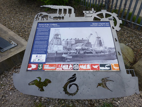
The first information board on our extension along the paths around the former Point of Ayr colliery site. 
A winding wheel from around the former Point of Ayr colliery.
Reminders of the around the former Point of Ayr colliery. 
Shingle fenced off at Pont of Ayr / Talacre, indicating that some of the Little terns have relocated.
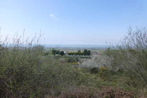
Looking west towards the Point of Ayr Lighthouse.
Mist rising over Presthaven Sands Beach.
Tried to get the call of a Cetti warbler, but had to do with a more persistent Sedge warbler!
Sedge warbler and a Grasshopper?
A Peackock enjoys a snack on a a flowering Butterfly Bush (Buddlieia).
Walk Stats:
Distance: 9.8 miles. Climb: 204'
Time: 4 hours 49 minutes. On the move walking average: 2.6 m.p.h.
Overall walk average: 2.0 m.p.h.
Temperature: At the start – 14.4 Celsius. At Lunch – 19.2 Celsius. At the end of walk – 14.5 Celsius
Beaufort Wind force: 0 – 2. Mainly calm, but occasionally managed to rise t a Light Breeze.
Group: Martyn and Ed.
The forecast today for the originally planned Moel Famau walk was not very good with the prospect of thunder and rain.
After a last minute rethink we decided on a walk from Lower Gronant as we knew of two options where we could have lunch under cover. In the end we didn’t need it, as we had bright sunshine for most of the day, and not even a hint of any rain.
The only unusual aspect of the weather was in the middle of the afternoon when a sort of mist that seemed to be rising up out towards the sea and seemed to be rolling in over the sands. Even so it was still misty over the inland hills and when we arrived at the old Little tern viewpoint Prestatyn couldn’t be seen..
Once again, we decided to complete the walk in the opposite direction to that which we usually do, but today, we missed out Prestatyn altogether!
Today the Spring flowers seen included: Ramson, Bluebell, Common daisy and May flower,
Birds seen or heard today included: Chiffchaff, Willow warbler, Mallard, Cetti warbler, Black billed magpie, Woodpigeon, Sedge warbler, Winter wren, Common blackbird, Little egret, Wheatear, Stonechat, Reed bunting, Skylark, Meadow pipit, Greenfinch, Canada goose, House sparrow, Barn swallow, Moorhen, Common coot, Mute swan, Little tern, Woodpigeon, Collared dove, Ring plover, Common pheasant and Carrion crow.
Lunch was taken along the path from the RSPB Hide to Talacre where we took advantage of one of the available picnic tables.
As expected there were lots of people on the beach from Talacre to Gronant, taking advantage of the pleasant warm sunshine. We even spotted some brave souls in swimming gear heading for the distance sea!
We had no rain, but arriving at the Blue Bell in Halkyn, the ground was pretty wet, suggesting that they had experience a fair bit of rain.
Overall a very enjoyable walk made all the better by being able to celebrate with a pint of Lees Bitter when I got home.




Wednesday 26 April 2023

Two Canals and Little Leigh From The Anderton Boat Lift 26th April 2023

The local guide instructs!
A pair of Mallards and their brood.
A Mallard family on the Weaver Navigation Canal.
A good display of Bluebells next to the Weaver Navigation Canal.
A pair of Mute swans at the nest in the reeds.
A Moorhen sitting on the nest in the reeds.
Elevenses!
One of the Grey herons seen today.
Walking next to a field of Oilseed rape.
St.  Michael and All Angels Church at Little Leigh.
Ducklings entertaining us on the Trent and Mersey Canal.
The same ducklings still entertaining.
 Are they trying to catch insects or are they going round in circles just for fun?
One of many Ramson flowers seen and smelled throughout the walk today.
The waiting game.
How many Buzzards, most counted five, but eagle-eyed Sue counted six!
Walk Stats:
Distance: 8.3 miles. Climb: 725’.
Time: 3 hours 45 minutes. On the move walking average: 2.5 m.p.h.
Overall walk average: 2.2 m.p.h.
Temperature: At the start – 10. 0 Celsius. At Lunch – 15.0 Celsius. At the end of walk – 14.0 Celsius
Beaufort Wind force: 0 – 1. Mainly calm, as we left our lunch spot the breeze was just about detectable.
Group: Martyn, Ed, Sue and Michel, David S, Fran and Nigel...
The forecast today was pretty good, although I think we did get more sunshine than was predicted. DS decided he would complete the walk in the opposite direction to that which we had done when MD led the walk post covid.
Today the Spring flowers showed well. These included: Ramson, Jack by the hedge, Bluebell, Lesser stitchwort, Wood anemone, Common daisy, May flower, Lesser celandine, Dandelion and Red campion,
Birds seen or heard today included: Blackcap, Great tit, Blue tit, Common chaffinch, Wood nuthatch, Chiffchaff, Willow warbler, Mallard, Cetti warbler, Pied wagtail, Great crested grebe, Eurasian jay, Black billed magpie, Woodpigeon, Sedge warbler, Winter wren, Common blackbird, Common buzzard, Grey heron, Barn swallow Great spotted woodpecker, Moorhen, Common coot and Carrion crow.
Lunch was taken next to the path, just before the Leigh Arms, where we sat on the steps leading to the Weaver Navigation from the local Rowing Club Boat House.
Overall a very enjoyable walk, worthy of visiting the Rake Hall at little Stanneyfor refreshments. There was a debate by some as to which beer was best, Weetwood’s Cheshire Cat or the Salopian’s Lemon Dream. Ed had no doubt - it was Titanic’s Chocolate Vanilla Porter!
DS and I didn’t even debate as to whether the coffee or tea was the better choice. Today, I think the coffee would have won!
Overall a very enjoyable walk made all the better by all of the flowers seen, especially the displays of Bluebells and Ramsons. The number of bird seen or heard today was quite impressive, but hearing several Cetti warblers was a bonus and it was a joy to see so many ducklings dashing across the surface of the water.


Saturday 22 April 2023

The Welsh Highland Railway With a Bit of Train Spotting 22nd April 2023

A section of the Bryngwyn Branch Line.
Coastal views from the Bryngwyn Branch Line. 
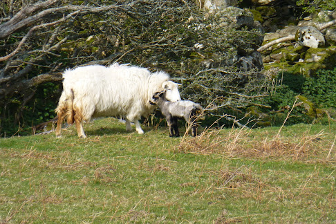
"Mum, why am I not white like all the others lambs?"
Rhostryfan Station, the start and end of both walk today.
The only Welsh Highland train of the day from Caernarfon goes through Tryfan Junction.
Bruce looks straigh at us!
Bruce on the move with commentry from EM.
Yr Eifl still in the mist.
An unexpected enticement for Ospreys to nest.
Four Spring flowers in one spot.
Bontnewydd Station, our lunch spot.
Train parts as we approached Dinas Station.
Old trains stock, but will they ever run again?
"Let's play trains!"
Dinas Station.
Coastal views from the Bryngwyn Branch Line again.
More info on Rhostryfan.Distance: 10.5 miles. Climb: 925’.
Distance: 10.5 miles. Climb: 925’.
Time: 4 hours 52 minutes. On the move walking average: 2.4 m.p.h. Overall walk average: 2.1 m.p.h.
Temperature: 1.5. Celsius at the start. 4.4 Celsius at lunch. Max – 5.5 Celsius mid-afternoon in the sunshine.
Beaufort Wind Force: Max - 2 (a gust of 5.5 m.p.h.) just a light breeze. Group: Martyn and Ed.Time: 4 hours 52 minutes. On the move walking average: 2.4 m.p.h. Overall walk average: 2.1 m.p.h.
Temperature: 10.5. Celsius at the start. 14.4 Celsius at lunch. Max – 15.5 Celsius mid-afternoon in the sunshine.
Beaufort Wind Force: Max - 2 (a gust of 5.5 m.p.h.) just a light breeze.
Group: Martyn and Ed.
This turned out to be a really good day for walking weather-wise, not too hot and not too cold and only six spots of rain at lunch as we sat in the warm sunshine at Bontnewydd Station.
Distant views were rather misty, but that didn’t stop us identifying the lighthouse on Ynys Llanddwyn on Ynys Mon, Yr Eifl on the Lleyn and Mynydd Mawr in Yr Eryri.
Although this walk didn’t offer a lot in terms variety, it did provide some different historical interest as the walk came close to the Welsh Highland Railway track and three of its stations.
Lunch was taken at Bontnewydd Station, where we took advantage of a seat made out of ld railway lines and sleepers.
This seemed to be an area where Lesser celandine, Stitchwort, Primroses, Dog violet and even Bluebells could all thrive.
Birds seen or heard today included: Common blackbird, Common chaffinch, European robin, winter wren, Woodpigeon, Black billed magpie, House sparrow, Chiffchaff, Willow warbler, Canada goose, Carrion crow, Rook, Wheatear, Jackdaw Blue tit, Great tit, Blackcap, Meadow pipit, Barn swallow and Common buzzard.
We arrived back at the car having had a very enjoyable walk, looking forward to suitable liquid refreshment when we were at home.


Thursday 20 April 2023

Walks and Dates April 2023


 The Monthy Shorter Walk followed by a meal will only be on the 5th Wednesday of a month.

Suggestions for all Wednesday Walks are always welcome.
Remember to let me know that you plan to walk so that it becomes easier to arrange car sharing. in addition it helps me to know how many route maps I need to bring and on special occasions how many pieces of fruit cake or treats will be needed.
Letting me know that you won't be walking is just as important otherwise I am left guessing as to how many maps to run off and invariably I end up printing too many!
Latest Information About Harris Hikers from 23rd March 2023
After much discussion between group members, those present decided to follow DS’s suggestion that “Short walks with an option of a meal at a nearby venue” should take place on the fifth Wednesday in a month, and members of the group would take it in turns to plan the walk and venue.
There are only four such Wednesdays in 2023.
March 30th, May 31st, August 30th and November 29th.
March 30th - Short Walk and Meal – Cancelled.
DS will plan a replacement walk for “Short Walk and Meal”, currently down for 26th April.
It was also agreed that Wednesday Walks should in the main be walks of around 8 miles with no more than about 1200’ of climb. If proposed walks exceed these suggestions routes should have obvious short cuts to reduce distance and / or climb involved.
It was also agreed that each month a different member of the group should plan the walk.
Which day in the month wasn’t agreed, but it would make sense that it should be the last Wednesday in the month and that would include the “Short Walk and Meal Option” on the fifth Wednesday in the month.
In order to include that walk in the monthly “Dates and Walks Post", details of the walk need to be sent to me by 15th of the previous month.
Wherever possible I would like people to let me know of their intention to walk or not to walk by Monday afternoon/early evening prior to the walk on Wednesday. There isn’t an issue with last minute cancellations for any reason. This happens anyway when adverse weather is forecast at the last minute.
This will enable me to provide the right number of maps/ descriptions, hence reducing unnecessary printing costs.
Where the “Short Walk and Meal” is concerned, the person planning the walk and meal should be contacted directly and informed of theirr intentions as soon as you have made your decision.

Saturday 1st April 2023.
Another Walk On Conwy Mountain.
Distance: 9-10 miles. Climb:1800' at a guess!
Start: Long stay car park on the B5106 at Conwy. Pay and Display. Grid ref:SH781773.
Leave Chester 08-30 a.m.
Those planning to walk: Martyn, Ed.
(Those not walking: Mike . )
This walk is taken from Carl Rogers's book "Walking in the Conwy Valley". Much of the routes as far as Conwy is the same as we have done on the last two occasions,. It goes through the harbour, follows riverside before passing the school and then climbing to Conwy Mountain along he North Wales path. The return route goes South towards Henryd. It is similar to a route we used many years ago, but appears to miss out much of the road walking.
Wednesday 5th April 2023.
Chirk - Offa's Dyke, A Canal Tunnel and maybe a Castle.
Walk Cancelled due to an horrendously wet weather forecast predicted for the whole of the day.
Distance: 9.0 miles. Climb: 800'.
Start: Chirk Centre Car Park. Grid ref: SJ291377. 
Leave Chester at 09-00 a.m.
Those planning to walk: Martyn, Sue and Michel (if his neck pain eases), Ed
(Those not walking: Mike, Fran, David S., Nigel, Wendy )
This walk is taken from Dave berry's booklet " Walks Around the Berwyns and The Ceiriog Valley". It is described as a walk of great variety and explores the attractive undulating countryside around Chirk. At times it follows the Offa's Dyke Footpath. Part of the route follows the Llangollen canal towpath and includes going through a short tunnel We may in fact go through a second tunnel. You may wish to bring a torch, but there is a handrail to guide you. This will be the second time that we have started a walk from Chirk.
Saturday 8th April 2023.
The Swallow Falls, Cyffty Mine and More.
Distance: 8 - 9 miles; Climb:1500'.
Start: Betws-y-coed Station (Long Stay) Car Park (Pay and Display £5-00?) Grid ref: SH792567
Leave Chester 08-30 a.m.
Those planning to walk: Martyn, Ed, Mike, Alexandra. 
(Those not walking: )
This walk uses part of a walk from Dave Berry's book "Walks Around Betws-y-coed and The Conwy Valley" with an extension takes us into part of the Gwydir Forest, with the return route following the Afon Llugwy riverside path from the Miners' Bridge  back to Betws-y-coed.
Wednesday 12th April 2023.
Moel Famau, Moel Dywyll and Moel Llys-y-coed.
Postponed too wet and too windy!
Distance: 8.0 miles. Climb: 1500'.
Start: Car park area West of Cilcain. Grid ref: SJ170652.
Leave Chester at 09-00 a.m.
Those planning to walk:
(Those not walking: Martyn, Phil, Mike, Wendy, David S, Sue and Michel, Fran )
To get to the parking area, at the crossroads in Cilcain turn right (Westward), past the White Horse, Church and Village hall, at the end of a few houses on the right turn, left and the parking area is a few hundred yards further on on the right. 
This walk is a repeat of the walk posted on the 14th August 2020. Only three of us started the walk, but none of us completed the walk as originally planned. This walk includes three hills along Offa's Dyke Footpath - Moel Famau, Moel Dywyll and Moel Llys-y-coed. Although Moel Llys-y-coed  is not one of my favourite hills in the Clwydian range especially its ascent from  from North to South, on this occasion I will bite the bullet this way. 
 On a good clear day we should get excellent views in all directions.
Saturday 15th April 2023.
Beyond the Ro and Moel Fferna
Posponed.
See below for replacement walk.
Distance: 9-10 mile. Climb:1500'.
Start: Lay-by next to The Butterfly Man and Craft Centre on the A5. Grid ref: SJ1586942449.
Leave Chester 09-00 a.m.
Those planning to walk: Martyn, .
(Those not walking: Mike )
This walk combines one of the walks from Dave Berry's book "Walks Around Llangollen and the Dee Valley" with an extension to the summit of Moel Ferna (weather permitting). We will decide the return route on the day. We have visited Moel Ferna in all sorts of conditions, some good, some not so good, hopefully it will be a good one this time.
Replacement Walk Saturday 15t April 2023.
Gwydir Forest from Llanwrst.
Distance: 8-9 miles. Climb: 1800'.
Leave Chester at 08-30 a.m.
Start: 
Plas yn Dre,Riverside car Park, Llanrwst . Grid ref: SH795617.
Those planning to walk: Martyn, Ed .
(Those not walking: Mike )
The walk is taken from Carl Roger's book "Walking in the Conwy Valley. It is described as a
moderately strenuous route exploring the Eastern sectrions of the forest with its many lakes.
It follows mainly good forest tracks and paths.  Last we did this walk Ed persuaded me explore one or two off piste paths!

Wednesday 19th April 2023.
Ffrith Mountain and the Alyn Gorge.
Distance: 9 miles. Climb: 1010'.
Start: Lay-by on the Cadole to the Pantymwyn road. Grid ref: SJ205627. Approaching Loggerheads on the A494, Mold to Ruthin Road and after passing the former Rainbow Inn (now a smalll new housing estate), take the next road on the right just before the newsagent. The lay-by is almost immediately on the right by the telephone kiosk.
Leave Chester: 09-00 a.m.
Those planning to walk: Martyn, Ed. Nigel, Fran, Sue and Michel 
(Those not walking: Mike, David S, Wendy )
This walk is taken from Dave Berry's Book " More Walks in the Clwydian Hills" He describes it as an excellent walk exploring beautiful valleys and foothills. We usually start at Loggerheads, but as it is £5 to park for more than 4 hours we will start up the road in Cadole.
Saturday 22nd April 2023.
The Welsh Highland Railway and Bryngwyn Branch Line.
Distance: 9-10 miles. Climb: 925''.
Leave Chester at 08-30 a.m.
Start: Rhostryfan Old Station Car Park
 . Grid ref: SH498579.
Those planning to walk: Martyn, Ed.
(Those not walking: Mike )
This walk combines two walks by Dave Berry, "The welsh Highland Railway" and the "Bryngwyn Branch Line", both of which start at 
Rhostryfan Old Station Car Park.
As much of the walk follows close to the railway track or along the a dissused track bed, the climb is quite gentle.
On a clear day there should be good views of the coast towards the Lleyn Peninuslar and Anglesey as well as some of the nearby mountains of Eryri.
At this time of the year there is a good chance of hearing some of the Spring migrant birds like Chiffchaff and Willow warbers. 
Spring flowers should be blooming as well.
Some field paths can be muddy and there is a fair bit of roadwalking along manly quiet country lanes.
Wednesday 26th April 2023.
A Great Barrow and Plemstall Walk
and Meal at The Stamford Bridge Inn.
Cancelled
See below for the Replacement Walk.
Distance: 6.5 miles. Climb: 250'.
Start: Stamford Bridge Inn Car Park, Tarvin Road, Chester Grid ref: SJ467673
Leave Chester 09-00 ready to start the walk at 09-30.
Those planning to walk: Martyn, .
(Those not walking: Mike. )

The walk is described as a moderate walk exploring two contrasting villages, one on a hilltop and the other in the lonly valley of the River Gowy.
Expect wet grass and muddy sections and after prolonged rain some of the low lying meadows may be flooded.
If we have had a prolonged rainy spell, I will replace the walk with an alternative  "Tarvin and The Roman Bridges" a slightly shorter walk (5.5 miles).
Both walks have been taken from the Stamford Bridge Web site.
Replacement Walk 26th April 2023
A Two Canal Walk from Anderton Lift
Distance: 8-9 miles, Climb: < 400ft
Based on 7th April 2021 walk led by Mike Dodd and Upton Trekers 17th July 2021
Start; Anderton Boat Museum Car Park, Lift Lane, Anderton - CW9 6FW - SJ646754. Pay & Display - Ticket on foot
Leave Chester 09-00.
Those planning to walk: Martyn, Ed, Sue and Michel,David S, Nigel, Fran 
(Those not walking: Mike, Wendy . )
Access via M56 J10, A559, Gib Hill and Comberbach due to long term closure of Soot Hill
From the Anderton lift descend to Winnington Swing Bridge and take the Weaver Navigation tow path downstream almost to Acton Swing Bridge. Here go right and up a slight rise to gain the Trent & Mersey Canal at Bridge 208. Go right along the tow path to Bridge 207 where go off left to reach Little Leigh. Suggested lunch break in the village. Leave Little Leigh on a path which leads back to the Trent & Mersey at Bridge 204. Continue left along the tow path and negotiate two tunnels by walking over the top. The descent from the top of Barnton Tunnel and another mile of tow path leads back to the car park.
Saturday 29th April 2023.
Moel Famau, Moel Dywyll and Moel Llys-y-coed.
Distance: 8.0 miles. Climb: 1500'.
Start: Car park area West of Cilcain. Grid ref: SJ170652.
Leave Chester at 09-00 a.m.
Those planning to walk: Martyn
(Those not walking:  Mike,  )
To get to the parking area, at the crossroads in Cilcain turn right (Westward), past the White Horse, Church and Village hall, at the end of a few houses on the right turn, left and the parking area is a few hundred yards further on on the right. 
This walk is a repeat of the walk posted on the 14th August 2020. Only three of us started the walk, but none of us completed the walk as originally planned. This walk includes three hills along Offa's Dyke Footpath - Moel Famau, Moel Dywyll and Moel Llys-y-coed. Although Moel Llys-y-coed  is not one of my favourite hills in the Clwydian range especially its ascent from  from North to South, on this occasion I will bite the bullet this way. 
 On a good clear day we should get excellent views in all directions.

Wednesday 19 April 2023

Ffrith Mountain and The Alyn Gorge 19th April 2023

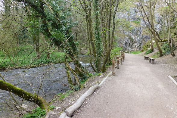
Near the start of our walk along the Leete path in the Alyn Gorge.
The Leete path in the Alyn Gorge.
 Strolling along the Leete path in the Alyn Gorge.
Strolling along the Leete path in the Alyn Gorge.
Bluebells just coming into bloom.
Wood anenome in flower next to the Pentre Cilcain path.
Time for a elevenses!
Primroses in the hedgerow.
"What are we suppose to be looking at?"
"We're not all sheep in Wales you know!"
The Cholomendy Outdoor Centre from Brithdir Mawr.
A warning about aboat tree cutting about to beging in May for eght weeks.
A few of the many lambs seen today.
Daffodils still blooming in the hedgerow west of Loggerheads Country Park.
Everyone loves a donkey!
This one nibbles on a fallen tree in a field near to the Loggerheads Country Park.
Walk Stats:
Distance: 9.3 miles. Climb: 978’.
Time: 4 hours 51 minutes. On the move walking average: 2.2 m.p.h.
Overall walk average: 1.9 m.p.h.
Temperature: At the start – 10. 5 Celsius. At Lunch – 11.3 Celsius. At the end of walk – 12.2 Celsius
Beaufort Wind force: 0 – 3. Mainly calm as we were sheltered from any wind, very occasionally rising to light air / light breeze and on two occasions gusted to a gentle breeze...
Group: Martyn, Sue and Michel, Fran, Nigel and Ed.
The biggest surprise today was that everyone arrived to the start before Ed, but we still set off well before 10-00!
The forecast today was pretty accurate, largely overcast with the easterly wing making it feel a little bit on the cool side. In reality this made almost the perfect weather for walking, no chance of overheating – I didn’t really need to change my shirt at lunch time and only used one handkerchief throughout the walk.
As a change and because we had been reminded we had done this walk only a few months ago, I decided we would complete the walk in the opposite direction.
As you would expect we saw most people on the section near the Loggerheads Country Park Visitor Centre as we headed along the Leete Path.
Today the Spring flowers showed well. These included: Dog violet, Jack by the hedge, Bluebell, Primrose, Stitchwort, Wood anemone, Ramson (just showing buds), Dandelion and Daffodil.
Birds seen or heard today included: Blackcap, Great tit, Blue tit, Common chaffinch, Wood nuthatch, Chiffchaff, Willow warbler, Mallard, Common pheasant, Red grouse, Winter wren, Common blackbird, Woodpigeon, Common buzzard and Carrion crow.
Lunch was taken next to the path, south west of Ffrith Mountain, where an old field boundary provided suitable resting places.
Just as we were about to leave after lunch, we were entertained by a Common buzzard being harassed by a Carrion crow.
Distant views weren’t that good, but we could still make out the top of Moel Famau from several points on the walk.
Overall a very enjoyable walk, worthy of visiting the Glasfryn for refreshments. Brimstage Elderflower IPA and Hawkshead Porter went down well, but unfortunately a problem with the water supply meant that they couldn’t brew a cup of tea!