About Me

My photo
When? Started: 1993 Who? Started with staff and friends from U H S, Chester. Organiser: Martyn Harris We walk every Wednesday and Saturdays, New Years day and May Day. How many walk? Walks take place as long as there are at least 2 wanting to walk on that day. More walk on a Wednesday than on a Saturday. Most ever: 29. Current group size walking: 2-10 in mid-week and 2-4 on Saturday. Where do we walk? Saturday: Anywhere in North and Mid-Wales, Peak District, Shropshire and the Long Mynd and as far North as the Trough of Bowland. Thursday: Anywhere within about 40 miles of Chester. Type of walk: Distance: 6 – 14 miles (but usually under 10 miles). Climb: up to 4000’ (but usually very much less!). People involved on walks in 2020:- Martyn Harris, Fran Murphy, Sue and Michel Pelissier, Mike Dodd, David Savage, Wendy Peers, Celia de Mengle, Wendy and Ian Peers, Roger Smith, Paul Collinson, Ed Meads, Nigel and Elaine Taylor, Celia de Mengle, Sue Pearson.

Wednesday 30 November 2022

A Cadole, Pantymwyn, Pont Newydd and Leete Round 30th November 2022

Into the woods not long after setting off from Cadole.
At the view point, but too misty today.
On the way to Pantymwyn.
Autumn leaves on the trees next to The Leete.
Walking along The Leete.
Autumn colours west of The Leete.
The Afon Alyn from The Leete.
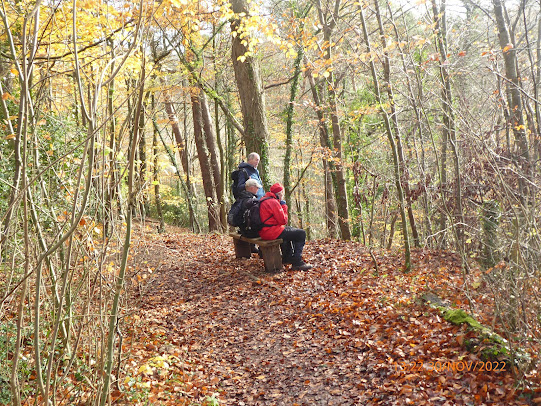
Some had time for a rest after climbing the steps on the way from Loggerheads to the Loggerheads Monument.
Walk Stats: 
Distance: 5.3 miles. Climb: 423'.
Time: 2 hours 15 minutes. On the move walking average: 2.4 m.p.h. Overall walk average: 2.3 m.p.h.
Temperature: 3.5 - 4.7 Celsius.
Beaufort Wind Force: 1 Light air at most.
Group: Martyn, Paul, Wendy, David S, Nigel and Elaine, Mike completed the short walk.
Glasfryn diners: Martyn, Wendy, David S, Nigel and Elaine, Mike, Sue and Dave P and Celia. 
A little on the cool side, but with no noticable wind, it never felt too cold.
The initial climb alongside the Cefn Mawr Quarry was a little tricky with the wet leaves on the limestone making it feel slippy in places. Thankfully we all avoided any mishaps and it wasn't long before we were down to the main track and lane to Pantymwyn.
Ther was plenty of traffic on the Pantymwyn to Pont Newydd Road, but it wasn't long before we could escape onto The Leete Path.
Walking along The Leete Path is always enjoyable, but today it was a choicebetween vivid Autumnal colours on the trees nearby or the impressive flow of Afon Alyn below us the vied for the star display of the walk.
Birds seen or heard today included: European robin Common blackbird, Wood nuthatch, House sparrow and Woodpigeon.
We all enjoyed the walk, and even more enjoyed the meal and drinks at The Glasfryn afterwards.


 

Monday 28 November 2022

Harris Hikers Walks and Dates November 2022

 A Shorter Walk each month.
Some of group's regular walkers have suggested that it would be a good idea to include one walk each month that is shorter (5 - 6 miles) that might tempt anyone put off by a 10 mile walk, to joins us. 
These walks will be on the last Wednesday each month.
I am happy to receive suggestions for suitable short walks, particularly if they free from stiles.

All Covid Restrictions in Wales have been lifted,  so it is no longer the law to wear face coverings in any situation, although you may feel more comfortable in some situations to do so.  I will still have my face covering with me, you may wish to do the same.

 Although it is no longer a law, you may also want to use them in places like as Public Conveniences (PCs), shops or on Public transort.

When car sharing you may also want to continue to wear face coverings.

Remember to let me know that you plan to walk so that it becomes easier to arrange car sharing. in addition it helps me to know how many route maps I need to bring and on special occasions how many pieces of fruit cake will be needed.

Wednesday 2nd November 2022.
Foel Fenlli and Cwm Blaenant.
Distance: 6-7 miles.
Climb: 1524'
Start: Bwlch Penbarras car park (Pay and display - cash works better than cards).
Grid ref:SJ162606.
Leave Chester at 09-00 a,.m.
Those planning to walk: Martyn,  (I will need a lift) Sue and Michel, Nigel, Mike, Wendy, Fran .
(Those not walking: Ed, David S)
This walk is taken from Dave Berry's booklet "Walks on the Clwydian Hills". It is described as an interesting walk, visiting an impressive iron-age hill-fort. Sections mender along the Offa's Dyke footpath as far as the Clwyd Gate. The return route will take us through little known Western fringes of the Clwydian Hills. It includes attractive woodland paths  and explores a delightful hidden valley. Most of the walk is along clear paths with excellent views throughout.
 The walk is nominally shorter than usual, but the last time we completed this walk it was in August 2017, and we didn't bother with any extension, admittedly the weather wasn't good! However if the group are keen to extend the walk, it will be easy to do so. This is a decision we can leave until we get back to the cars if need be. There are plenty of tracks through the forest at Moel Famau Country Park to create a loop of whatever length we want.
Saturday 5th November 2022.
World's End from the Ponderosa.
Postponened - now on Saturday 19th November 2022
Distance: 9 miles. Climb: 1600'.
Start: Car parking area opposite the Ponderosa Cafe. Grid ref: SJ192480.
Leave Chester at 09-00 a.m.
Those planning to walk: Martyn,  (I will need a lift) .
(Those not walking: Ed)
This walk is taken from Dave Berry's book " Walks Around Ruabon Mountain, the Clywedog Valley and Hope Mountain." This is described as an exhilarating walk of great variety, on good upland paths and tracks with panoramic viewscapes.
Wednesday 9th November 2022.
Cwm Conwy, Castle Wood and Moel Y Gaer.
Distance:7 - 10 miles. Climb: 1200'.
Start: Rhosesmor. Parking area next to the children's play area. Grid ref:SJ214684.
Leave Chester at 9-00 a.m.
Those planning to walk: Martyn,  (I will need a lift), Sue and Michel, Ed.
(Those not walking: David S, Nigel, Wendy )
This walk is based on a walk  from Dave Berry's book "Walks Around Holywell and Halkyn Mountain".  The Cwm Conwy walk is one of my favourite walks in the Halkyn area at any time of the year. The extension continues the walk as far as the old cemetry at Halkyn, but any additional extension would need to include Halkyn Mountain itself - not to everyone taste! 
Saturday 12th November 2022.
Vivod Mountain.
This walk will probably be postponed.
Distance: 9.2 miles. Climb;1250' .
Start: Roadside parking at Glyn Ceiriog. SJ202378. As it is a Saturday, it may be possible to park near the school. Grid ref: SJ202378.  . Post Code: LL20 7ER
Leave Chester at 08-30 a.m.
Those planning to walk: Martyn,  (I will need a lift) , Ed.
(Those not walking: Mike)
This walk is taken from Dave Berry's booklet "Walks Around the Berwyn Mountains and the Ceiriog Valley".This explores the the high heather moorland ridge north west of Glyn Ceiriog. The walk follows a path around the western flank of Y Foel before joining the North Berwyn Way to the top of Vivod Mountain. The return route includes paths through the Ceiriog Forest (Nantyr Forest). at the highest point of the walk we should get 360 degree viewsi ncluding the Shropshire Hills, the Berwyns, Snowdonia and the Clwydian Hills.
Wednesday 16th November 2017.
Wat's Dyke, Brynford, St., Bueno's Well and St., Winifride's Well and More.
Distance: 8-10 miles. Climb: 1000'.
Start: Bryn Celyn Car Park, Holywell. Grid ref: SJ189769. This a free car park on the B5121 on the Hoywell to Greenfield Road. The car park is on the right after the pub an the Bryn Celyn sign.
Leave Chester at 09-00 a.m.
Those planning to walk: Martyn,  (I will need a lift) , Ed, MikeWendy?, Fran?.
(Those not walking: Sue and Michel, Nigel, David S)
This is another figure of eight walk made by combining two walks and maybe three walks from Ron Williams and Elfed Jones's booklet "10 walks Around Holywell".
One walk explores the countryside between Holywell and Brynford. The other walks around the Greenfield Valley, will hopefully lead us to find the location of St., Bueno's Well again.
Saturday 19th November 2022.
The Little Orme and Bryn Euryn. 
Postponed - see below for new walk.
Distance: 8 miles Climb: 800'.
Roadside parking
Leave Chester at 08-30. Roadside parking next to Paddling Pool and PC on Coast Road at Craig y Don, East side of Llandudno. Grid ref: SH799821.
It may be a little early, but there is a chance that we will be able to see seals i Porth Dyniewaid.
Those planning to walk: Martyn,  (I will need a lift) .
(Those not walking: )
After the Little Orme we head along the coast. High tide is at about 07-00, so we will probably be able to walk alog the beach towards Rhos-on-Sea. After climbing out of Rhos-on-Sea to Bryn Euryn. On a clear day we should get good views from the top of Bryn Euryn to compliment those we get from the Little Orme. The return route to the start is largely along quiet lanes.
World's End from the Ponderosa.
Start: Car parking area opposite the Ponderosa Cafe. Grid ref: SJ192480.
Leave Chester at 09-00 a.m.
Those planning to walk: Martyn, Mike (I will need a lift)  Mike, Ed .
(Those not walking: )
This walk is taken from Dave Berry's book " Walks Around Ruabon Mountain, the Clywedog Valley and Hope Mountain." This is described as an exhilarating walk of great variety, on good upland paths and tracks with panoramic viewscapes.
Wednesday 23rd November 2021.
Coed-y-Felin, Moel Ffagnalt and Moel-y-Gaer.
Distance: 9-10 miles. Climb: 1400'.
Start: Coed-y-Felin, Hendre. Grid ref: SJ196678.
Leave Chester at 09-00.
Those planning to walk: Martyn (I will need a lift),  Ed, Nigel .
(Those not walking: Mike, David S, Wendy Sue and Michel)
This walk combines two walks taken from Dave Berry's booklet " Walks Around Holywell and Halkyn Mountain.
The last time we did this walk from Coed-y-Felin, we all enjoyed it. The main walk explores the varied countryide between the Wheeler Valley and and Halkyn Mountain (although the walk never gets to Halkyn Mountain, you do just see it in the distance!), whilst the extensions explores Moel Ffagnalt and the area around Rhes-y-cae.Weather pemitting we can expect good views from both Moel Ffagnallt and Moel-y-Gaer.
Saturday 26th November 2022.
The Ceiriog Trail East of Pontricket.
Postponed -  new walk will be arranged later in the week.
Distance: 8.5 miles. Climb: 1100'.
Start: The Pontricket Layby on the B4500 , about 3 miles South of Glyn Ceiriog. Grid ref: SJ186343.
Leave Chester at 09-00.
Those planning to walk: Martyn,  
(Those not walking: )
This is a variation of the walk we did in September, but includes much more of the Llwybr Ceiriog Trail and visits the Pen-y-Gwely Reservoir. We may also be able to explore paths that avoid having to descend the steep unpleasant bridleway from Cefn-y-braich-uchaf with its concrete enclosed drainage pipes.
Wednesday 30th November 2022.
This month's short walk.
A Cadole, Pantymwyn. Pont Newydd and Leete Round.
Distance: 5 - 6 miles. Climb: 1100'.
Start; Layby on the Cadole to Gwernaffield Road. Grid ref: SJ2052 6270.
Leave Chester at 09-30.
Those planning to walk: Martyn, Wendy, David S. Mike, Nigel and Elaine, Paul, (Sue and Dave Pearson and Celia will join us at the Glasfryn). 
I have booked a table for 12-45.
(Those not walking: Ed Fran, Sue and Michel)
David S has suggested that we go to the Glasfryn for lunch, so make sure everyone in the car you go in is doing the same thing.
Going for lunch after the short monthly walk is likely to be the norm as long as a suitable venue near to the walk can be found.
This walk heads northward, initially on woodland path, takes a climbing path below Cefn Mawr Quarry, eventually heading northward again to a minor road. The minor road bleads us to Pont Newydd and eventually to the Pantywyn / Cilcain Road which is followed downhill to the start of the Leete Path. The Leete Path is followed back to Loggerheads.
The 5 mile walk then takes the road back to the start.
To extend the walk by a mile or so, we will cross the A494 and take the Clwydian Way as far as the Colomendy Outdoor Centre. Here a the path heading eastward is followed towards Gwernymynydd. we folllow the path as far as the former Rainbow Inn site, now a new small housing estate. The A494 road is the followed back to Cadole.

Saturday 26 November 2022

A Llanrwst Walk in the Rain Road Testing a Shower Cap 26th November 2022

Looking back towards the Gower Footbridge at Llanrwst.
Looking over the Afon Conwy towards Llanrwst.
"Where do we go next?"
This was the answer - Llanrhychwyn.
Lunch time at Llanrhychwyn.
The northward as we left Llanrhychwyn.
The best views of Snowdinai today as we approchedCastell y Gwynt.
Also the strongest wind we experienced (16.7 m.p.h,)
Hafna Mines.
Looking northward over the Afon Conwy  towards Llanrwst.
Evidence of the felling in process throughout the Gwydyr Forest.
Distance: 10.3 miles. Climb: 1775' (wind assisted GPS readings).
Time: 4 hours 44 minutes.  On the move walking average: 2.4 m.p.h. Overall walk average: 2.0 m.p.h.
Temperature: 9.2 Celsius - 12.5 Celsius.
Beaufort Wind Force: 2 - 4. Mainly a gentle breeze, occasionally gusting to a moderate breeze.
Group: Martyn, Mike and Ed.
A later than usual start today, as Mike had to take his car to the garage and we ended up waiting while the mechanic sorted it out there and then. We ended up leaving Mike's at about 09-20.
The forecast for today wasn't good, light rain pretty well all day - they weren't wrong! A good test for the shower cap!
In never felt cold, even on the most exposed parts of the walk, but finding a suitable place for lunch was limited to one - Llanrhychwyn where we sheltered in the lychgate.
At this point we had only done about 3 miles, but it was the right choice.
Much of the return route from Llyn Glangors was on forest roads and occasionally paths where we were sheltered from the worst of the winds.  Lots of trees had been felled in the Gwydyr Forest, but this opened up the roads, making it feel less enclosed and a more pleasant route.
We arrived back at the cars with light rain still falling, but managed to change out of our wert gear under the canopy by the library.
Birds seen or heard today included: Mallard, Common blackbird, European robin, Black billed magpie, Eurasian jay, Winter wren and Mistle thrush.
We went to the Tal-y-Cafn for after walk drinks, Purple Moose's Snowdonia Ale was on offer, but alas we had to send it back as it was undrinkable and I ended up having a £4-00 pint of coca cola - it will be some time before we go back!
Now you can see the purpose of road testing the shower cap.


Wednesday 23 November 2022

Coed-y-Felin, Moel Ffagnallt and Moel-y-Crio 3rd November 2023

A nice new notice at the start of our walk.
The path through Coed-y-Felin.
One fallen tree in Coed-y-Felin. two went under, two went round, neither were good unless you coulda limbo dance!
It wouldn't be a proper walk in Flintshire if you did see Moel Famau somewhere on route!
The Clwydian Hills from Moel Famaur to Moel y Parc from the road near Cilcain Hall.
Enjoying the Sun on Moel Ffagnallt.
Our route to Moel-y-Crio seen in the distance.
The climb towards Moel-y-Crio with Rhes-y-cae in the background.
Exploring a new path into Coed-y-Felin.
Enjoying a paddle!
Autumnal colours in Coed-y-Felin.
More Autumnal colours in Coed-y-Felin.
Walk stats:
Distance: 8.0 miles. Climb: 1382' (Wind assisted GPS reading, a little on the high side!).
Time: 4 hours 0 minutes. On the move walking average: 2.4 m.p.h. Overall wal average: 2.0 m.p.h.
Temperature: 7.7 Celsius (although it did feel cooer in the wind) - 11.2 Celsius (When sheltered and in the Sun).
Beaufort Wind Force: mainly 2 (a light breeze), but did gust to 4 (a moderate breeze od 16.1 m.p.h.)
Group: Martyn, Fran, Nigel and Ed.
Both the BBC and the Met Office weather forecast today were spot on, bright and sunny to mid-day, an hour of rain, sunny again for an hour and then rain.
At the start of the walk on the west side of Hendre Quarry, boot brushes had been installed, which we took advantage of at the start and end of the walk, which meant cleaning boots when we arrived at home only need a quick wash to ensure that the boot treads were all clean.
We explored two new paths through Coed-y-Felin, one at the start and the other that linked the road (on the wst side of Hendre Quarry) to the woodland.
The start of the walk through Coedy-Felin was along a pleasant woodland track, eventually emerging onto the roadsouth east of Cilcain Hall. It was here that we had superb views of the Clwydian Hill in bright sunshine and blue skies.
It was still  blue skies and sunshine when we arrived at the top of Moel Ffagnallt, but we could see that rain was falling on Moel Famau and it was heading our way! 
Although it was now lunch time, we couldn't find a sheltered spot, so we decided to battle on through the rain, missing out Moel y Gaer. It continued to rain, and only stopped as we approached the road on the west side of Hendre Quarry after we had ovecome the challenge of the flooded road (which Ed had already been through in his car having been diverted by the closure on the Denbigh to Mold road).
Ed remembere that we had past picnic tables in Coed-y-Felin, and suggested we should head there for lunch.
This we did, a plastic picnic table that dried quickly after we brushed away the leaves, that provided a pleasant lunch spyt in the Sun.
We heard from a local dog walker that this was a good spot for seeing a Little owl. We didn't see one, although we did hear some unual bird calls that were somewhat owl like.
Birds seen or heard today were very few, but included: Common blackbird, Common buzzard and Carrion crow.
As we arrived back at the cars, it started to rain quite heavily again, so we decide to head straight for home rather than head for refreshment at a local hostelry.
Whisky in my tea for me when I got home - this was he third week running that we had missed out on our usual traditional visit to the Blue Bell or other local.

Saturday 19 November 2022

World's End and Cyrn-y-Brain from the Ponderosa 19th November 2022

The start of the walk today.
Descending the Clwydian Way towards World's End.
Limestone Escarpments above World's End.
Lookin back towards the ford at World's End.
The view down the Eglwyse Valley from the Llandegla / Minera Road.

The open Llandwegla Moorland that we crossed on our way to the Watkin's Tower.
A brief encounter with Offa's Dyke across the moors towards Llandegla.
At the Cyrn-y-Brain trig point with the Watkin's Tower to the right.
At the Cyrn-y-Brain trig point.
Mike leaving the cairn (now a shelter) near the Wireless Station.
A last slook at the Esglwyseg Escarpments.
The Ponderosa still looks a long way away!
No comment!
Walk stats:
Distance: 9.3 miles. Climb: 1739'.
Time: 5 hours 3 minutes. On th move walking average: 2.3 m.p.h Overall walk average: 1.8 m.p.h.
Temperature: 9.8 Celsius at th start, although it felt coolder. Max - 14.0 Celsius in the sunshine on the CLwydian Way. 12.8 Celsius in the sunshine at lunch. Minimum - 5.5 Celsius in the shade at World's End and Cyrn-y-Brain trig point.
Beaufort Wind Force: 0 - 1. Never got more than light air.
Group: Martyn, Mike and Ed.
This was a really good day for walking, far sunnier and warmer than the forecasts had suggested, although the feel like temperature of 6 Celsius were experienced, particularly towards the end of the walk.
Views all day were pretty good, early on towards the Eglwyseg Valley and later on neAr Cyrn-y-Brain trig point, we could see Moel Famau and the Clwydian Hills, the Arrenigs and Moel Siabod and the mountains of Eryri and o corse the nearby Llantyslio Mountains.
We set off down the Clwydian Way, I had forgotten how boggy it gets at times, but we still coped with its challenges, eventually  joining up with the original described route.
Lunch was taken n the roadsidwe at the point where we had climbed out of the valley from World's End and had clear views over the moorland.
Well matured fruit cake was provided to give us energy fro the final trek across the moorland.
Offa's Dyke over the moorland was in the past helped by boardwalks, but these had been removed and we were distracted and took a path slightly west of the true path. This became obvious that it was a track used by gamekeepers as we soon came across wure snares (which I thought were illegal!
Birds seen or heard today included: Common pheasant, European robin, Red grouse (that serenaded us as we crossed the moorland),  Meadow pipit, Winter wren, Fieldfare and Common buzzard.
Overall a very enjoyable walk, celebrated by two of at the Bridge Inn at Pontblyddyn where the beer on offer was brewed by Hardy and Hanson (Part of the Greene King Group).
Alas we couldn't get near the fire in the bar, so we had to sit in the restaurant area which felt on the chilly side, even with a fleece on!


Wednesday 16 November 2022

A Holywell, Brynford and Wat's Dyke Round 16th November 2022

A rare sight- who's that at the back?
On the track on the east side of Bryn Mawr Quarry.
Misty views of Tryfan and the Snowdonia Mountains from the path on the east side of Bryn Mawr quarry.
Not the easiest path to take from the limekilns towards Holywell Common.
Leaving our lunch spot in Brynford.
We think that is Liverpool Cathedral in the distance.
Autumnal colours in the leaves on the old railway track in the Greenfield Valley.
The old railway track in the Greenfield Valley showing signs of Autumn.
The reservoir in the Greenfield Heritage Park covered in green algae - challenge for the Mallard and Moorhen residents.
Walk stats:
Distance: 8.6 miles. Climb: 1257'.
Time: 4 hours 8 minutes. On the move walking average: 2.6 m.p.h. Overal walk avrage: 2.0 m.p.h.
Temerature: Max -14.2 Celcius. Min  12.2 Celsius.
Beaufort Wind Force: 1-2. Mainly light air , but frequently reaching a light breeze.
A good forecast, particularly in the morning where we enjoyed the pleasant sunshine asnd little wind. Evan after lunch we had more sunshine that the overcast / cloudy skies BBC and Met Office suggested we would experience.
This was the first time we had started the walk from the Bryn Celyn Car Park, so we set off heading for Holywell along the old railway track in the Greenfield Valley.
Autumn was very much in evidence with the fallen leaves along the track showing all sorts of orange / yellow colours.
Remembering all the recent rain we have had recently, we decided to miss out our usual route through Coed Llwyr-y-bi and explored alternative paths to reach the Wat's Dyke Path.
Heading past the Bry Mawr Quary, we had our best distant views of Tryfan, beter than the nearer Moel Famau with its summit still in cloud.  We vdidn't even get a glimpse of Halyn Mountain!
Lunch was taken green at Brynford, where we took advantage of the several seats available to enjoy the warm sunshine while we replenished energy needs.
Over six miles at lunch, not far to go unless everyone agreed to an extension - they didn't and we ended uo nack at the car just after 15-00.
Birds seen or heard today were few, but included: Common blackbird, Moorhen, Mallard, House sparrow and Raven,
After walk drinks were enjoyed at the Market Cross (Wetherspoons), Holywell where Farmer's Belgian Blue Bitter and Purple Moose's Dark Side of bthe Moose were sampled. Alas the Titanic 's Plum Port had run out!