About Me

My photo
When? Started: 1993 Who? Started with staff and friends from U H S, Chester. Organiser: Martyn Harris We walk every Wednesday and Saturdays, New Years day and May Day. How many walk? Walks take place as long as there are at least 2 wanting to walk on that day. More walk on a Wednesday than on a Saturday. Most ever: 29. Current group size walking: 2-10 in mid-week and 2-4 on Saturday. Where do we walk? Saturday: Anywhere in North and Mid-Wales, Peak District, Shropshire and the Long Mynd and as far North as the Trough of Bowland. Thursday: Anywhere within about 40 miles of Chester. Type of walk: Distance: 6 – 14 miles (but usually under 10 miles). Climb: up to 4000’ (but usually very much less!). People involved on walks in 2020:- Martyn Harris, Fran Murphy, Sue and Michel Pelissier, Mike Dodd, David Savage, Wendy Peers, Celia de Mengle, Wendy and Ian Peers, Roger Smith, Paul Collinson, Ed Meads, Nigel and Elaine Taylor, Celia de Mengle, Sue Pearson.

Saturday 28 September 2019

Jumbles, Wayoh, Turton and Entwistle Reservoirs 28th September 2019

About to cross the bridge over the outflow of Jumbles Reservoir.
The overflow from Jumbles Reservoir.
One of many paths that were more like a stream.
Jumbles Reservoir from the western shore.
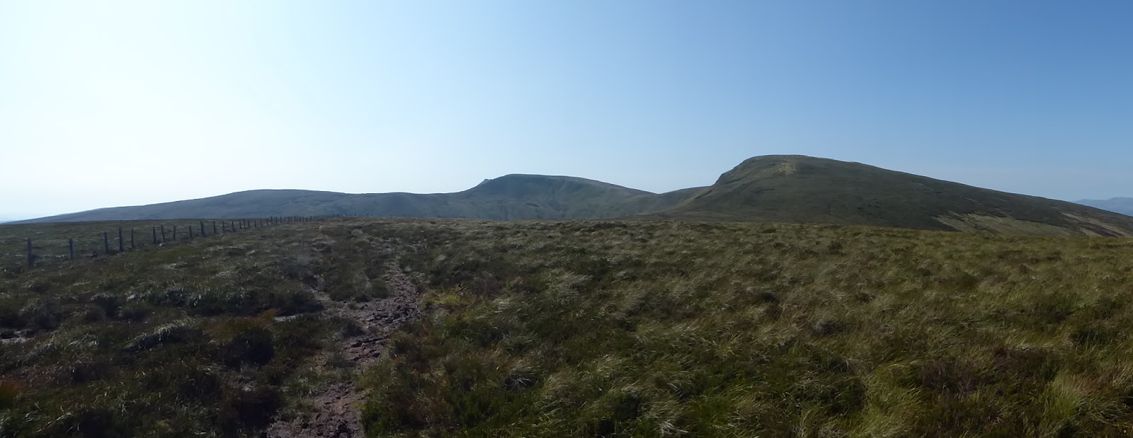
The north east panorama from the Witton Weaver Way north of Cheetham Close.
Turton and Entwistle Reservoir from the road over the dam.
Great cormorants in Turton and Entwistle Reservoir.
Heron art in Turton and Entwistle Reservoir near our lunchspot.
Elaine leading the way to the footbridge north of Fox Hill.
Not risking the ford!
Wayoh Reservoir from the Witton Weaver Way path at the south east corner of the reservoir.
A path being used by Mallards.
Walk stats: Distance: 9.4 miles. Climb: 972'.
Time: 4 hours 6 minutes. On the move walking average: 2.5 m.p.h. Overall walk average: 2.0 m.p.h.
Group: Martyn, Mike and Elaine.
Just as we arrived at the Water Fold car park it started to rain, and we ended up sitting in the car just hoping that the torrential rain would stop. Thankfully after an hour it eased sufficiently, for Mike  to open the his door say "come on lets go".
 It was still raining, so we all set off full waterproofs, but I decided to remove them just before we reached the road to Turton Towers.
 Many of the paths encountered today were more like streams and he paths around Turton and Entwistle were flooded so much that we were unable to walk along the southern side of the reservoir.  
 On the northern side we were able to get as far as the Heron art work, but even this was only done by weaving our way through the trees / forest adjacent to the path.
 Thankfully one of the benches was dry and on dry land, but the other was partially submerged in water.
 We were able to sit enjoying our lunch, not exactly in sunshine, but at least it had stopped raining.
 After lunch, it was decision time, do we retrace our steps to the dam or should we be more adventurous and use a bit of map reading and use some unknown paths to rejoin the planned route at Entwistle Station. We ended up choosing the latter, but the route north of Fox Hill to and beyond the footbridge wasn't easy, especially climbing up the steep wooded bank on the north side of the footbridge. Once we had rejoined the Witton Weaver Way it was all plain sailing.
 Navigating on new paths in an unknown area is always rewarding, but I don't think I will be repeating the Fox Hill footbridge route again, especially when an alternative is available even if it is a little longer.
 Birds seen or heard today included: European robin, Common blackbird, Great crested grebe, Black-headed gull, Wood nuthatch, Mallard and Common buzzard.
 We arrived back at the car, grateful that the car park was no longer awash, and having had an enjoyable walk with one of our Bolton friends.
 after walk drinks were enjoyed at the Netherton Hall at Frodsham, where the Lees bitter went down well, but of course it always does!

Wednesday 25 September 2019

The Alun Valley, Llyn Gweryd and Limestone Pastures 25th September 2019

On the Offa's Dyke Path North of Llandegla.
Fungi on ffa's Dyke Path  North of Llandegla.
On the Offa's Dyke Path North of Llandegla.
Still climbing.
Negotiating one of the new gates recently installed on our route today.
Heading towards the Clwydian Hills.
The Clwydian Hills on the skyline fro the path south of Alyn Bank.
A young buzzard near Alyn Bank.
South west view from the track leading to Llyn Gweryd.
Lunch time on Offa's Dyke near Nurse Gorlan overlooking the Vale of Clwyd.
Limestone pastures an one of the hidden valleys.
St. Tecla's Church at Llandegala.
Inside St Tecla's Church.
Leaving St. Tecla's Church at Llandegla.
St.Tecla's Church from the car park inllandegla.
Start: distance: 8.2 miles. Climb: 763'.
Time: 4 hours 17 minutes.On the move walking average: 2.4 m.p.h. Overall wal average: 1.9 m.p.h.
Group: Martyn, Roger, Mike, Wendy and Nigel.
 Low cloud / mist covered the higher ground as we set off, but it soon cleared and we were blessed with good views throughout the walk. It was pretty wet underfoot, but the soaking wet grass ensured that at least the upper part of our boots were pretty clean at the end of the day. 
 Following Offa's Dyke Footpath past Tecla's Church, the awkward stile had been replaced by a new gate. This was the first of several experienced today, much appreciated by all of us. Even the stile near Alyn Bank was made easier to negotiate by one step being provided.
 As we approached the Llyn Gweryd track we had our first real views of the Clwydian Hills with Moel Y Plas directy in front of us.
  The Llyn Gweryd track is always a bit of a slog, but at least some of us  knew that we were approaching a suitable lunch spot.
 Lunch was taken sitting on the bank just as we reached the Offa's Dyke Path south west of Llyn Gweryd.  We had set a pretty good pace so far, and we had already completed 5.4 mikles as we stoppe for lunch.
 Our lunch spot gave us good views over the Vale of Clwyd with the Clocaenog Forest Wind Farm on the horizon.
  After lunch we had a fair bit of road walking, but on this quiet road our greater danger was from fast moving cyclists who only had their voice to warn us of their imminent arrival.
 The limestone patures around Rhen Wylfa are delightful hidden quiet valleys always come aas a surprise for those experiencing then for the first time.
 Birds seen or heard today included: Blackbird, Common pheasan, Rook, Carrion crow, Woodpigeon, Wood nuthatch and Europea robin.
 However the bonus of the day was to as we arrived back at Llandegla. arriving back at the car early, we all decided to see inside the parish church of St. Tecla with its welcoming notice to everyone including walkers with boots, a place to eat lunch, make hot drinks in their kitchen nand even use the loo. What a welcome to visiors. Well done St. Tecla's and the community of Llandegla.
 Entering the church the east  window was one no-one had ever seen before.  The glass of the east window was made for the he east window of St. Asaph Cathedral in 1799 by Francis Eginton of Birmingham. It was one painted on smoked / enamelled glass.
After walk drinks were enjoyed at the bridge Inn at Pontybodkin, where Crocodile Tears brewed by the Parkway Brewery.
 A good walk enjoyed by all.

Sunday 22 September 2019

Cadair Bronwen via the Wayfarer's Memorial 21st September 2019

Passing the sheepfold on he way to open country.
Crossing Pont Rhyd-yr-Bydd.
The final climb to the Wayfarer's Memorial.
At the Wayfarer's Memorial.
The Berwyns on the skyline.
Desceding to our lunch spot on the north side of Cadair Bronwen.
The Clocaenog Wind Farm from Cadair Bronwen.
Distant mountain views from Cadair Bronwen.
The way to Bwlch Maen Gwnedd from Cadair Bronwen.
The start of the path down the Clochnant Valley.
A better section of the the Clochnant Valley.
A final look back to the Clochnant valley.
A delightful shaded section of the path through Cefn Pen-letty wood.
Llandrillo from path on the west side of Cefn Pen-letty wood.
Walk stats: 10.3 miles. Climb: 3434' GPS wind assisted reading, realistically about 2400' according to Memory Map route properties.
Time: 6 hours 32 minutes. On the move walking average: 2.0 m.p.h. Overall walk average: 1.6 m.p.h.
Group: Martyn, Nigel, Mike and Roger.
We arrived at the riverside car park at about 09-30 to find it was already quite full. it obviously now a popular start point for mountain bikers as well as walkers.
it wasn't long before Roger realised that he had brought the wrong pair of boots and decided that the best option was to return home. Thankfully a Wrexham bus was due in about ten minutes and he was able to have a leisurely bus ride, first to Wrexham and then back to Chester.
 The rest of set off from Llandillo, already in warm sunshine and only a gentle breeze, but it wasn't long before a group of mountain bikers caught us up on their way to Pen Bwlch Llandrillo. The more we climbed the better the views became, first over Llandrillo towards the North and later towards  the South east when ridge to Cadair Bronwyn came in to view.
 By now the wind had picked up quite a bit and I found it difficult to keep my sunhat on.
 After a brief pause at the Wayfarer's Memorial to have a photo taken and for Nigel to add a note in the log book, we set off on the steady climb up the often grassy, sometimes peaty and sometimes boggy moorland to the summit of Cadair Bronwen.
 The views in all directions from Cadair Bronwen were superb, despite being somewhat hazy, especially to towards Snowdonia.
 We decided to have lunch on the top of Cadair Bronwen, but dropped down a little way on the north side to shelter a little from the strong wind.
 Thankfully the wind never reached the forecast gusts of 42 m.p.h, and perhaps only reached about half of that.
 The path down the Clochnant valley proved the downfall for each one of us. First I put my foot down a hole and ended up on my back like a tortoise on its back and found it difficult to get up. Mike rushed to my rescue, but he put his foot down a bigger hole and ended up with a wet foot. so far Nigel had escaped, but further down he too succumbed to of putting his foot in a hole.
 The Clochnant valley path, particularly in the upper sections was difficult to find and frequently we had to use the GPS and its map to bring us back on track. throughout the descent the views ahead of us were excellent.
 On this occasion we returned to Llandrillo a path, new to us, that went along the western edge of Cefn Pen-llety wood, a delightful track, much better than the road route that we had used on previous occasions.
Birds seen or heard today included: House sparrow, Meadow pipit, Carrion crow, Raven, Wheatear, Red grouse, Common pheasant, Stonechat and Common pheasant.
 We arrived back at the car, having had a a great walk, but with tired legs and looking forward to refreshments at the Bridge Inn at Pontybodkin. a Weetwood brew and Parkway brew went down well.

Thursday 19 September 2019

Dates and Walks September 2019

Wednesday 4th September 2019.
The Ceiriog Valley - Cefn-Hir-Fynydd 
and 
Bwlch-Adwy-Wynt.
Distance: 8 -10 mles. Climb: 1250'. 
Start: Pontricket Layby. Grid ref: SJ186344.
Leave Chester at 09-00 a.m.
This is a walk taken from David Berry's booklet " Walks Around the Berwyn Mountains and the Ceiriog Valley. The described walk start at Llanarmon Dyffryn Ceiriog, but parking there isn't easy, hence extending the walk a little by starting at Pontricket.
The short walk involves descending the quite rocky sunken track back to Pontricket which most of us in the past have found rather unpleasant. The longer route avoids this but means thee is more uphill before descending through the Siambr gerrig valley.
The walk is a very varied walk with extensive views, and at one point follows a delightful section of the Upper Ceiriog Trail across Cefn-Hir-Fynydd at 1509'. Sections of the Ceiriog Valley Way are followed through fields and woodlands.
Saturday 7th September 2019.
Vivod Mountain.
Distance: 9.2 miles 1500'. 
Start; Roadside parking at Glyn Ceiriog. SJ202378. As it is a Saturday, it may be possible to park near the school.
Leave Chester at 08-30.
This walk is taken from Dave Berry's booklet "Walks Around the Berwyn Mountains and the Ceiriog Valley". This is a new walk for me and explores the the high heather moorland ridge north west of Glyn Ceiriog. The walk follows a path around the western flank of Y Foel before joining the North Berwyn Way to the top of Vivod Mountain. The return route includes paths through the Ceiriog Forest (Nantyr Forest). at the highest point of the walk we should get 360 degree viewsncluding the Shropshire Hills, the Berwyns, Snowdonia and the Clwydian Hills.
Wednesday 11th September 2019.
Cefn Ddu and Y Graig and East of Tremerchion.
Distance: 9 miles. Climb: 1500'.
Start; Roadside parking East of Tremerchion. Grid ref: SJ095740.
Leave Chester at 09-00 a.m.
This is another walk from one of Dave Berry's booklets "walks in the Clwydian Hills".
This is a slight variation of the walk that we usually follow, but it also includes one or two new paths for us to explore. On good clear days we should get views of Snowdonia as well as north towards the coast.
 The extension, which we will probably complete at the start, explores the countryside to the east of Tremeirchion, an entirely new area for me.
Saturday 14th September 2019.
Dove Dale and More.
Distance: 9-10 miles. Climb: 1300'
Start: Dovedale Car Park near Thorpe Cloud. Grid ref: SK146509.
Leave Chester at 08-00 a.m.
This is a walk taken from the pathfinder guide to the Peak District. It is a long time since I have walked in Dovedale, possibly 20 years ago! The walk starts by visiting Illam before heading northward to Stanhope. Dovedale will be joined at Milldale. Dovedale is a really beautiful valley and is a very popular place. There  are stepping stones t the end of the walk, but they can be avoided if preferred  as there is also a footbridge. If we are till feeling energetic, we will also climb to the summit of Thorpe Cloud from which you get superb views down Dovedale.
Wednesday 18th September 2019.
St. Cwyfan's Trail and More.
Distance: 9-10 miles. The main part of the walk is taken from Dave Berry's book "Walks in the Clwydian Hills
Start: Roadside parking in Llandyrnog on the Llangynhafal road (Gladstone Terrace) . Park on the wider part of the road after Nant Glyd. Grid ref: SJ109650.
Leave Chester at 09-00 a.m.
The main part of the walk is taken from Dave Berry's book "Walks in the Clwydian Hills" and the extension is around the lower slopes of  Penycoddiau along the Clwydian Way.
It is described as a delightful walk in the countryside North of Llandyrnog and visits the smallest church in the Vale of Clwyd.
Saturday 21st September 2019.
Cadair Bronwen
Distance: 10 miles. Climb: 2400'
Start: Llandrillo Riverside Car Park. Grid ref: SH035372.
Leave Chester at 08-30 a.m.
This walk is taken from Dave Berry's booklet "Walks Around the Berwyn Mountains and the Ceiriog Valley". It is described as a walk for experienced walkers. It includes two ancient upland paths and visits the most northern summit of the Berwyns, Cadair Bronwen at 2558'. Once on the Berwyn ridge, we should get some stunning views of Cadair Idris, Snowdonia and even the Shropshire Hills. Moorland sections and the descent down the Chlochnant Valley have in the past proved somewhat boggy, but hopefully at this time of the year we shouldn't get wet feet!
Wednesday 25th September 2019.
The Alun Valley, Moel y Waun, Llyn Gweryd and Limestone Pastures.
Distance: 9-10 miles; Climb: 1000'.
Start: Llandegla Village car park, adjacent to the bus shelter and opposite the Post Office. Grid ref: SJ196523.
Leave Chester at 9-00 a.m.
This walk combines another two walks from Dave Berry's book "Walks on the Clwydian Hills". He describes one walk as being delightful and the other as being an easy walk with scenic delights. What more could we want from a walk, and as we know Dave Berry is frequently delighted on his walks! From past experience parts of the route can be muddy underfoot.
Saturday 28th September 2019.
Jumbles, Wayoh, Turton and Entwistle Reservoirs.
Distance:10 miles. Climb:1100'.
Start:Waterfold Car Park, off Bradshaw Road (A676), Jumbles Country Park. Grid ref: SD736139
Leave Chester 8-30 a.m.
This walk is based on a walk taken from Terry Marsh's book "Fifty Classic Walks in Lancashire". He describes the walk as a pleasant walk on good paths. The extension to Turton and Entwistle Reservoirs includes another section of the Witton Weaver Way and crosses Turton Heights and a hill called Cheetham Cross. A good and varied walk. Has been known to be on the boggy side on the descent from Cheetham Cross! If we miss out Cheetham Cross, it will making the walk just over 9 miles.

Wednesday 18 September 2019

St. Cwyfan's Trail and More 18th September 2019

Not the easiest style to negotiate, but in the end we had to negotiate it in both directions.
Trying to catch up!
Looking towards the North Wales Coast across the Vale of Clwyd.
An unexpected notice, only seen after crossing the footbridge.
"How do you get over this "style"?"
This is how you do it. Commentary by Wendy.
A friendly Alpaca.
"Wait for me"
An Alpaca that still wants to be friendly!

Moel y Parc and Penycodiau.
The Clwydian Hills.
How great it would be if all landowners marked out footpaths through their gardens in this way.
Inside St.Cwfan's Church.
The grave of a man that lived in three centuries, just outside the door to St. Cwyfan's Church, Llangwyfan.
An as yet unidentified butterfly in a field south west of Llangwyfan.
Probably a painted lady.
Can you spot the difference between these three photos of the Painted lady?
The site of the earliest Methodist church in the area in a field south west of Llangwyfan.
Is this the rare Black poplar mentioned in the walk description?
Walk stats: Distance: 8.7 miles. Climb: 624'.
Time: 5 hours 2 minutes. On the move walking average: 2.3 m.p.h. Overall walk average: 1.7 m.p.h.
Group: Martyn, Wendy, Mike, Nigel and David S.
A good day weather wise, well at least it was dry and sunny and later in the day a pleasantly cooling wind released us from the humidity earlier on.
 The walk today was to present us with several unexpected challenges, most of them involving styles. These awkward stiles often needed us to help each other to cross as steps were loose and wobbly or gates had to be braced as we crossed them. Good for team building - better than undergoing an SAS training event!
 The first no style problem faced us as we entered a field of maize, we should have gone straight across, but this wasn't an option, going round the edge also proved diffiicult and we ended up crossing a partially blocked (due to a fallen tree - there for at least two years) twice.
 We managed to get back on track by following a forest track that led us to the road. This isn't an official route but today we got away with it as the property we had to go past was really a building site.
 We were soon back on route as we went down the lane passed Pentre Mawr, holding our noses on the way when we couldn't avoid passing a long dead juvenile Badger.
 Further challenges involved Mike having to display his skills with a secateur on the path near Glan Clwyd Ganol.
 However the worst challenge were as we were getting around Glan Clwyd, attempts were made to stop us using this way through, but didn't offer any alternative way through.
 The next challenge, at least for some, was going through a field with three Alpacas. One of these was particularly friendly, getting quite up close at times, but didn't show any signs of wanting to spit at us.
 After escaping from the Alpaca field, we ended heading owards for the Clwydian Hills on paths that were new to all of us. 
 The path through Dre-goch's garden was well directed, including the steps leading to the road, as was the path through the grounds of Finger Cottage.
 Lunch was take along the track south east of Berth Farm where we sat by he track with good views over the Vale of Clwyd.
 On this occasion we went inside St. Cwfyan's Church, a bonus as the was the last time we went passed, it was under restoration.
 Birds heard or seen today included: Goldfinch, Woodpigeon, European robin, Rook, Carrion crow, Common pheasant and Common buzzard. 
Despite the problems encountered it had been a walk enjoyed by all, capped by refreshments at the Dinorben Arms at Bodfari. Purrpe Moose's Snowdonia Ale was on offer - I think John as been talking to Emma! Other brews were enjoyed too.