About Me

My photo
When? Started: 1993 Who? Started with staff and friends from U H S, Chester. Organiser: Martyn Harris We walk every Wednesday and Saturdays, New Years day and May Day. How many walk? Walks take place as long as there are at least 2 wanting to walk on that day. More walk on a Wednesday than on a Saturday. Most ever: 29. Current group size walking: 2-10 in mid-week and 2-4 on Saturday. Where do we walk? Saturday: Anywhere in North and Mid-Wales, Peak District, Shropshire and the Long Mynd and as far North as the Trough of Bowland. Thursday: Anywhere within about 40 miles of Chester. Type of walk: Distance: 6 – 14 miles (but usually under 10 miles). Climb: up to 4000’ (but usually very much less!). People involved on walks in 2020:- Martyn Harris, Fran Murphy, Sue and Michel Pelissier, Mike Dodd, David Savage, Wendy Peers, Celia de Mengle, Wendy and Ian Peers, Roger Smith, Paul Collinson, Ed Meads, Nigel and Elaine Taylor, Celia de Mengle, Sue Pearson.

Saturday 28 October 2023

Around Penycloddiau and Moel y Parc 28th October 2023

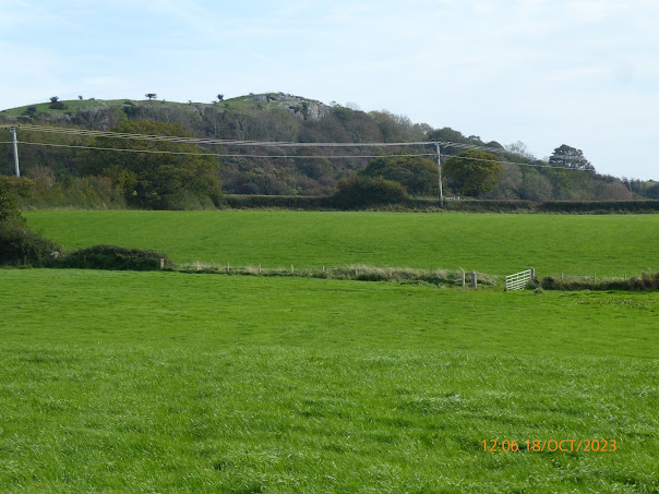
The path leading to Penycloddiau from the Coed Llangwyfan Car Park.
At the new gate (replacing a stile) onto Penycloddiau.
On part of the new to us path around the East side of Penycladdiau.
Still on the new to us path around the East side of Penycladdiau.
Our first sighting of the Moel y Parc TV Mast.
The closest we got to the Moel y Parc TV Mast.
Moel y Parc trig point - no longer able to be bagged!
Our first sigt of the wind turbines off Prestatynproducing power.
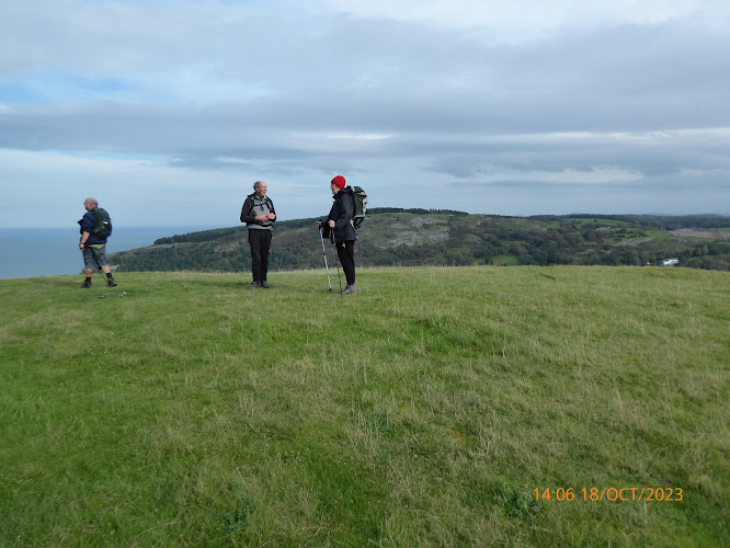
A first for Ed - visiting the cairn on Moel y Parc.
The wind turbines seen from the cairn on Moel y Parc.
Any commentary ics not s by me!
Descending Moel y Parc towards Penycloddiau.
Inspecting a well known landmark on this part of the Clwydian Way  - a 60 cubic metre water tank that has seen better days!
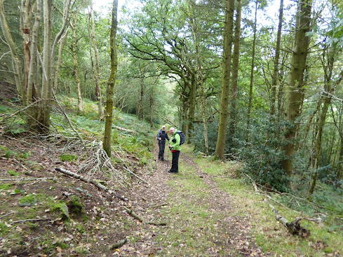
Looking back down the "Blue Walk" through Coed Llangwyfan.
Walk Stats:
Distance: 8.2 miles. Climb: 1316’.
Time: 4 hours 23 minutes. On the move walking average: 2.3 m.p.h.
Overall walk average: 1.8 m.p.h.
Temperature: 11.2 Celsius at the start.
9.2 Celsius on reaching the outer rampart of Penycloddiau.
11.2 Celsius at lunch and 14.1 Celsius at the end of the walk when the Sun had come out to play!
Beaufort Wind force: 0-4. Max just a Moderate Breeze as we descended Moel y Parc towards Penycloddiau.
Group: Martyn and Ed.
This was another last minute change of walk as we thought Llandegla Moors might be on the boggy side after all the rain we had had recently.
As we approached the car park, we were slowed down by lots of Red legged partridge ambling along the road and showing a great reluctance to get out of the way.
We set off on the main path heading for Penycloddiau, but arriving at the outer rampart, we decided to take that went around the East side of the hill fort. This proved to be a very pleasant path despite not being being designated a Right of Way, but was obviously well used and easy to follow. This was a new path to me and one that I would be happy to take again.
Another first for me was taking the path in an anticlockwise direction to reach the cairn on the top of Moel y Parc – the windiest spot of the day.
Distant views weren’t great, but as we approached the cairn on Moel y Parc we did get views towards the North Wales Coast and the many wind turbines gently rotating.
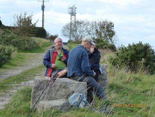
Lunch was taken on the Clwydian Way towards Aifft, where the remains of an old wall gave us comfortable places to sit.
At lunch we were briefly entertained by a party of Long tailed tits who decided to feed in a tree next to where we were sitting.
After lunch we decided to extend the walk slightly and follow the Clwydian Way that contoured around the Western flanks of Penycloddiau ad then climb through Coed Llangwyfan on the “Blue Trail” but in reverse to the directions shown by the arrows.
In fact the whole walk was done in the opposite direction to that was given in the route description.
Birds seen or heard today included: Carrion crow, Common buzzard, Stonechat, Common pheasant, Red legged partridges (large numbers on the road as we approached the Coed Llangwyfan Car Park), Raven, Meadow pipit and Long tailed tit.
Overall an enjoyable walk in weather conditions that were on the cool side (fleece warn throughout the walk, although could have been discard for the climb through Coed Llangwyfan).
After walk drinks were enjoyed at the Blue Bell in Halkyn, where the Lees Bitter went down well and I think Mike enjoyed his Pepsi and a packet of Piper’s Chilli Crisps!
Arrived home in time to clean my boots outside in the warm sunshine - always a bonus!
Wednesday 25 October 2023

Talacre and Barkby Beach from Lower Gronant 25th October 2023

 Blue skies above the Prethaven Sands and the sea,
A glimpse of the Point of Ayr Lighthouse from Prethaven Sands beach.
A glimpse of the Point of Ayr Lighthouse from footpath through The Warren N.R.
The only residents of The Warren Nature Reserve that we saw.
The Point of Ayr Lighthouse above the Sand dunes at Talacre.
The sea still keeps rolling in on Talacre Beach. 
(Even though th tide is on the way out).
A male Stonechat in the Gronant Dunes Nature Reserve.
The view from our lunch spot.
The western side of the Gronant Dunes Nature Reserve from our lunch spot.
The Beach Hotel looks a long way away!
Wind turbines having a day off.
The Prestatyn Gutter acting like a mirror.
A Moorhen trying to hide in the reeds on the ege of the Prestayn Gutter.
Walk Stats:
Distance: 9.4 miles. Climb: 184’.
Time: 4 hours 28 minutes. On the move walking average: 2.6 m.p.h.
Overall walk average: 2.1 m.p.h.
Temperature: 14.2 Celsius at the start.
18.2 Celsius at lunch in the sunshine in the boardwalk shelter in the Gronant Dunes Nature Reserve.
19.8 Celsius in the sunshine at the end of the walk.
Beaufort Wind force: 0-1. Mainly calm, but reached a 2.4 m.p.h. Light air as we walked across Barkby Beach.
Group: Martyn and Ed.
It was a last minute decision to do this walk, the only one we could think of that would be walk that avoided crossing any fields likely to be muddy or flooded.
The weather forecast for today was pretty good, once the early morning fog experienced on the way to Gronant.
It felt cool at first, but once the Sun came out, it almost wall to wall blue skies and pleasantly warm for the rest of the day.
We set off for Talacre by going through the Caravan Park and The Warren Nature Reserve. We had anticipated getting to the Point of Ayr Lighthouse could be a problem if flooding was still around. Thankfully it wasn’t and we were able to walk back along the beach to Gronant.
Lunch was eventually (we had to wait for it to be vacated before we could take our seats) taken in the boardwalk shelter in the Gronant Dunes Nature Reserve.
A very pleasant lunch break, lasting a little longer than usual, was enjoyed by both of us.
Once more we were able to walk along the Barkby Beach as far as the Beach Hotel.
The final leg of the walk was through Prestatyn Golf Course on e path that runs parallel with the Prestatyn Gutter that was as full as I have ever seen it.
Birds seen or heard today included: Great cormorant, Herring gull, Great black backed gull, Common redshank, Black headed gull, Jackdaw, Rook, Carrion crow, Cetti warbler, Stonechat, Common pheasant, Black billed magpie, Woodpigeon, Common coot, Moorhen, Oystercatcher, Common starling and Eurasian curlew.
Overall an enjoyable walk, even if the number of birds seen was much lower than expected.


Tuesday 24 October 2023

Walks and Dates October 2023


 Latest Information About Harris Hikers from 23rd March 2023.
After much discussion between group members, those present decided to follow DS’s suggestion that “Short walks with an option of a meal at a nearby venue” should take place on the fifth Wednesday in a month, and members of the group would take it in turns to plan the walk and venue.
There are only one such Wednesdays left in 2023, 
November 29th*.
It was also agreed that Wednesday Walks should in the main be walks of around 8 miles with no more than about 1200’ of climb. If proposed walks exceed these suggestions routes should have obvious short cuts to reduce distance and / or climb involved.
It was also agreed that each month a different member of the group should plan the walk.
This walk should be for the Wednesday in the month and that would include the “Short Walk and Meal Option” on the fifth Wednesday.
In order to include that walk in the monthly “Dates and Walks Post", details of the walk need to be sent to me by 15th of the previous month.
Wherever possible I would like people to let me know of their intention to walk or not to walk by Monday afternoon/early evening prior to the walk on Wednesday. There isn’t an issue with last minute cancellations for any reason. This happens anyway when adverse weather is forecast at the last minute.
Where the “Short Walk and Meal” is concerned, the person planning the walk and meal should be contacted directly and informed of theirr intentions as soon as you have made your decision.
Wednesday 4th October 2023.
Foel Fenlli and Cwm Blaenant.
Distance: 7-8 miles.
Climb: 1524'
Start: Bwlch Penbarras car park (Pay and display - cash works better than cards). All day now costs £5-00.
Grid ref:SJ162606.
Leave Chester at 09-00 a,.m.
Those planning to walk: ,   .
Those not walking: Martyn (I tested positive for Covid on 30th September and will be self isolating for 5 - 10 days until I test negatve) .
This walk is taken from Dave Berry's booklet "Walks on the Clwydian Hills". It is described as an interesting walk, visiting an impressive iron-age hill-fort. Sections mender along the Offa's Dyke footpath as far as the Clwyd Gate. The return route will take us through little known Western fringes of the Clwydian Hills. It includes attractive woodland paths  and explores a delightful hidden valley. Most of the walk is along clear paths with excellent views throughout.
 The walk is nominally shorter than usual, but the last time we completed this walk it was in November 2022, and we didn't bother with any extension, admittedly the weather wasn't good! However if the group are keen to extend the walk, it will be easy to do so. This is a decision we can leave until we get back to the cars if need be. There are plenty of tracks through the forest at Moel Famau Country Park to create a loop of whatever length we want.
Saturday 7th October 2023.
Abergele and Moelfre Isaf.
Distance: 9.0 miles. Climb:1250'.
Start: Pensarn Beach Car Park. Grid ref: SH944787. Park near the PC block as we will be heading South towards the centre of Abergele.
Leave Chester at 08-30 a.m.
Abergele and Moelfre Isaf.This walk is by Debbie Hamelton and starts in the centre of Abergele, but we will start on the coast. This will extend the walk by about 2 miles. The main walk is described as exploring the beautiful North Wales countyside South of Abergele. The outward route passes a well preserved watch tower.
Those planning to walk: Martyn, . 
Those not walking:  
Wednesday 11th July 2023.
Moel Famau , Around Ffrith Mountain and Clwyd Forest.
Distance: 7-8 miles. Climb: 1500'.
Start: Bwilch Penbarra Car park ( £5-0 last time we used this car park. 
Cash is better than a credit card), south west of the PC block. This is the top car park that overlooks the Vale of Clwyd.
Grid ref: SJ161605
Leave Chester at 09-00 a.m.
Those planning to walk: Martyn, .
Those not walking:
Sue and Michel
This walk combines to routes from Dave Berry's Books, one from "Walks in the Clwydian Hills" and one from "Walks in the Clwydian Hills - New Edition." This is a walk that we first did in 2015, and every one said that they enjoyed it.  Hence its inclusion again this year. Perhaps at this time of the year we will reach the Jubile Tower on a warm wind free day with superb views in all directions!
Saturday 14th October 2023.
The Lawley and Caer Caradoc.
Distance:10 miles; Climb:2000'.
Start:Church Stretton centre car park (pay and display). Grid ref:SO454911.
Leave Chester 8-30 a.m.
Those planning to walk: Martyn, .Mike, Ed. 
Those not walking:   
I think the last time we did this walk it was about four years ago. It is a good varied walk, so I thought it was worth putting on again . The walk combines two walks taken from Ian Jones' booklet "20 Walks From Church Stretton".It is a walk that we first did in 1998 and have done several times since then. This is a superb walk, especially on a good day. It is the nearest that you can get to a ridge walk, particularly along the Lawley!
Wednesday 18th October 2022.
Mynydd Marian.
Distance: 7-8 miles. Climb: 1000'.
Start: Llandulas Beach Car Park. Grid ref: SH907786.
Leave Chester at 08-30.
Those planning to walk: Martyn,Mike, Nigel, Ed, Fran. 
Those not walking:   
Sue and Michel
This walk is taken from Dave Berry's book, "Walks on the North Wales Coast". It combines an interesting section of the coast line with the attractive limestone countryside between, Old Colwyn, Llysfaen and Llandulas. This is one of my favourite walks, but the walk today wil llowe us to see what work is being done on the sea defences from Old Colwyn to Colwyn Bay.
Saturday 21st October 2023.
A Clwydian Trio - or part of it. 
Postponed due to weather - ground likely to be very waterlogged and driving conditions difficult. 
Distance: 9 miles. Climb;1900' .
Start: Pentre-celyn car park .. Grid ref: SJ150534Post Code: LL15 2HE
The car parking area is on the left adjacent to the sign for Pentre-celyn, just off the B5429.
Leave Chester at 09-00 a.m.
Those planning to walk: Martyn . 
Those not walking: 
This is another walk by Debbie Hamilton and is taken from the "Walking" magazine. This walk includes the section of Offa's Dyke Path goes near Moel y Plas, Moel Gyw, Moel Llanfair and Boncyn y Waen-grogen. Her walk starts from Llanfair Dyffryn Clwyd, but we will start at Pentre Celyn about half a mile beyond Graigfechan.
The last time we did this walk, we shortened it to about 8 miles and 1300', so we may do the same today.
Wednesday 25th October 2023.
Thurstaston Common, The Dungeon, Stapledon Wood, Caldy and More.
Postponed.
 There is so much ground water around at the moment that I can't see conditions underfoot  improving that much by Wednesday, so I have decided to postpone the walk.
Distance: 8-9 miles. Climb: 600'
Start: Thursaston Visitor Centre Car Park. Grid ref:SJ239835.
Leave Chester at 09-00 a.m.
Those planning to walk: Martyn . 
Those not walking: Sue and Michel, Nigel, Mike 
This is a repeat of the walk that we last did in January 22 and combines two walks from Raymond Roberts' booklet "Wirral Walks - the West Wirral Six". This is a relatively easy walk with good views along the way, especially from Thurstaston Hill. We hope to walk back Thursaston along the beach, so bring binoculars with you. Low tide is at 13-00, so we should have no problems walking along the beach in the afternoon.
Last minute replacement 
for Walk on Wednesday 25th October 2023.
Gronant, Prestatyn, Talacre and The Point of Ayr.
Distance: 710 miles. Climb: 200'.
Start at Gronant Dunes Car Park on Shore Road: Grid Ref: SJ090837 This road off the A548, Moston Road and signposted to Presthaven Sands / Gronant Dunes.This is a new starting point.
Leave Chester at 09-00 a.m.
This walk isn't usually one we do at this time of the year as the Little terns have long gone to warmer climes. but it is still worth bringing binoculars as Winter visitors have started to arrive. We may even be lucky enough to see a  Snow bunting. 
High tide is at about 09-45, and is  27.0' / 8.2 m, so there shouldn't be any problem walking along the beach if we want to do so.The route starts by heading north down Shore Road to Presthaven Sands where will first we head east throuh the caravan park, The Warren Nature Reserve.  We may go as far as the RSPB Point of Ayr bird hide before returning to Talacre.   If possible we will walk along the beach from the Lighthouse, although we my have to rethink if we can't cross the beach car park should it be fooded.
Lunch will be taken in the shelter by the boardwalk next to the Prestatyn Golf Course. After lunch we will either head through the golf course or take the path along the top of the sand dunes as far as Prestatyn's Barkby Beach before returning to Gronant and the start on Shore Road.. 
Those planning to walk: Martyn, Ed.
(Those not walking: Mike, )
Saturday 28th October 2023.
World's End from the Ponderosa.
Start: Car parking area opposite the Ponderosa Cafe. Grid ref: SJ192480.
Leave Chester at 09-00 a.m.
Those planning to walk: Martyn, .
Those not walking: 
This walk is taken from Dave Berry's book " Walks Around Ruabon Mountain, the Clywedog Valley and Hope Mountain." This is described as an exhilarating walk of great variety, on good upland paths and tracks with panoramic viewscapes.
This is a good walk, but the paths crossing the moorland to the masts on Gyrn-y- Brain are not always that easy to find.


Wednesday 18 October 2023

Mynydd Marian 18th October 2023

Bird on the rocks.
Heading aliong the Coastal Path to Old Colwy,
Old Colwyn sea defenses - work still in progress.
Part of the stram through the Fairy Glen, Old Colwyn.
First views of Mynydd Marian.
Our lunch spot east of Mynydd Marian.
An unexpected "sculpture" in Llysfaen,
On the North Wales Path south east of Llysfaen.
On the top of s s Cray y Forwyn with the trig point on Cefn yr Ogof just visible on the skyline.

Memorial to the founder of the Welsh Nationalists - just for Fran.

The main stain glassed window in St. Cynbryd's Church, Llanddulas.

Walking through St. Cynbryd's Churchyard

Looking towards Rhyl from Llanddulas Beach Car Park.

The tide is reteating, but the waves keep rolling in at Llanddulas.
Walk Stats:
Distance: 8.6 miles. Climb: 1283’.
Time: 4 hours 39 minutes. On the move walking average: 2.2 m.p.h.
Overall walk average: 1.8 m.p.h.
Temperature: 11.7 – 13.7 Celsius.
Beaufort Wind force: Max – 5 (19.7 m.p.h.) - Fresh breeze.
Group: Martyn,Mike, Fran, Nigel and Ed.
The weather forecast for today suggested that it would be dry, but we could expect it to be pretty breezy.
We set off along the Coastal Path towards Old Colwyn, and it wasn’t long before we were thinking of taking off our fleeces and banishing them to our rucksacks.
Arriving at Old Colwyn the long time improving the sea defences was still ongoing, but there was still a lot of good work already completed.
As soon as we started on the path across Old Colwyn Golf Course, the Sun came out and stayed with us for most of the day - a bonus we weren’t expecting.
Distant views from Mynydd Marian were somewhat hazy, but we could just about make out the northern end of the Carneddau.
We had lunch just after Mynydd Marian, where once more we took advantage of slabs of limestone lining the track down to Llysfaen.
The surprise of the day, at least for Ed, was Martyn deciding to take the path over Craig y Forwyn rather than take the North Wales Path across the scree.
Craig y Forwyn was the windiest spot today, but we did get good views across the valley to the trig point on Cefn yr Ogof.
On the way through Llanddulas we noticed the St Cynfryd’s Church was open, so we all went in. The organist was kind enough to put the lights on for us as we walked around the church.
Birds seen or heard today included: Great cormorant, Meadow pipit, Herring gull, European robin, Wood nuthatch, Collared dove, Carrion crow, Jackdaw, Common pheasant and Common kestrel.
Overall an enjoyable walk celebrated by the Chester contingent by calling in at the Blue Bell at Halkyn. Everyone enjoyed the Lees bitter and I enjoyed amping the the Lees stout for the first time.


Sunday 15 October 2023

The Lawley from Church Stretton 14th October 2023

Mike's rainbow.
A self-service coffee shop offered by Gaerstones Farm.
First views of Caer Caradoc.
A more complete view of Caer Caradoc from the track leading to Cwms Farm.
A wood carved buzzard on the roadside heading for Enchmarsh.
On the path shouldn't have taken!
First view of The Lawley.
The start of the path over The Lawley.
At the first "false" summit with its communication mast.  
The weathervane on the real top can just be made out betweenMike and Ed.
The man ridge of The Lawley lies ahead.
The highest point onThe Lawley with its bird weathervane.
Part of Caer Caradoc from the track across its northern slopes.
On the path through Houghs Coppice.
Caer Caradoc Hill from the All Stretton to Church stretton Road.
Mike's rainbow x 2.
Walk Stats:
Distance: 12.7 miles. Climb: 2123’.
Time: 6 hours 51 minutes. On the move walking average: 2.2 m.p.h.
Overall walk average: 1.8 m.p.h.
Temperature: 9.2 – 11.8 Celsius.
Beaufort Wind force: Max – 4 . Moderate breeze.
Group: Martyn, Mike and Ed.
The weather forecast for today suggested feel like temperatures of about7 Celsius, so I decided that use my Winter Paramo gear. This turned out to be a mistake as wearing summer shorts would have been the more comfortable option and I ended up with my Paramo jacket in my rucksack for most of the day. It was largely bright and sunny, although we did get a few very short showers. The only wind of note was as we walked along top of The Lawley when we had 14.7 m.p.h. gusts – no more than a moderate breeze.
Our route took on paths south of Caer Caradoc and The Lawley, and we had good views of the hills we hoped to climb later.
The route description that we had proved difficult to follow and we ended up heading towards Hurst Barn and ended up going through a farm complex to get to the road leading to The Lawley. Lunch was taken on Hoar Edge where we took advantage of an old wall on which to sit. Initially we were in bright sunshine, but our lunch break was cut short by one of the rain showers.
In future we would not take the track down to the valley and the Hurst Barn route taken today, instead we would continue along Hoar Edge to the road and follow the road to north east end of The Lawley to pick up the path heading up the ridge.
The climb along the ridge of The Lawley crosses over two mini-tops before reaching s the highest point with its bird topped weathervane.
As we descended from The Lawley we were entertained by several Ravens souring, tumbling and diving as they took advantage of the moderate breeze.
As it was getting late we decided not to attempt the climb over Caer Caradoc and instead follow the lower path across the northern side of the hill.
Once more the route description wasn’t easy t follow and we ended up going through Houghs Coppice and on to All Stretton, where we followed the road back to Church Stretton and the car.
Birds seen or heard today included: Common buzzard, Carrion crow, Jackdaw, Raven, European robin, Common blackbird and Stonechat.
Overall an enjoyable walk, if you can forget about the final tedious road walk from All Stretton to Church Stretton.
After the walk Mike and I decided to visit a local hostelry for refreshments while Ed decided his preferred option was to visit the local chippy. Having rejected the Buck’s Head, we ended up in the busy King’s Arms, a Joules brewery outlet. This hostelry claims to welcome dogs and cyclists. We saw plenty (at least 4) of the former, but none of the latter unless they incognito!
Just as we were leaving the King’s Arms, it started to rain quite heavily, but it also threw up a magnificent rainbow that Mike managed to photograph with his phone camera.A late finish by the time we got back to Chester, too late to clean my boots and too tired to complete the blog.