A Shorter Walk each month.
Some of group's regular walkers have suggested that it would be a good idea to include one walk each month that is shorter (5 - 6 miles) that might tempt anyone put off by a 10 mile walk, to joins us.
These walks will be on the last Wednesday each month.
I am happy to receive suggestions for suitable short walks, particularly if they free from stiles.
All Covid Restrictions in Wales have been lifted, so it is no longer the law to wear face coverings in any situation, although you may feel more comfortable in some situations to do so. I will still have my face covering with me, you may wish to do the same.
Although it is no longer a law, you may also want to use them in places like as Public Conveniences (PCs), shops or on Public transort.
When car sharing you may also want to continue to wear face coverings.
Remember to let me know that you plan to walk so that it becomes easier to arrange car sharing. in addition it helps me to know how many route maps I need to bring and on special occasions how many pieces of fruit cake will be needed.
Saturday 2nd October 2022.
Conwy Mountain and Around Maen Esgob and Craigfedwen
Distance: 8 miles. Climb:1447'.
Start: Long stay car park on the B5106 at Conwy. Pay and Display. Grid ref:SH781773. Post code: LL32 8LS
Leave Chester 08-30 a.m.Those planning to walk: Martyn (I will need a lift) , Mike, Ed .
(Those not walking: )
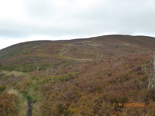
The walk starts by heading through the castle walls and on the North Wales Coastal Path along the harbour as far as the secondary school. The North Wales Path is the followed over Conwy Mountain through Castell Caer Seion and onto the Sychnant Pass.
The views from the Conwy Mountain Ridge can be superb, with the Great Orme in one direction and Tal y fan in the other, as well as good views towards Conwy castle and the Conwy Valley.
After crossing the Sychnant Pass Road, the North Wales Path is once more folowed. At the point where there is a definite fork, it is possible to make a short there and back extension to visit the site of a monument. Returning to the North Wales Path, it is then followed along the East side of Maen Esgob as far as the head of the Fairy Glen. A path heading eastward then takes us past Llyn y wrach.
Once the West side of Maen Esgob is reached, the main track is followed parallel to the stone wall towards Craigfedwen, where the footpath goes South of Waeny-fedwen and onto the minor road near Llechwedd. The route goes Northward on the road ad then takes the first path on the right which leads around Bryn-mawr to a minor access road. It is along this road that several large and/or interesting properties can be seen. at the T-junction, the route goes right and in a very short distance a broken kissing gate leads the way to a field path leading to the Sychnant Pas Road at Mount Pleasant on the outskirts of Conwy. The Sychnant Pass Road is then followed back to Conwy.
Wednesday 5th October 2022.
Fron Hen, Loggerheads and More.
Postponed - forecast rain all day and too windy!
Dstance: 7-8 miles. Climb: 1250' Start: Layby (Plymog) on the A494 Mold to Ruthin Road, about 1/2 mile South of Llanferres. Grid ref: SJ187597. . Post Code: CH7 5ST
Leave Chester at 09-00 a.m.
Those planning to walk: Martyn, (I will need a lift) .
(Those not walking: Nigel, Sue and Michel)
This walk explores the lower slopes of the Clwydians on the way to Loggerheads and eturns to Llanferes along the Western edge of Big Covert.
Saturday 8th October 2022.
Vivod Mountain.
Postponed until later in the month.
Replaced by a walk from Flint Castle.
Distance: 9.2 miles. Climb;1250' .Start: Roadside parking at Glyn Ceiriog. SJ202378. As it is a Saturday, it may be possible to park near the school. Grid ref: SJ202378. . Post Code: LL20 7ER
Leave Chester at 08-30 a.m.
Those planning to walk: Martyn ((I will need a lift), Ed.
(Those not walking: Mike)
This walk is taken from Dave Berry's booklet "Walks Around the Berwyn Mountains and the Ceiriog Valley". This explores the the high heather moorland ridge north west of Glyn Ceiriog. The walk follows a path around the western flank of Y Foel before joining the North Berwyn Way to the top of Vivod Mountain. The return route includes paths through the Ceiriog Forest (Nantyr Forest). at the highest point of the walk we should get 360 degree viewsi ncluding the Shropshire Hills, the Berwyns, Snowdonia and the Clwydian Hills.Replacement Walk.
Exploring the Flint Castle Hinterland.
Distance: 9 – 10 miles. Climb: 900 – 1000’.
Start: Flint Castle Car Park near the IRB Inshore Rescue Boat) Station.
Grid Ref: SJ 2472 7322.
Those planning to walk: Martyn (I will be catching the 08-50 bus that arrives in Flint about 1 hour later), Ed.
(Those not walking: Mike)
The route heads eastward towards Oakenholt before heading south
via Pentre Fferndan, Waen y Balls and Mynydd y Fflint as far as the Welsh College of
Horticulture.
The return route northward follows the Afon Conwy and part of Wat’s Dyke Way along
Halkyn Road. A field path above Maes-gwyn-mawr farm is followed to a path that leads across
Cornist Park Golf Course back to Flint.
Wednesday 12th October 2022.
The Moel Hebog Ridge.
By request!
May take place on Monday 11th.
Distance: 7 - 8 miles. Climb: 3200'
Start: Car park in Beddgelert. Grid ref:SH589482, Post Code: LL55 4YE
To get to the car park, take the A498 from Capel Curig to Beddgelert. In Beddgelert turn left with the A498 over the bridge and the car park is on the right about 200 yards past the ice cream shop. If you get as far as the Royal Goat Hotel you have gone too far.
Leave Chester at 08-00 a.m. (May be earlier). Sunset: 18-23.
Those planning to walk: Ed Nigel, Mike, Fran .
(Those not walking: Martyn, David S, Sue and Michel)
This route is one we have done several times before and is one described by Terry Marsh in his book "The Mountains of Wales". This is a good walk, especially on the ridge. Routes through the forest are not so easy, at least they weren't the last time we did it. It is quite interesting to note that the Nuttalls recommend a larger than usual scale orienteering map for use in the forest as most of the paths aren't on the normal OS map! Now that the Carenarfon, Rhyd Ddu to Beddgelert railway is fully up and running, after crossing it we will need to follow a new path (The Slate Trail) back to Beddgelert. Views of the Nantlle Ridge and Snowdon Group can not be bettered.
Saturday 15th October 2022.
The Ceiriog Valley - Cefn-Hir-Fynydd
Bwlch-Adwy-Wynt.
Postponed.
Three of us, Mike, Ed and myself are going to Leek for three days of walking.
Distance: 8 -10 miles. Climb; 1250'.
Start: The Pontricket Layby on the B4500 , about 3 miles South of Glyn Ceiriog.
Grid ref: SJ186343. Post Code: LL20 7HT,
Leave Chester at 08-30 a.m.
Those planning to walk: Martyn (I will need a lift) ,
(Those not walking: )
This is a walk taken from David Berry's booklet " Walks Around the Berwyn Mountains and the Ceiriog Valley. The described walk start at Llanarmon Dyffryn Ceiriog, but parking there isn't easy, hence extending the walk a little by starting at Pontricket.
The short walk involves descending the quite rocky sunken track back to Pontricket which most of us in the past have found rather unpleasant. The longer route avoids this but means thee is more uphill before descending through the Siambr gerrig valley.
The walk is a very varied walk with extensive views, and at one point follows a delightful section of the Upper Ceiriog Trail across Cefn-Hir-Fynydd at 1509'. Sections of the Ceiriog Valley Way are followed through fields and woodlands.
Wednesday 19th October 2022.
Into the Wood and Border Views
Distance: 8 miles. Climb; 600'.
Start: Hawarden Road (Roadside parking on a No through route section of the road), Penymynydd, Grid ref: SJ30316241. Post code: CH4 0LZ . To get to the start, take the A5104 Pen-y-ffordd / Corwen Road and take the first left (Hawarden Road) at the Penyfordd sign and almost immediately turn left into the no through route road where we will park.
Leave Chester at 09-00 a.m.
Those planning to walk: Martyn (I will need a lift) ,Ed, Mike, Fran, Wendy, David S, Fran.
(Those not walking: Sue and Michel)
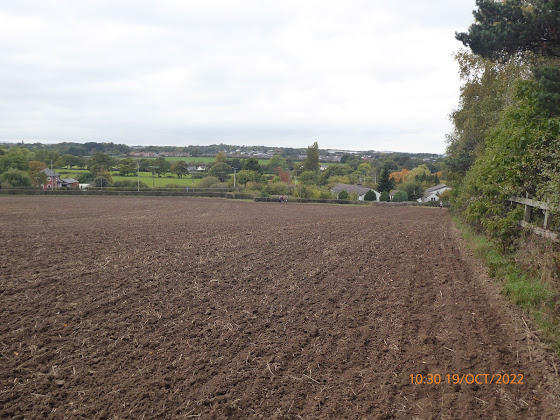
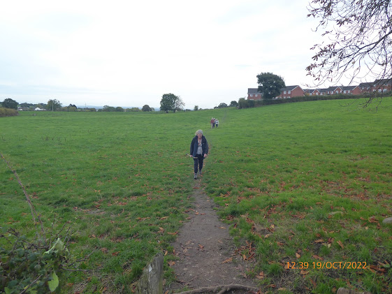
This is a walk that I did as one of my solo walks during the covid stay in Wales restrictions. It combines two of the Pen-y-ffordd Circular Waks.
The Walk "Into The Woods" is described as a gentle 5 mile walk through Penymynydd and Dobs Hill villages, experience nature in the semi-ancient woodland of Prices Hill Wood, wander ancient lanes and bridle paths and take in the beauiful scenery of the borderlands.
The other walk "Border Views" is described as a gentle 4 mile circular walk on countrylanes, farmer's field and bridle paths. You will be able to enjoy beautiful views towards Hope Mountain and across Cheshire to the Beeston Hills.
This walk is effectively a figure of eight walk eight walk,
Saturday 22nd October 2022.
A Clwydian Trio - or part of it!
Distance: 9 miles. Climb;1900' .Start: Pentre-celyn car park .. Grid ref: SJ150534. Post Code: LL15 2HE
The car parking area is on the left adjacent to the sign for Pentre-celyn, just off the B5429.
Leave Chester at 09-00 a.m.
Those planning to walk: Martyn (I will need a lift) Mike, Ed ,
(Those not walking: )
This is another walk by Debbie Hamilton and is taken from the "Walking" magazine. This walk includes the section of Offa's Dyke Path goes near Moel y Plas, Moel Gyw, Moel Llanfair and Boncyn y Waen-grogen. Her walk starts from Llanfair Dyffryn Clwyd, but we will start at Pentre Celyn about half a mile beyond Graigfechan.
The last time we did this walk, we shortened it to about 8 miles and 1300', so we may do the same today.
Wednesday 26th October 2022.
This month's short walk.
A Kelsall Round from the Morris Dancer.
Distance: 5.2 miles. Climb; 400.Start: Public car park next to the playing field by the Morris Dancer. Grid ref: SJ52266815. Post code: CW6 0RZ
Leave Chester at 09-00 a.m.
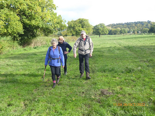
Those planning to walk: Martyn (I will need a lift), DS will pick me up bus stop opposite Chester Railway Station at about 0930.) David S, Wendy, Fran .
(Those not walking: Sue and Michel, Nigel, Ed, Mike)
This walk was suggested by DS. Initially it explores part of Kelsall village, taking the path souhward on the west side of Castle Hill and on past Kelsall Barrow Castle, alongside Birch Hill stowards Willington.
The return route uses lots of field paths via Weetwood Common and Hallowgate.
We will all be indulging in a meal at the Morris Dancer after the walk, anyone interested is welcome to join us for the meal, even if they can't make the walk. We anticipate finishing the walk at about 12-30.
Saturday 29th October 2022.
Traeth Lafan and Its Foothills
This walk will probably change as there are still major roadworks around Abergwyngregyn.
Distance:7-8 miles. Climb:1000'.
Start: Abergwyngeryn Free Car Park Grid ref: SH0652728. Post code: LL33 0LF
PC (opens about 09-30) nearby and a cafe at the outdoor centre that allows walkers to use the toilets (opens earlier than PC.)
Leave Chester at 08-30 a.m.
Those planning to walk: Martyn (I will need a lift) ,
(Those not walking: Ed)
This walk taken from Dave Berry's book "Walks On the North Wales Coast". The Traeth Lafan and it Foothills. This walk is an annual favourite and has in the past given us some wonderful experiences, especially in Winter trampling through soft fluffy knee deep snow, that didn't stick or wet our legs. You never know we may get some snow, this time too. It should be worthwhile bringing binoculars with you as we may visit The Spinnies Nature Reserve on the way back to our car.
This walk is described as walk of contrasting coastal and upland scenery with good views from the higher points on the North Wales path.
This time we will use the road to The Spinnies, and avoid the unpleasant smelly muddy experience of taking nthe path through the farm yard,
High tide is at about 13-40 and is about 9.2 m (30.2'), so the coastal birds may still be a little fairly close around the time we get there mid afternoon. Hopefully the tide won't be too far in by the time we get close to Traeth Lefan where we need to drop down onto the beach.
