About Me

My photo
When? Started: 1993 Who? Started with staff and friends from U H S, Chester. Organiser: Martyn Harris We walk every Wednesday and Saturdays, New Years day and May Day. How many walk? Walks take place as long as there are at least 2 wanting to walk on that day. More walk on a Wednesday than on a Saturday. Most ever: 29. Current group size walking: 2-7 in mid-week and 2-4 on Saturday. Where do we walk? Saturday: Anywhere in North and Mid-Wales, Peak District, Shropshire and the Long Mynd and as far North as the Trough of Bowland. Thursday: Anywhere within about 40 miles of Chester. Type of walk: Distance: 6 – 14 miles (but usually under 10 miles). Climb: up to 4000’ (but usually very much less!). People involved on walks in 2024:- Martyn Harris, Fran Murphy, Sue and Michel Pelissier, Mike Dodd, David Savage,, Ed Meads, Nigel and Elaine Taylor, Winston Feather.

Saturday, 28 September 2024

World’s End and Cyrn-y-Brain from the Ponderosa 28th September 2024


The Ponderosa at the start of our walk.
First views of Moel Famau.
The Berwyns above the Berwyn Quarries.
On the delightful moorland path, heading towards the Eglwyseg Valley.
Still on a good path.
Head for the sheep pens.
The new gate we should have used.
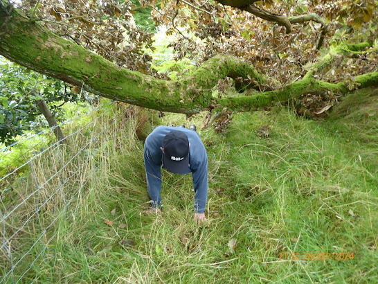
Autumnal leaves on a fallen oak tree that blocked the way ahead.
This was the only way to get past!
Looking back across the field below the quarry.
A n Offa's Dyke Footpath marker stone on the roadside.
The ford at World's End.
Using the stepping stones  to get past the ford at World's End.
Autumn leaves are falling.
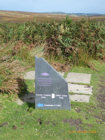
The slate Offa's Dyke Footpath marker stone showing the start of the paved section across the moors.
Heading for Llandegla Forest.
Is that the narrow path we want on the left of the fence.
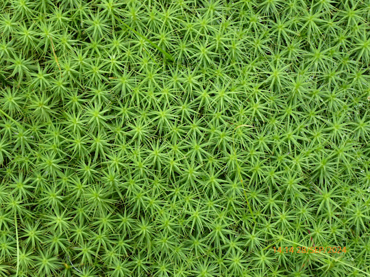
A beautiful moorland plant - it is a type of Star moss.
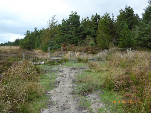
The stile that we wish we had remembered would have allowed us to bypass the heather and bilberry challenge.
Sir Watkin's Tower and trig point on Cyrn-y-Brain.
Moel Famau from Cyrn-y-Brain.
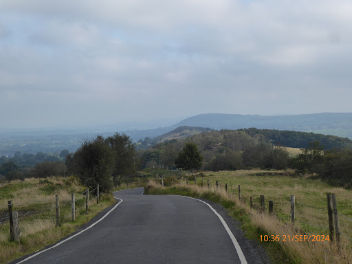
The Eglwyseg Escarpments from the track / road leading to the Panderosa.
Distant mountains of Eryri.
The final approach to the Ponderosa and the car.
Walk stats: 8.8 miles. Climb: 1545'.
Time: 5 hours 42 minutes. On the move walking average: 2.3 m.p.h. Overall Walk average: 1.5 m.p.h.
Temperature: 10.8 Celsius to 14.7 Celsius, but mainly around 11.8 Celsius
Beaufort Wind Force: Mainly 0-3. Mainly Calm, but did rise to a 7.8 m.p.h. Gentle breeze as we descended from Cyrn-y-Brain.
Group: Martyn and Mike.
The weather forecast was pretty good, but the feel like temperature given as below 10 Celsius, made me opt for my Paramo winter gear. After an hour, I thought I had made a mistake again and took off my jacket and kept it off until lunch time.
Near distant views were good, but mountains of Eryri and the Berwyns were not so easily identified. Moel Famau and the Clwydian hills were easily identified.
The start of the path across the moorland, heading south eastward to the Eglwyseg Valley gave superb views of the limestone escarpments.
The biggest challenge of the day was getting past a fallen oak tree. The only was we were able to get past, was to take off our rucksacks and crawl under the branches on our hands and knees.
Lunch was taken just before crossing the paved section of the Offa’s Dyke Footpath heading across the moors to Llandegla forest.
At the forest, we debated where the route description was directing us. We chose the right path through the heather and bilberries, that proved to hard going. We afterwards found we could have by-passes by going through the gate and taking the forest track to a stile that would enable you to rejoin the path across Cyrn-y-Brain.
Wooden pallets had been placed across the peat bog sections of the path, making it easier to avoid the worst bits.
We took the usual there and back to the Sir Watkin's Tower and trig point, before descending the track / road from the masts down to the Ponderosa.
As we went to the Sir Watking's Tower, it started to rain, but thankfully stopped after a few minutes.
Birds seen or heard included: Carrion crow, Jackdaw, Raven, Meadow pipit and Red grouse.
Overall, an enjoyable walk and home in time to clean my boots outside.
As we had heard that there was a new landlord at the Bridg Inn at Pontybodkin, decided to call in to see what it was like. Yes, things had changed, the only beer on hand pump was “Doom Bar”. Lots of young people drinking lager, it reminded me of being more like a rugby club bar. I don’t think I will be stopping there again for a drink anytime soon!

Wednesday, 25 September 2024

Cwm Blaenant and Around Foel Fenlli for Some September 2024


The easy start, downhill to Cwm Blaenant.
Heads up around Cwm Blaenant.
On the dark side of Cwm Blaenant!
V
View  of Bryn Alyn an Moel Findeg from our lunch spot.
The path heading for Foel Fenlli.
Still heading for F
oel Fenlli.
The path following the ramparts.
"I'm glad I didn't go that way!"
Part of the path along the ramparts on Foel Fenlli.
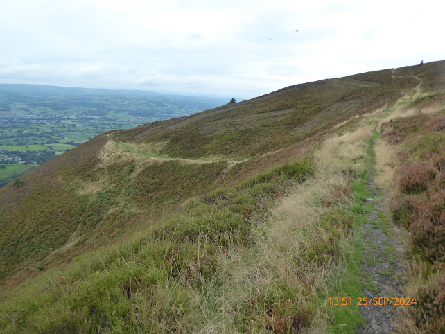
On the path along the ramparts on Foel Fenlli.
The final descent to the car park at Bwlch Penbarra.
Moel Famau from the path around the ramparts of Foel Fenlli
Walk stats: 6.5 miles. Climb: 1578.

Time: 4 hours 30 minutes. On the move walking average: 2.1 m.p.h. Overall Walk average: 1.4 m.p.h.
Temperature: 12.5 Celsius to 16.8 Celsius.
Beaufort Wind Force: Mainly 0-3. Mainly Calm, but did rise to an 8.2 m.p.h. Gentle breeze as we contoured around Foel Fenlli.
Group: Martyn, Sue and Michel, Nigel and Fran.
We were hopeful that we would complete the walk before the rain came in. At least the wind forecast indicated that using an umbrella would be feasible.
The temperature was forecast to be around 12 Celsius all day. But it was better than that, and at lunch tie in brief sunshine, it nearly hit 17 Celsius.
This was a walk that last year was finished in gale force condition, so today we were optimistic that it would be a better experience today,
We stared from the Bwlch Penbarra car park (now pay and display at £5-00), and started down the road towards Ruthin. The surprise of the day was seeing several Reed buntings around the bracken on the roadside.
It turned out to be a good, pleasant day for walking, although distant views were still in cloud or mist. How ever, we didn’t miss out on views of Moel Famau as we descended from Foel Fenlii to Bwlch Penbarra.
Surprising this is a bit of a roller coaster of a walk, with several downs, ups and even more downs.
Lunch was taken along the Offa’s Dyke Footpath, west of Moel-eithiinenen Farm, which we could see below us.
Fran's Bead cke and Martyn's frit gave us the extra nergy needed to climb the "stee3 path to the arm parts on Foel Fenlli.
The stiffest climb of the day was the climb from Bwlch Crug-glas to up to the ramparts of Foel Fenlli.
Nigel was keen to climb to the centre of Foel Fenlli, but without MD, he was looking for someone to join him. Surprisingly Michel opted to be that person!
Three of us took the easier option of taking the path that followed the rim of the ramparts, giving us good views across the Vale of Clwyd.
Birds seen or heard included: Woodpigeon, House sparrow, Common buzzard, Common kestrel, Black billed magpie, Carrion crow, Jackdaw, Raven, House martin, Meadow pipit, Winter wren, Jackdaw, European wren, Mistle thrush, European robin, Coal tit and Reed bunting.
Overall, an enjoyable walk, although no-one opted to take up the option of an extension that could have included Moel Famau.
After walk drinks were enjoyed at the Glasfryn in Mold, when the Purple Moose’s, Snowdonia Ale went down well with most of us. The real fire was burning well, very welcome as it did feel quite cool outside when we arrive.

Sunday, 22 September 2024

Congleton Edge, Mow Cop Castle and More 21st September 2024

Ed on his last Saturday Walk with Harris Hikers before heading to Scotland.
The view towards Jodrell Bank from the Cheshire View layby.
Congleton Edge from Mow Lane.
Part of path on the Gritstone Trail through Willcocks Wood.
The start of the climb up Congleton Edge.
The view from Congleton Edge towards Jodrell Bank.
On Congleton Edge.
A delightful section of the path over Congleton Edge.
The view towards Macclesfield and Sutton Common as we emerged from Whitemoor Wood.
On the Biddulph Valley Way.
On the towpath (part of the Cheshire Ring Canal Walk).
Crossing the canal, heading to our lunch spot.
Rudie the parrot had a chat with Ed, but went quiet when I went past.
Lunch time in the shade.
Ducks and  geese.
A Moorhen - catch me if you can.
The way ahead.
A few Canada geese grazing in the field next to the canal.
One of three appropriately named bird boxes in the trees next to the canal.
"I think it's this way."
A different view of the Old Man of Mow and Mow Cop Castle.
Ed standing next to the Old Man of Mow.
A place to rest and meditate.
Mow Cop Castle.
Mike descends the steps on the East side of Mow Cop Castle
A Common kestrel - our bird of the day.
Walk stats: 9.2 miles. Climb: 1066’.
Time: 5 hours 0 minutes. On the move walking average: 2.5 m.p.h. Overall Walk average: 2.2 m.p.h.
Temperature: 16.8 Celsius to 23.9 Celsius.
Beaufort Wind Force: Mainly 0 -3. Calm, mainly Light breeze, gusting to a 10.5 mph wind at Mow Cop Castle.
Group: Ed, Martyn and Mike
The forecast for today was pretty good, with the possibility of rain coming in after 16-00.
Arriving at the Cheshire View Point lay0by, our view was marginally better than the last time we did the walk. At least this time we could just about make out Jodrell Bank in the distance.
We decided to tackle Congleton Edge first and leave the Old Man of Mow and Mow Cop Castle to the end of the walk.
We set off on the walk a little later than expected as road closures at Astbury sent us on quite a long detour around Congleton.
Initially it quite pleasant walking, with the temperature around 17 Celsius, and plenty of cloud cover or tree cover shading us from any direct sunlight.
It was only when we left the Biddulph Valley Way onto the towpath of the of the Macclesfield Canal (part of the Cheshire Ring Canal Walk) that the Sun came out in full force. At one point the temperature rose to around 23.9Celsius, any occasional breeze was very welcome.
Lunch was taken by the canal, where several picnic benches and a bench provided good seats overlooking a canal basin, where we were entertained by the many Mallards a couple of Moorhen and a few squabbling geese.
After lunch we had we had the three-mile trudge along the tow path as far as “Ackers Crossing”.
Sometimes when you complete a walk in the opposite direction to the way you have done it in the past, it presents a few problems that you didn’t expect. Today was no exception, and trying to follow the South Cheshire Way to Roe Park took a few careful looks at the map before we got it right.
As we left Road Park / Hanging Wood, we had views of the Old Man of Mow and Mow Cop Castle that we hadn’t seen before, a real bonus.
It was good to see that they had removed the unsightly fence around the Old Man of Mow. Arriving at Mow Cop Castle, we found it to very busy, obviously it is a hot spot for tourists.
The final walk along Congleton Road / Mow Lane in good visibility was a pleasant contrast to the heavy mist / fog encountered last year.
Birds seen or heard today were but included: Woodpigeon, House sparrow, Common buzzard, Common kestrel, Black billed magpie Carrion crow, Wood nuthatch, Moorhen, Herring gull, Canada goose, Mallard, Winter wren, Jackdaw and Coal tit.
Arriving back at the car around 15-30, well before any expected rain, having had a really enjoyable walk, but disappointed that Ed had not been able to see the superb views that you can get from the view point layby on clear crisp day.
As we set off for home, we could se the rain clouds coming in, but it wasn’t until we were enjoying refreshments at The Stamford Bridge Country Inn at Barrow, that it began to rain and saw lightening through the window and heard thunder.