About Me

My photo
When? Started: 1993 Who? Started with staff and friends from U H S, Chester. Organiser: Martyn Harris We walk every Wednesday and Saturdays, New Years day and May Day. How many walk? Walks take place as long as there are at least 2 wanting to walk on that day. More walk on a Wednesday than on a Saturday. Most ever: 29. Current group size walking: 2-7 in mid-week and 2-4 on Saturday. Where do we walk? Saturday: Anywhere in North and Mid-Wales, Peak District, Shropshire and the Long Mynd and as far North as the Trough of Bowland. Thursday: Anywhere within about 40 miles of Chester. Type of walk: Distance: 6 – 14 miles (but usually under 10 miles). Climb: up to 4000’ (but usually very much less!). People involved on walks in 2024:- Martyn Harris, Fran Murphy, Sue and Michel Pelissier, Mike Dodd, David Savage,, Ed Meads, Nigel and Elaine Taylor, Winston Feather.

Saturday, 29 June 2024

The Dinorben Arms, Bodfari, Around Moel-y-Gaer, Sodom and More 29th June 2024

At the start of the walk.
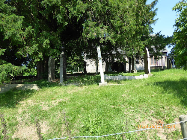
The War Memorial in the grounds of St. Stephen's Church, Bodfari.
The view from Coed y Lan towards the Clwydian Hills.
On the first climb of th day, heading towards Coed Moel-y-Gaer.
The view across the Vale of Clwyd from Coed Moel-y-Gaer.
Crossing the field towards Graig Tremeirchion.
The Great Orme just coming into view.
Moel y Parc from the highest point on the walk.
The view across the Vale of Clwyd from Sodom.
The Afon Wheeler.
Can't be far now, that's St. Stephen's Church we can see.
Nearly there, we can just about see the cars in the car park at the Dinorben Arms.
Walk stats: 5.9 miles. Climb: 991’.
Time: 3 hours 33 minutes. On the move walking average: 2.2 m.p.h. Overall Walk average: 1.7 m.p.h.
Temperature: 17.1 Celsius at the start, gradually increasing to 20.1 Celsius at the end.
Beaufort Wind Force: 0 - 2. Calm to light air and briefly increasing to a welcome 5.5 m.p.h. Gentle breeze
Group: Martyn, Tony, Gavin, Peter and John for the walk, with Jim and Nigel joining us for the meal.
This walk was the first walk for many years that a few of the men from Waverton Evangelical Fellowship have been able to get together on a walk followed by a meal at a nearby hostelry.
The weather forecast wasn’t looking good, with >60% chance of light rain expected throughout the morning.
We arrived at the Dinorben Arm, just as the rain started, so waterproofs were needed, although I decided to use an umbrella instead.
At least it wasn’t cold or windy. In fact, it was rather humid at times, and little wind we occasionally had was always welcome.
After leaving the Dinorben Arms, or route took us through the grounds St. Stephen's church. Some us paused to look at the small war memorial, appropriate as today was “Armed Forces Day”.
After leaving the church the walk took us through Coed y Lan, where I needed a help in hand to get over one rocky section. Leaving Coed y Lan, we started the climb up to Coed Moel-y-Gaer. Usually, you get good views from Coed y Lan across the valley and beyond, but today we could only see just across the valley.
However later on, we did manage to make out the Great Orme and the Clocaenog windfarm as the clouds lifted slightly.
By now, the rain had stopped and waterproofs had been discarded, making it feel much better temperature wise.
Probably our clearest views came as we approached the highest part of the walk and started to descend down the road through Sodom.
Arriving at Bodfari, we had a decision to make. Do we take the short cut back to the Dinorben Arms or do we take planned route south of the Denbigh Road to Aberwheeler. In the end we all ended up completing the whole walk.
Arriving back at the start, we were able to join Jim and Nigel in the Dinorben Arms. Everyone seemed to enjoy their meals and some cases a starter or pudding as well.
I also enjoyed the Elderflower Ale brewed at the Purple Moose Brewery at Porthmadog.
Birds seen or heard today were few, but included: Woodpigeon, House sparrow, Winter, House Martin, Barn swallow, Common swift, European robin and Common blackbird.
Overall, an enjoyable outing to the Dinorben Arms for a walk and / or meal.

Wednesday, 26 June 2024

In Search of St. Cynhafal 26th June 2024.

Distant view of Moel Famau from the banks of the Afon Clwyd.
The Afon Clwyd.
Our first encounter with some of the locals.
St. Hychan's Church near Gellifor.
St. Hychan's Church entrance seen through the trees.
Pointing out the Welsh St. Hychan's Church Notice Board.
Heading to church. 
Inside St. Hychan's Church
Distant view of Sy. Cynhafal's Church.
You  don't need to be able to understand Welsh to know the meaning of this message to those that walk by.
We were very tempted to call in for a pint, but resisted!
On the road to Llandyrnog.
Walk Stats:
Distance: 6.9 miles. Climb: 410’
Time: 4 hours 24 minutes.
On the move walking average: 1.6 m.p.h.
Overall walk average: 1.3 m.p.h.
Temperature: 23.1 Celsius. Max – 29.1 Celsius
Beaufort Wind Force: 2, just light air, but very pleasant to feel on the brief occasions we were experienced it.
Group: Martyn, Sue and Michel, Nigel and Ed.
The weather forecast today was good, warm and dry with plenty of sunshine, in fact it was too warm and humid, particularly after lunch, so much so that we cut the walk short.
A varied walk, marred by one path that was overgrown and made us divert through an adjacent field.
Many of the stiles had been replaced by kissing gates, always welcome by those of us that are challenged by climbing over stiles. After lunch we were challenged by a narrow path with barbed wire on one side and lots of nettles on the other. Needless to say, we all experienced the “joy” of being nettled.
On this occasion we were able to go inside St. Hychan’s Church before having an early lunch opposite the church. Thankfully we were able to sit in the shade as we had lunch.
No photo of my view at lunch time as the local refuse collectors were having their lunch break sitting on the grass opposite.
We had good views of the Clwydian Hill, especially Moel Arthur and Mol Famau.
As we cut the walk shoe didn’t make it as far as St. Cynhafal’s Church, although we did see it in the distance.
Arriving back at the car we were grateful to be able to take our boots off and head to the Dinorben Arms for liquid refreshments.
Birds seen or heard today: Carrion crow, Jackdaw, House sparrow, Dunnock,
European robin, Common blackbird, Chiffchaff, Winter wren, Woodpigeon, Common buzzard Goldfinch, Greenfinch, Grey wagtail and Grey heron.
After walk drinks today were enjoyed at the Dinorben Arms at Bodfari where Purple Moose’s Elderflower Ale went down well. We were able to sit outside in the shade of a parasol and enjoy the views across the valley towards the Clwydian Hills.


Saturday, 22 June 2024

Holyhead Breakwater Country Park and South Stack Cliffs Nature Reserve 22nd June 2024.

Sight and sounds of the sea.
Looking across the bay to Soldiers Point and Holyhead.
Porth Namarch.
The trig point on Holyhead Mountain.
On the coastal path.
On the way to Holyhead.
North Stack ahead.
Canoes on the sea.
More canoes on the sea.
North Stack.
The magazine store at North Stack.
South Stack from North Stack.
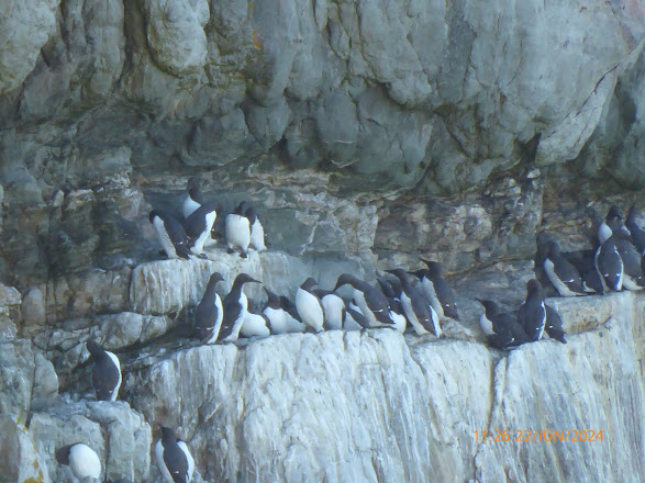
Guillemots on the cliffs at North Stack.
Fulmars on the cliffs at North Stack.
Nesting Great cormorants or are they Shags?
Two ferries and a Cruise liner ay Holyhead
Two walkers approach the trig point on Holyhead Mountain.
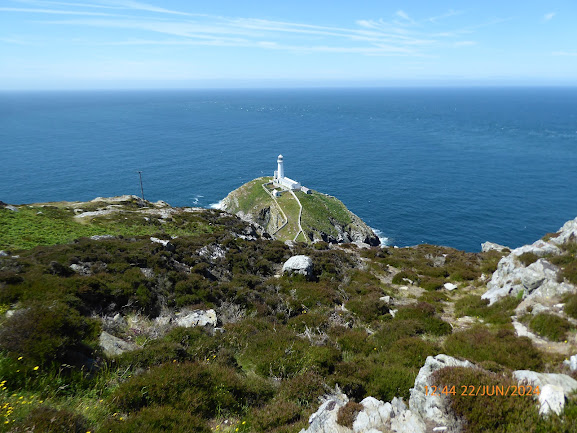
South Stack.
Is that a Puffin coming into land?
Guillemots at South Stack cliffs,
South Stack again.
More Guillemots on the cliffs at South Stack.
Distant views of Yr Eryri.
"I think this is the path we want!"
Holyhead Breakwater.
Walk Stats:
Distance: 7.8 miles. Climb: 1467’
Time: 5 hours 36minutes.
On the move walking average: 2.0 m.p.h.
Overall walk average: 1.3 m.p.h.
Temperature: 17.1 Celsius. Max – 20.6 Celsius
Beaufort Wind Force: 3, a very pleasant Gentle breeze as we approached South Stack and for much of the afternoon. Felt more like a Moderate breeze when we descended the steps towards the South Stack Lighthouse.
Group: Martyn and Ed.
The weather forecast today was looking good. In fact, it was better than forecast as we had blue skies all day.
We started at the parking area near the entrance to Soldiers Point. As usual we completed the walk in an anticlockwise direction, following the coastal path with its superb views over the sea.
On this occasion we decided to visit North Stack rather than climb to the top of Holyhead Mountain.
We surprised to see the number of orchids still flowering close to the coastal path, At North Stack, we had good views of nesting Guillemots and Fulmars.
We stopped for lunch at South Stack, where we heard Red billed choughs calling nearby, but never close enough to photograph.
After lunch we set of down the South Stack steps in the hope of seeing a Puffin, but we didn’t see any with any degree of certainty.
We took the inland route back to the start, determined this time to find the path that avoided dropping down to the road.
Birds seen or heard today: Carrion crow, Jackdaw, Raven, House sparrow, Dunnock,
European robin, Common blackbird, Stonechat, Chiffchaff, Winter wren, Common whitethroat, Woodpigeon, Meadow pipit, Barn swallow, Common pheasant, Guillemot, Great cormorant, Oystercatcher, Herring gull, Ganet and Kestrel.
Overall, an enjoyable walk, despite not seeing a Puffin.
After walk drinks today had to wait until we were back at home.

Thursday, 20 June 2024

Around Minera Mountain 19th June 2024.


One of many orchids seen today.
Minera limestone quarry.
Minera limestone quarry from the south (north of Park Farm).
Distant views of Moel Famau.
At the trig point on Esclusham Mountain.
A Beluga XL passes overhead as we had lunch.
Moel Famau from the trig point on Esclusham Mountain.
The Clwydian Hills from the trig point on Esclusham Mountain.
Plenty og Bog cotton Fron-deg Flats. 
Crossing Fron-deg Flats.
White Park Cattle in what is usually a sheep (Jacob's Sheep) field.
The Jacob Sheep are still around, just moved to a different field.
A young foal with its mother.
Walk Stats:
Distance: 7.8 miles. Climb: 1156’
Time: 4 hours 43 minutes.
On the move walking average: 2.4 m.p.h.
Overall walk average: 1.7 m.p.h.
Temperature: 17.1 – 20.2 Celsius
Beaufort Wind Force: Max 2, a very pleasant Light breeze as we crossed Minera Mountain mid-afternoon.
Group: Martyn, Mike Sue and Michel, and Ed.
The weather forecast today was looking good, even a little warm / humid towards lunch time.
Distant views today were good, particularly towards the Berwyns and Clwydian Hills.
We missed one of the paths that we wanted and ended up seeing more extensive views of the Minera Quarry than we expected. Lunch was taken by the trig point on Esclusham Mountain.
Later on, we followed a path that took us a little further south from Fron-deg than we wanted. Thankfully we managed to get down to a minor road that linked with our route.
The final part of the walk allowed us to explore another path that led towards The Nant, and it was on this section that we encountered stiles for the first time, but at least it meant we avoided walking down one of the busier roads back to the Minera Lead Mine Centre.
Overall, an enjoyable walk, glad to take off our boots and sit in the car in the shade.
Birds seen or heard today: Carrion crow, Jackdaw, Raven, House sparrow, Dunnock,
European robin, Common blackbird, Common chaffinch, Chiffchaff, Winter wren, Common whitethroat, Woodpigeon, Willow warbler, Meadow pipit, Skylark, Barn swallow, Common pheasant, Red grouse and Cuckoo,
After walk drinks were enjoyed at the Pant yr Ochain where Purple Moose’s Cwrw Eryri went down well us for most of us and the alcohol free Fentiman’s Ginger Beer was enjoyed by the driver. We even sat outside, still in the Sun.