Looking northward towards Llandrillo.
We know our route is over there, but it doesn't look too promising.
Bog aspodel.
Crossing the moorland on the west side of Carnedd y Ci.
Just before crossing Nant Cwm Tywell near the sheepdip.
A fingerpost points the wayup Foel Fawr and Cadair Berwyn.
Nigel at the trig point on Caair Berwyn.
At Cadair Berwyn trig point.
Crossing the Cadair Beryn ridge on the way to Bwlch Maen Gwynedd.
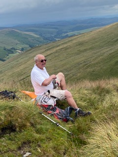
Lunch time at the top of BwlchMaen Gwynedd.
Druids at the Bronze Age cairn circle on Moel Ty-uchaf?
No, an elderly couple and in the centre a couple of teenagers that were enjoying the view and something else that we could smell as we went past them.
Distance: 10.4 miles. Climb: 2480' on one GPS and 2078' on the second GPS.
Time: 7 hours 0 minutes. On the move walking average: 2.0 m.p.h. Overall walk average: 1.5 m.p.h.
Max temperature on the way up: 25.2 Celsius. Lowest temperature: 13.2 Celsius o Cadair Berwyn.
Beaufort Wind Force: 0 - 3. Mainly calm/light air/light breeze and gentle breeze at Bwlch Maen Gwynedd.
Group: Martyn and Nigel.
The forecast for today wasn't good, but we were optimistic that the mist/fog/low cloud would lift by the time we got there. it almost did, we didn't get really good views from the Berwyn Ridge, although we did get that magical moment when the cloud /mist lifted and we had a good view south down Cwm Bwlch Maen Gwynnedd.
Our main challenge toay was crossing streams, the Chlochnant, an unnamed stram and Nant Cwm Tywell, but it was the first one that gifted us wet feet for the rest of the day.
The only rain we had, lasted for about half an hour when I had to resort to using my umbrella.
Surprisingly we did see more people on the moors than we expected, a farmer checking his sheep and a group of four walkers on the summit ridge and a lone walker out with his dog.
Conditions were such that we didn't stop for lunch until 14-00, when we dropped down on the south side of Bwlch Maen Gwynedd to get out of the cool wind.
It was while we had lunch that we had some superb views of Red kites, briefly being able to look down on them.
Not many birds seen or heard today but those we did included: Red kite, Common buzzard, Wood nuthatch, Goldfinch and Meadow pipit.
The path we used in descent from Bwlch Maen Gwynedd contouredaround the west of Cadair Bronwen and Moel Pearce, before visiting the Bronze Age cairn curcle on Moel Ty-uchaf.
We arrived back at the car, knowing we had had a good walk lasting exactly 7 hours and with feet still wet. This didn't bother us, and at least Nigel could put a tick next to Cadair Berwyn on his list of hills/mountains done!


No comments:
Post a Comment