About Me

My photo
When? Started: 1993 Who? Started with staff and friends from U H S, Chester. Organiser: Martyn Harris We walk every Wednesday and Saturdays, New Years day and May Day. How many walk? Walks take place as long as there are at least 2 wanting to walk on that day. More walk on a Wednesday than on a Saturday. Most ever: 29. Current group size walking: 2-7 in mid-week and 2-4 on Saturday. Where do we walk? Saturday: Anywhere in North and Mid-Wales, Peak District, Shropshire and the Long Mynd and as far North as the Trough of Bowland. Thursday: Anywhere within about 40 miles of Chester. Type of walk: Distance: 6 – 14 miles (but usually under 10 miles). Climb: up to 4000’ (but usually very much less!). People involved on walks in 2024:- Martyn Harris, Fran Murphy, Sue and Michel Pelissier, Mike Dodd, David Savage,, Ed Meads, Nigel and Elaine Taylor, Winston Feather.

Wednesday, 29 January 2025

Burton, Neston and More 29th January 2025.


Looking at the Quaker Graves in Burton Wood.
The entrance to the Burton Wood challenge.
Which way now? Left or right?
They don't know either - they're just following us.
First views of Moel Famau.
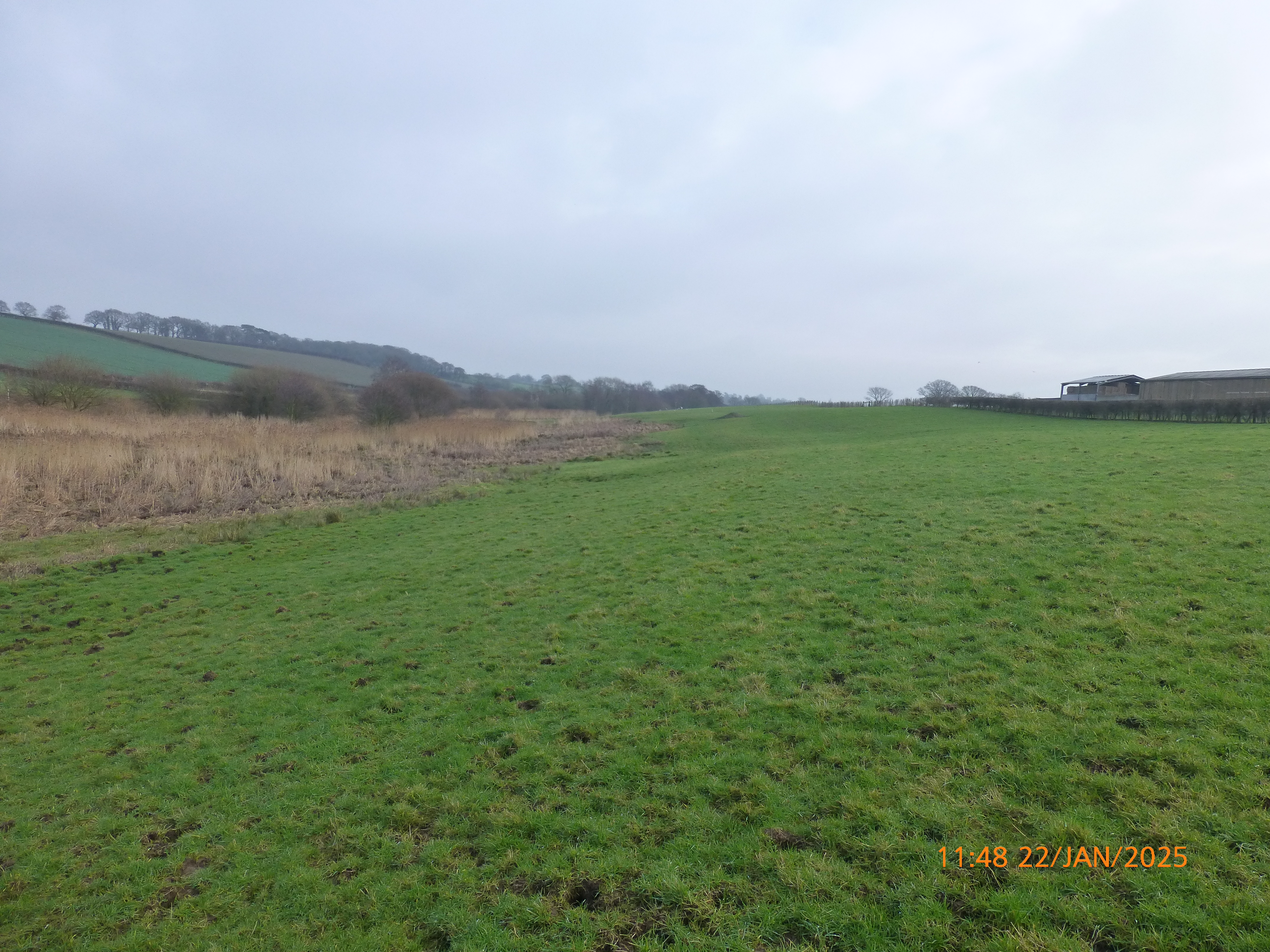
Distant views of the Clwydian Hills and North Wales.
Common coots on a flooded field.
Greylag geese and Shoveler on the flooded field.
A Eurasian curlew in fields near the footpath.
Snowdrops just beginning to show.
Fran's better photo of Snowdrops on our walk today.
A better view of Moel Famau.
The pipeline of slurry disappearing into the distance.
The delightful path leading to the Wirral Way.
A new bridge being constructed on the Wirral Way - thankfully we didn't need to cross it.
A  delightful section of the Wirral Way.
The Fairy Garden and picnic site.
"Are you looking for my marmalade sandwich?"
A Carrion crow overlooks our lunch spot.
The Wirral Way through the Neston Cutting.
Distance: 7.8 miles. Climb: 1542’
Time: 4 hours 28 minutes.
On the move walking average: 2.5 m.p.h.
Overall walk average: 1.7 m.p.h.
Temperature: 4.4 Celsius at the start. 7.8 Celsius at lunch and 7.8 Celsius at the end.
Beaufort Wind Force: 0 – 2. Mainly calm, but reached a 5.7 m.p.h. Light breeze near the end of the walk
Group: Martyn, Mike, Nigel and Fran.
We have done this walk many times and finding the way through Burton Wood to Mill Lane has always been a challenge. Today was no exception, and we emerged onto Wood Lane, not Mill Lane – failed again.
The surprise of the day was seeing a very long pipe system fill with slurry and move through the pipe into a field in the distance.
Lunch was taken on the Wirral Way, where we took advantage of suitably place tree trunks by the “Fairy Garden”. This was a pleasant lunch stop, as we basked in the warm sunshine, listening to all the birds singing in the trees nearby.
Birds seen or heard today: House sparrow, Dunnock, Jackdaw, Common blackbird, Common starling, Carrion crow, Woodpigeon, Blue tit, Coal tit, European robin Common chaffinch, Eurasian curlew, Mallard, Common coot, Greylag goose, House sparrow, Great spotted woodpecker, Goldfinch, Black billed magpie, Shoveler, Great tit, Tufted duck, Black headed gull, Great white egret and Common buzzard.
Overall, an enjoyable walk, despite the frequent muddy paths we encountered.
Thankfully, cleaning my boots, proved a ten-minute job which I managed to do just after getting home.
After walk drinks were enjoyed at Rake Hall, Little Stanney where Brimstage Brewery’s Trappers Had was the beer of choice. Despite the fact that the first pint seemed too cold, it didn’t stop a second pint being samples. Two of us decided that another pot of tea was not required!

Tuesday, 28 January 2025

Walks and Dates January 2025


Saturday Walks.
I have decided that it has become pointless for me to plan Saturday walks in advance as most weeks I am the only one around.
However Saturday walks can be arranged on request.
One short walk a month could be included on request.
Wednesday 1st January 2025.
 A Cilcain and Moel Arthur Round.
Postponed due to a very wet and windy weather forecast.
Distance: 8.0  miles. Climb: 1844'
Start: Cilcain Viewpoint Car Park area. Grid ref: SJ17046522
Leave Chester at 09-00 a.m.
Those planning to walk: Martyn, Mike, Fran, Nigel.
Those not walking: .
Initially, it was suggested that the walk should include Penycloddiau, but the distance came to nearly 12 miles with a climb of 2230'.  In my thinking that is too demanding for a walk on New Years Day.
The walk that I suggest  we do, includes Moel Arthur, but takes the forest path from the Coed Llangwyfan Car Park before joining the track that contours around the hillside west of Moel Arthur, eventually joining the Moel Arthur - Cilcain Road.  Rather than retracing our steps along the road , I suggest we take the path that rises as it crosses the northern slopes of Moel Llys-y-coed, eventually joining the Cilcain Road at Gronfoel.  We would then retrace our steps  from Gronfoel back to the Cilcain Viewpoint car park.
Fran has suggested that a 5 mile walk would encourage some of the group to come out for a walk on 1st January 2025.
The walk she suggested would be:-
Distance: 5 miles. Climb: 1100'
Initially the route follows the road  track leading to the Moel Arthur Car Park. The walk then would involve following Offa's Dyke Path around the eastern slopes of Moel Arthur and returning over the summit the summit and back to the car parking area.
From the Moel Arthur Parking are, I suggest that we we take the path that rises as it crosses the northern slopes of Moel Llys-y-coed, eventually joining the Cilcain Road at Gronfoel. We would then retrace our steps  from Gronfoel back to the Cilcain Viewpoint car park.
The amount of climb involved could be reduced by about 100' by retracing our steps from the Moel Arthur parking area back to the car.
Saturday 4th January 2025.
No planned walk - see below for a list of possible walks.
Wednesday 8th January 2025.
Around the Little Orme to Rhos On Sea. 
Distance: 8-9 miles. Climb: 700'.
Start: Roadside parking next to Paddling Pool and PC on Coast Road at Craig y Don, East side of Llandudno.
Leave Chester at 08-45 a.m.
This has become a regular walk at any time of the year, but at this time of the year we stand a good chance of seeing Grey seals in Angel Bay, especially as Low Tide is around 11-10. 
The views from the top of the Little Orme are always superb. 
The main reason for doing the walk so early in the year is to see if there are any Seals around Porth Dyniewaid.
Bring binoculars with you if you have them.
Saturday 11th January 2025.
No walk - I am going to a friend's leaving do.
Wednesday 15th January 2025.
Rhuddlan L.N.R ., the Rhuddlan to Rhyl Riverside Walk with possible extensions to the Brickworks Pool N.R. and the Forydd.
Distance: 8 - 9 miles. Climb: 120'.
Start: Park at the Rhuddlan L.N.R. car park. Grid ref: SJ020776. 
The car park is on the Western side of Rhuddlan. To get to the car park, from the A55, turn right on to the A525 (St. Asaph Road towards Rhyl and Rhuddlan), at the next roundabout take the 3rd exit onto Station Road (to Rhuddlan centre / Castle). The car park is on the right, opposite a new hotel. If you get to the bridge over the river you've gone too far!
Those planning to walk: Martyn, .
Those not walking: .
This walk is an annual favourite, at least for those that like to do as little birdwatching as well. It is a good time of the year as there are lots of Winter visitors that frequent coastal areas and river estuaries. Bring binoculars with you.  Last time we had lunch by the Marine Lake, near the Foryd.  We have also had lunch on the beach at the Foryd. Although we didn't see Snow buntings on the Foryd last year, with a bit of luck we may see them this year. High tide at the Foryd is at 09-09, 8.3 m / 27,2'.Last year we didn't do any of the extensions!  Extension, if any will  be taken at each appropriate point in the walk on the day.
Saturday 18th January 2025.
The Edge to Nether Alderley and the Edge and Hough.
Distance: 9-10 miles; Climb: Not a lot (less than 1000' at a guess).
Start: National Trust car Park close to the Wizard Restaurant, Alderley Edge. This is a Pay and Display car park - Free to National Trust Members. Grid ref: SJ860773.
This walk combines two walks from Graham Beech's book " East Cheshire Walks". He describes it as being moderate. The walk will again probably give us views of the communications tower on Croker Hill/Sutton Common. We may also get the opportunity to visit Nether Alderley Mill (National Trust- so bring your N.T cards with you if you are members.
Wednesday 22nd  January 2025.
The Trent and Mersey Canal, Great Budworth and More.
Start: Marbury Country Park car Park (Pay and Display £2-50 last time). Grid ref: SJ652763.
Distance: 7-8 miles. Climb: 1000'.
Leave Chester at 09-00 a.m.
Those planning to walk: Martyn, . 
Those not walking: . 
The main 7 mile walk is taken from the "Pathfinders Guide to Cheshire". This is described as a varied walk with plenty of historic interest, including the Anderton Boat Lift.. The extra mileage will be made by exploring the Anderton Nature Park, Marshall's Wood, Carey Park, Ashton's Flash and Neumann's Flash.  Bring binoculars with you if you can. 
Saturday 25th January 2025.
 A Cilcain and Moel Arthur Round.
Distance: 8.0  miles. Climb: 1844'
Start: Cilcain Viewpoint Car Park area. Grid ref: SJ17046522
Leave Chester at 09-00 a.m.
Those planning to walk: Martyn, Mike, Fran, Nigel.
Those not walking: .
Initially, it was suggested that the walk should include Penycloddiau, but the distance came to nearly 12 miles with a climb of 2230'.  In my thinking that is too demanding for a walk on New Years Day.
The walk that I suggest  we do, includes Moel Arthur, but takes the forest path from the Coed Llangwyfan Car Park before joining the track that contours around the hillside west of Moel Arthur, eventually joining the Moel Arthur - Cilcain Road.  Rather than retracing our steps along the road , I suggest we take the path that rises as it crosses the northern slopes of Moel Llys-y-coed, eventually joining the Cilcain Road at Gronfoel.  We would then retrace our steps  from Gronfoel back to the Cilcain Viewpoint car park.
Wednesday 29th January 2025.
Burton, Neston and Parkgate with short Extension.
Distance: 8-10 miles. (With plenty of opportunities to shorten the walk on the day if we decide that is what we want). Climb:215'.
Start: Roadside parking on Denhall Lane next to benches overlooking the marshes. Grid ref: SJ301747.
Leave Chester 9-00 a.m.
Those planning to walk: Martyn, . 
Those not walking: .
The Burton circuit is taken from Jen Darling's book "Walks in West Cheshire and the Wirral". The extension will involve some road walking through Neston to link up with the Wirral Way and onto Parkgate. The return route will use coastal paths as much as possible and passes Neston Old Quay and Denhall Quay on the way back to Denhall Lane.
High tide is about 10-35. 9.1 m / 29.8'. If preferred we can always return along the Wirral Way rather than along the beach from Parkgate to Little Neston.
List of Possible Saturday Walks.
England.
Bollington to Bowstones.
Distance: 9-10 miles.
Climb:1800' at a guess.
Start: Adlington Road, Car Park. Adlinton Road is on the north of Bollington, a left turn just off the B5090.
Grid ref: SJ93087802
This walk is taken from Graham Beech's book "East Cheshire Walks", and is the second walk from this book that we will undertake. He describes this walk as an exhilarating walk to the Bowstones, and is a popular walk. It includes a fair portion of Lyme Park and sections of the Gritstone Trail. He describes the walk as strenuous, but I think we can still cope, even though it is over fifteen years since we last did it.
Big Low, Berristall Vale and the Saddle of Kerridge.
Distance: 8-9 miles; Climb: 2000'
Start: The Adlington Street car park Grid ref: SJ931782.
This is another walk that combines two walks from Graham Beech's book "East Cheshire Walks". He describes the walks as moderate to strenuous and includes some of the most scenic surroundings around Bollington. We have already strolled along Kerridge Hill and can vouch for that part of the walk.
After walk drinks will be in the Vale Inn, a hostelry.
Wales.
Conwy Mountain and Around Maen Esgob and Craigfedwen.
Distance: 8 miles. Climb:1447'.
Start: Long stay car park on the B5106 at Conwy. Pay and Display. Grid ref:SH781773. Post code: LL32 8LS
The walk starts by heading through the castle walls and on the North Wales Coastal Path along the harbour as far as the secondary school. The North Wales Path is the followed over Conwy Mountain through Castell Caer Seion and onto the Sychnant Pass.
 The views from the Conwy Mountain Ridge can be superb, with the Great Orme in one direction and Tal y fan in the other, as well as good views towards Conwy castle and the Conwy Valley.
 After crossing the Sychnant Pass Road, the North Wales Path is once more folowed. At the point where there is a definite fork, it is possible to make a short there and back extension to visit the site of a monument. Returning to the North Wales Path, it is then followed along the East side of Maen Esgob as far as the head of the Fairy Glen. A path heading eastward then takes us past Llyn y wrach.
 Once the West side of Maen Esgob is reached, the main track is followed parallel to the stone wall towards Craigfedwen, where the footpath goes South of Waeny-fedwen and onto the minor road near Llechwedd. The route goes Northward on the road ad then takes the first path on the right which leads around Bryn-mawr to a minor access road. It is along this road that several large and/or interesting properties can be seen. at the T-junction, the route goes right and in a very short distance a broken kissing gate leads the way to a field path leading  to the Sychnant Pass Road at Mount Pleasant on the outskirts of Conwy. The Sychnant Pass Road  is then followed back to Conwy.
Traeth Lafan and Its Foothills.
Distance:7-8 miles. Climb:1000'.
Start: Abergwyngeryn Free Car Park Grid ref: SH0652728. Post code: LL33 0LF
PC (opens about 09-30) nearby and a cafe at the outdoor centre that allows walkers to use the toilets (opens earlier than PC.)
Leave Chester at 08-30 a.m.
This walk taken from Dave Berry's book "Walks On the North Wales Coast". The Traeth Lafan and it Foothills. This walk is an annual favourite and has in the past given us some wonderful experiences, especially in Winter trampling through soft fluffy knee deep snow, that didn't stick or wet our legs.  You never know we may get some  snow, this time too. It should be worthwhile bringing binoculars with you as we may visit The Spinnies Nature Reserve on the way back to our car.
This walk is described as walk of contrasting coastal and upland scenery with good views from the higher points on the North Wales path.
 This time we will use the road to The Spinnies, and avoid the unpleasant smelly muddy experience of taking the path through the farm yard,
We may see a Kingfisher at The Spinnies, but that often depends on whether the tide is coming.

Sunday, 26 January 2025

Moel Arthur and Coed Llangwyfan from the Cilcain Viewpoint 25th January 2025.

Moel Famau from the Cilcain Viewpoint.
The first Snowdrops seen on our walks this year.
Moel Arthur, our main objective today.
The higher path to Gronfoel that we will use later in the day.
On the summit of Moel Arthur with snow covered Eryri in the background.
The path descending Moel Arthur towards Penycloddiau.
Distant view of Eryri as we descended Moel Arthur.
Another distant view of Eryri as we descended Moel Arthur.
The start of the path through Coed Llangwyfan.
More of the path through Coed Llangwyfan.
A  distant view of Eryri from our lunchtime spot.
Another view of Eryri from our lunchtime spot.
Not what we expected to pass us as we had lunch.
The unusually designed property now complete near the start of "muddy" bridleway back to the Moel Arthur road.


More of the bridleway to the Moel Arthur road.
The bridleway to the Moel Arthur road - seems to go on for ever!
The gate that let's us escape from muddy trudge we had experienced for the last mile or so.
Mike takes the last few steps before escaping to the delights of walking on tarmac!
Looking back towards Moel Arthur from the Gronfoel path,
Distant views towards the Wirral from the Gronfoel path.
Moel Famau from the Gronfoel path, just before descending to Gronfoel.
Distance: 8.2 miles. Climb: 1542’
Time: 5 hours 17 minutes.
On the move walking average: 2.3 m.p.h.
Overall walk average: 1.6 m.p.h.
Temperature: 4.4 Celsius at the start. 7.8 Celsius at lunch and 7.8 Celsius at the end.
Beaufort Wind Force: 2 – 4. Mainly Light breeze, but did reach a 16.5 m.p.h. Moderate breeze on the top of Moel Arthur.
Group: Martyn, and Mike.
We arrived at the start with the temperature at 4.4 Celsius, but feeling much cooler. In fact, I had to borrow Mike’s spare hat which was much appreciated when it was needed until we got to the top of Moel Arthur.
Distant views towards North Wales were good and the snow-covered high tops were clearly seen. However distant views towards Cheshire were somewhat misty.
Lunch was taken just after leaving Coed Llangwyfan, where we sat on the bank overlooking the Vale of Clwyd. Sheltered from the wind a in the warm sunshine, this was a very pleasant place to stop. However, the path below us was a bridleway and we were briefly disturbed by a group of motorcyclists that needed to stop near us to open a gate enabling them to proceed.
After lunch we took the bridleway that contoured around the hills west of Moel Arthur. An easy track, but prone to being very muddy as it was today. I must remember in future to only choose this path after a long period of dry weather and never in Winter months.
Arriving at the bwlch between Moel Arthur and Moel Llys-y-coed, we decided to take the path across the hillside to Gronfoel. The highest point on this path was just over1300’, but by mid-afternoon the ground was still frozen hard.
Birds seen or heard today: House sparrow, Dunnock, Jackdaw, Common blackbird, Common starling, Raven, Carrion crow, Woodpigeon, Blue tit, Coal tit, European robin and Common buzzard.
Overall, an enjoyable walk, completed in warm sunshine and blue skies throughout, weather much better and less windy than we expected.
We did try to call in at the Blue Bell, but their car park was full, even the green opposite had lots of cars parked, so we decided o head for the Brit. After walk drinks were enjoyed at the Britannia Inn at Halkyn, where Sarah gave us a walm welcome and the Lees bitter went down well.

Thursday, 23 January 2025

Marbury Country Park, Great Budworth and Pick Mere 22nd January 2025


I'm still alive.
First views of Big Mere.
Gulls on ice.
The view across the mere towards Great Budworth.
Visiting the Great Budworth drinking fountain.
Walking through Great Budworth.
St. Mary's and All Saints Church, Great Budworth.
The way ahead to Pick Mere.
A Grey heron perched in a tree next to Pick Mere.
Mute swans on Pick Mere.
Looking down Pick Mere towards the village.
Common coot on Pick Mere.
Great cormorant at Pick Mere.
Our view from our lunch spot overlooking Pick Mere.
Great Budworth from the Trent and Mersey Canal towpath
The three "?" on the footbridge leading into Black Wood and Big Wood.
No comment.
The path through Big Wood.
One of many Grey squirrels seen at the feeding station in Big Wood.
Heading back to the car park.
A Goldeneye on Big Mere, Marbury Country Park.
Mute swans and Mallard on Big Mere.
One of the fine avenue of trees in Marbury Country Park.
Distance: 7.9 miles. Climb: 410’
Time: 4 hours 847 minutes.
On the move walking average: 2.4 m.p.h.
Overall walk average: 1.6 m.p.h.
Temperature: 3.0 Celsius at the start. 7.8 Celsius at lunch and 4.0 Celsius at the end.
Beaufort Wind Force: 0 – 1. Mainly Calm, but occasionally we just about felt something (Light air).
Group: Martyn, Mike, Fran and Nigel. It was pretty misty all the way to Marbury Country Park, and it didn’t look like lifting. Views across the mere were somewhat misty. There was still some surface on the mere, evident by a few gulls that were standing on it.
We had an interesting chat with birdwatcher / photographer who showed is pictures of a Hawfinch that he had taken in the park yesterday.
Conditions underfoot were boggy in places, but cleaning our boots when we got home was very easy.
The Sun did put in a brief appearance as we arrived at Pick Mere, making it a very pleasant lunchtime as we sat on the benches overlooking the mere.
The stretch along the towpath of the Trent and Mersey Canal is always rather tedious, although today we seemed to get to the footbridge quicker than usual. We finished the walk by exploring the Black Wood and Big Wood before dropping down to the mere-side path. It was interesting to see the new feeding stations, well stocked, appreciated by birds and Grey squirrels alike.
Birds seen or heard today: House sparrow, Dunnock, Jackdaw, Common blackbird, Common starling, Collared dove, Mallard, Carrion crow. Black headed gull, Goldfinch, Woodpigeon, Blue tit, Coal tit, Common chaffinch Great tit, European robin, Tufted duck, Grey heron, Goldeneye, Great cormorant, Common buzzard, Mute swan, Eurasian curlew, Eurasian jay and Wood nuthatch.
Overall, an enjoyable walk, that proved a little more challenging than we had originally expected.
After walk drinks were enjoyed at the Morris Dancer in Kelsall, where Mike and Nigel had a beer or and the rest of us had a pot of tea between us. Even better today, Nige got the tea pot topped up with hot water, so I was able to have more than a couple of cups!