About Me

My photo
When? Started: 1993 Who? Started with staff and friends from U H S, Chester. Organiser: Martyn Harris We walk every Wednesday and Saturdays, New Years day and May Day. How many walk? Walks take place as long as there are at least 2 wanting to walk on that day. More walk on a Wednesday than on a Saturday. Most ever: 29. Current group size walking: 2-7 in mid-week and 2-4 on Saturday. Where do we walk? Saturday: Anywhere in North and Mid-Wales, Peak District, Shropshire and the Long Mynd and as far North as the Trough of Bowland. Thursday: Anywhere within about 40 miles of Chester. Type of walk: Distance: 6 – 14 miles (but usually under 10 miles). Climb: up to 4000’ (but usually very much less!). People involved on walks in 2024:- Martyn Harris, Fran Murphy, Sue and Michel Pelissier, Mike Dodd, David Savage,, Ed Meads, Nigel and Elaine Taylor, Winston Feather.

Thursday, 31 October 2024

The Leete, Around Cilcain Reservoirs, Moel Famau and Ffrith Mountain 31st October 2024


The Alyn from the bridge at Loggerheads.
Part of the Leete Path heading northward.
More of the Leete Path heading northward.
The entrance to mine workings, seen from the Leete.
On the Leete Path.
Our first view of the restored site after removing the two reservoirs.
A different view of the restored site, showing the breach in the dam wall and Nant Gain flowing through it.
Nant Gain flowing into the restored site.
Nant Gain flowing through the restored sit (after the removal of the west reservoir).
The upper reservoir (south of Garth farm).
The upper reservoir seen from our lunch spot.
"I don't think it is worth going to the top of Moel Famau for the view!"
Back on track, after missing out the summit of Moel Famau.
Looking south east across the slopes of Ffrith Mountain.
A magnificent oak in autumnal colours.
Walk stats: 10.4 miles. Climb: 1332’
Time: 5 hours 46 minutes. On the move walking average: 2.3 m.p.h. Overall Walk average: 1.8 m.p.h.
Temperature: 10.6 Celsius to 11.8 Celsius
Beaufort Wind Force: Mainly 0. Calm, never enough to measure or drive the mist /low clouds away.
Group: Martyn, Fran and Nigel.
The weather forecast indicated that there was little chance of rain, winds around 4 m.p.h., mist early on. In fact, Moel Famau and the Clwydian never put in an appearance, just like the Sun!
This walk was planned at the last minute, and its main objective was to see how the Nant Gain restoration had been completed after removing two small reservoirs.
Nature seemed to have taken over already and with vegetation on both sides of the river. Part of one of the eastern damhad been removed to allow the river to flow through it.
As we were overlooking the restored site, we all were convinced that we had heard an owl calling.
We had planned to have lunch at the top of Moel Famau, but decided not to climb that high as we would have been in the mist / cloud. Instead, we stopped on the Tir Gofal path north of Pwll-y-Rhos where there plenty of suitable stones on which to sit.
Fruit cake was provided, the first tasting of the last of the fruit cakes made last January.
Despite the overcast conditions, non-existent distant views, this was an enjoyable varied walk.
We were even able to have a chat with the Ranger at Loggerheads where he informed us about the flood damage that occurred two weeks ago and what work was now being done to rectify the damage.
Birds seen or heard included: Carrion crow, Raven, Common buzzard, Tawny owl, Common pheasant, Red grouse, Winter wren, Woodpigeon and Stonechat
After walk drinks were enjoyed at the Glasfryn, where Purple Moose’s Cwrw Eryri was the refreshing beer of choice. The drive enjoyed her pot of tea.

Tuesday, 29 October 2024

Walks and Dates October 2024

Latest Information About Harris Hikers from 23rd March 2023.
After much discussion between group members, those present decided to follow DS’s suggestion that “Short walks with an. option of a meal at a nearby venue” should take place on the fifth Wednesday in a month, and members of the group would take it in turns to plan the walk and venue.
There is only one su
ch Wednesdays left in 2024. 
This is  October 30th.
It was also agreed that Wednesday Walks should in the main be walks of around 8 miles with no more than about 1200’ of climb. If proposed walks exceed these suggestions routes should have obvious short cuts to reduce distance and / or climb involved.
It was also agreed that each month a different member of the group should plan the walk.
This walk should be for the Wednesday in the month and that would include the “Short Walk and Meal Option” on the fifth Wednesday.
In order to include that walk in the monthly “Dates and Walks Post", details of the walk need to be sent to me by 15th of the previous month.
Wherever possible I would like people to let me know of their intention to walk or not to walk by Monday afternoon/early evening prior to the walk on Wednesday. There isn’t an issue with last minute cancellations for any reason. This happens anyway when adverse weather is forecast at the last minute.
Where the “Short Walk and Meal” is concerned, the person planning the walk and meal should
be contacted directly and informed of their intentions as soon as you have made your decision.
I am always happy to receive suggestions for Wednesday, Saturday or the Short Walk on 30th October.
Wednesday 2nd October 2024.
Moel Famau, Moel Dywyll and Moel Llys-y-coed.
Distance: 8.0 miles. Climb: 1700'.
Start: Car park area West of Cilcain. Grid ref: SJ170652.
Leave Chester at 09-00 a.m.
Those planning to walk: Martyn (I will drive, picking Mike up just before 09-00), Fran, Mike.
Those not walking: Sue and Michel, Nigel.
To get to the parking area, at the crossroads in Cilcain turn right (Westward), past the White Horse, Church and Village hall, at the end of a few houses on the right turn, left and the parking area is a few hundred yards further on on the right. 
This walk includes three hills along Offa's Dyke Footpath - Moel Famau, Moel Dywyll and Moel Llys-y-coed. The latter hill is not one of my favourite hills in the Clwydian range.  It is the ascent from North to South that I dislike so much, the fact that we will be descending from South to North - last time we did the walk in 2020, I think it was much better.
 On a good clear day we should get excellent views in all directions.
The last time we did this walk, we missed a path and then encountered a farmer that accused us of missing the path sign and ending up in his farm yard.  This time we will take a different path and so avoid any chance of confrontation.
Saturday 5th October 2024.
Traeth Lafan and Its Foothills.
Distance:7-8 miles. Climb:1000'.
Start: Abergwyngeryn Free Car Park Grid ref: SH0652728. Post code: LL33 0LF
PC (opens about 09-30) nearby and a café at the outdoor centre that allows walkers to use the toilets (opens earlier than PC.)
Leave Chester at 08-30 a.m.
Those planning to walk: Martyn, Mike.
Those not walking: .
This walk taken from Dave Berry's book "Walks On the North Wales Coast". The Traeth Lafan and it Foothills. This walk is an annual favourite and has in the past given us some wonderful experiences, especially in Winter trampling through soft fluffy knee deep snow, that didn't stick or wet our legs.  You never know we may get some  snow, this time too. It should be worthwhile bringing binoculars with you as we may visit The Spinnies Nature Reserve on the way back to our car.
This walk is described as walk of contrasting coastal and upland scenery with good views from the higher points on the North Wales path.
 This time we will use the road to The Spinnies, and avoid the unpleasant smelly muddy experience of taking the path through the farm yard,
High Tide is at about 12-45  and is 9.1m / 29.7', so hopefully we will arrive at The Spinnies at a time when we might have a better chance of seeing a Kingfisher.
Wednesday 9th October 2024.
Thurstaston Common, Stapledon Wood, Caldy and More.
Distance: 8-9 miles. Climb: 700'
Start: Thurstaston Visitor Centre Car Park. Grid ref:SJ239835.
Leave Chester at 09-00 a.m.
Those planning to walk: Martyn and Nigel.
Those not walking: Mike, Sue and Michel, Fran.
This is a repeat of the walk that we did last las April, but is a good walk to do at any time of the year. and combines two walks from Raymond Roberts' booklet "Wirral Walks - the West Wirral Six". This is a relatively easy walk with good views along the way, especially from Thurstaston Hill. We hope to walk back Thurstaston along the beach, if the tide hasn't covered the beachby the time we get there, so bring binoculars with you.  The Winter waders have started to arrive,  so hopefully we will see  some waders as the tide pushes them towards us. High tide is at 15-25 and is a 26.4' tide (8.1 m), 

Saturday 12th October 2024.
No walk planned - Going for my flu jab at 09-02.
Contact me if you fancy a local Saturday walk.
Wednesday 16th October 2024.
Rhosesmor, Sychdyn and Northop.
Postponed due to a very wet weather forecast all day.
Distance: 9.0 miles. Climb: 1000'.
Start: Parking area next to playground, Rhosesmor. Grid ref: SJ214681.
Leave Chester at 09-00 a.m.
Those planning to walk: Martyn, Nigel, Fran.
Those not walking: Mike, Sue and Michel.
This walk includes the "Northop - Sychdyn" walk from the booklet "Rural Walks in Flintshire". The "Northop - Sychdyn" walk starts from Northop and is only five miles. The car park in Northop is very small, and when I went on a reccy it was full. Starting at Rhosesmor overcomes that problem and extends the walk by four miles.
The "Northop - Sychdyn" walk is described as including a traveller's resting place, grand houses, parkland and woodland. It is also described as a moderate walk with many stiles and some boggy places.
The "Northop - Sychdyn" walk was completed fo the fist time in 2016.
 The link-up paths from Rhosesmor include many of the paths that we have used on Gwystaney walks from the same parking area.
Saturday 19th October 2024.
No walk planned.
Contact me if you fancy a Saturday walk.
Wednesday 23rd October 2024.
Leasowe Lighthouse to New Brighton.
Distance 9-10 miles Climb: 200'.
Start: North Wirral Coastal Park car park. Grid ref: SJ257915.
To get to this car park, instead of turning left towards the lighthouse, as the A551 turns right onto Leasowe Road, go straight on (past PC block on right and café /snack hut on left). This car park has a good tarmac surface.
Leave Chester at 09-00 a.m.
Those planning to walk: Martyn.
Those not walking: Mike, Fran, Sue and Michel.
Usually this is a walk along the beach to Perch Rock Fort, However this time, High tide is at about 15-55, 8.2 m, 27.0'. We should be able to walk along the beach s far as Perch Fort Rock,  although we still have the option of to walk along the promenade. From Perch Fort Rock, we will continue onto Vale Royal Park (where we in the past we have had lunch) and onto Wallasey Gardens. Hopefully the weather will be a little less windy than last recent years, but if it is there is always the Wind Shelters by the Marine lake to sit in as we have lunch.
 It is quite some time since we last did this walk, and I thought it would be a change to do it when it is less likely to be too Wintery!
Saturday 26th October 2024.
No walk planned.
Contact me if you fancy a Saturday walk.
Wednesday 30th October 2024.
This is the fifth Wednesday in the month, a Wednesday that we said would be a short walk followed by the option of a  meal.
Volunteer needed to organise this walk and meal.
If there is no demand for a short walk and meal this month, then the following walk is a possible alternative.
The Leete, Cilcain, Moel Famau Ffrith Mountain
and Loggerheads.
Distance: 10 miles. Climb: 2000'.
Start: Lay-by on the Cadole to the Pantymwyn road. Grid ref: SJ205627.
After passing the former Rainbow Inn (now a building site), take the next road on the right
just before the newsagent. The lay-by is almost immediately on the right by the telephone kiosk.
Leave Chester 9-00 a.m.
Those planning to walk: Martyn, Nigel and Fran?
Those not walking: Mike.
This walk starts at the Lay-by in Cadole and heads to Loggerheads Visitor Centre where
it picks up the path heading along the Leete. Route takes us past the Water Pumping Station
and follows the track past the reservoirs, formerly three, but now only two.
From the upper reservoir our route heads south on a Tir Gofal path to meet the Offa’s Dyke
Path west of Moel Famau.
From Moel Famau, the Cilcain path is taken as far as a cross path, where we turn right towards
Ffrith Mountain. The route then crosses the south west slopes of Ffrith Mountain towards
Brithdir Mawr.
The final part of the route heads back to Loggerheads Country Park using paths on the north
side of Clwyd Forest and a minor road.

Wednesday, 23 October 2024

Leasowe Lighthouse to New Brighton andBack 23rd October 2024

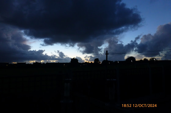
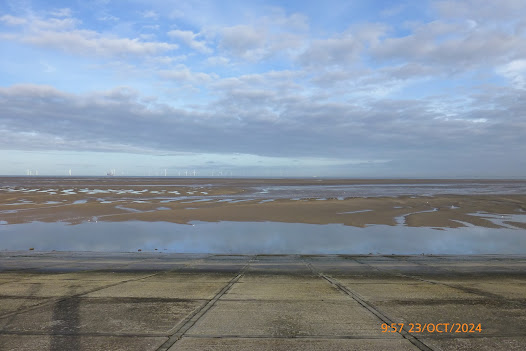
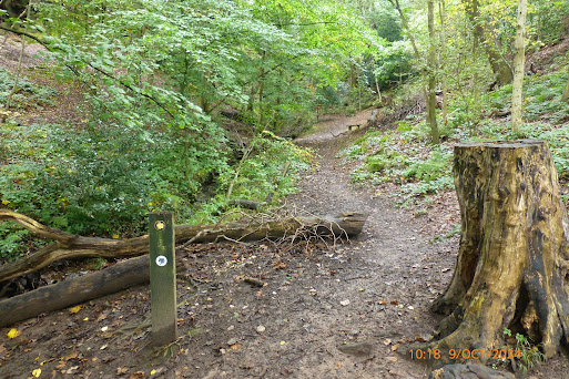
A few photos taken over the last couple  of weeks. 


The above photos were taken after sunset.

The October Harvest Moon, taken in the morning.

Photos from the Leasowe Lighthouse to New Brighton Walk.
Leasowe Lighthouse ahead.
The sea looks a long way off.
Oystercatchers galore.
Looking towards Liverpool at the start of our walk.
One of several Little egrets seen today.
Striding out to the groyne.
"Made it".
One of three Jellyfish seen stranded on the beach today.
The docks of north  Liverpool.
Crosby beach - I think we can see the Gormley statues.
Crosby beach and the Gormley statues.
Fort Perch Rock ahead.
Fort Perch Rock Lighthouse.
Bramley Moore Dock Football Stadium
.Anfield -  home of Liverpool F.C.
Goodison - home of Everton F.C.
Has the crane come too early?
In memory of a wooden driftwood pirate galleon.
The driftwood pirate ship as we saw it on 2ndFebruary 2017. 
The Black Pearl Pirate Shipas seen on 14th January 2016.
Everton's new stadium at Bramley MooreDock taken from near our lunch spot in Vale Park.
The view from our lunch spot in Vale Park.
The Liverpool skyline from near our lunch spot.
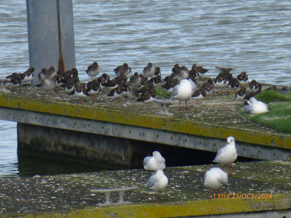
Turnstone, Common redshanks a a fe gulls on the pontoon in New Brighton Marine Lake.
An unusual boat on the Mersey heading towards Liverpool.
A sign for the Royalists amongst us!
Leasowe Lighthouse with the Clwydian Hill on the skyline, but I don't think you can see Moel Famau.
A platform out at sea, probably linked with the construction of more off shore wind turbine

Walk stats: 10.5 miles. Climb: 164’
Time: 4 hours 49 minutes. On the move walking average: 2.8 m.p.h. Overall Walk average: 2.2 m.p.h.
Temperature: Mainly around 17 Celsius throughout, although at times it felt warmer!
Beaufort Wind Force: Mainly 0-1. Mainly Calm to Light air. Max 3 - a 9.6 m.p.h. Gentle breeze as we approached the Leasowe Lifeguard Look out.
Group: Martyn and Nigel.
The weather forecast was very good, although we did get more sunshine than on the forecast.
We set off at low tide, so we were able to walk along the beach all the way to Perch Fort Rock.
We did see plenty of birds, but initially they were a good way off. Even so Oystercatchers seemed to be the dominant bird.
Distant views were excellent, we could just abort make out the Gormley statues on Crosby beach.
Lunch was taken in Vale Park, where we had a choice of several bench on which to see.
From Vale Park, we could see three football stadiums, two still in use, and one coming on stream in 2025.
Fruit cake was provided, but it was moist, it more like Christmas pudding!
Birds seen or heard included: Carrion crow, Little egret, Common buzzard, Oystercatcher, Great cormorant, Common redshank, Turnstone, Lesser black back gull, Herring gull, Common starling, Eurasian curlew and Greenshank.
Overall, a very enjoyable walk, one of the best I have experienced walking from Leasowe to New Brighton.
After walk drinks were enjoyed, sitting by the fire at Rake Hall. Brimstage Brewery’s Trappers Hat was the beer of choice, and I had my usual pot of tea.

Wednesday, 9 October 2024

Thursaston Common, Royden Park, Stapledon Wood, Caldy and More 9th October 2024.

View across the estuary towards North Wales from the Wirral Way ayt Thursaston.
Grazing Canada geese.
A new sign to the Dungeon.
The Dungeon ahead.
View across the estuary from the top of the Dungeon steps.
Looking at the waterfall in the Dungeon.
St. Bartholomew's Church, Thursaston.
Is this an old bell tower in the grounds of St. Bartholomew's Church?
If not, DS will put us right!
The front of St. Bartholomew's Church,
Autumnal colour as the bracken starts to die back.
At the toposcope on Thursaston Hill.
Volunteers cutting back the vegetation around the trig point on Thursaston Hill.
Royden Park Pond life.
A Moorhen on the water lilies on Royden Park Pond.
The view from our lunch spot in the gazebo in the Royden Park Walled Garden.
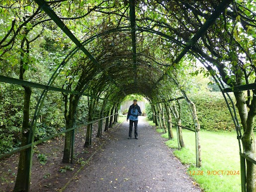
Under the laburnum arch in the Walled Garden in Royden Park.
Caldy Church of the Resurrection and All Saints.
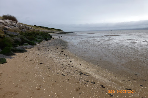
Looks lik we can make it back to Thursaston Country Park along the beach.
Hilbre Island from Caldy beach.
A couple of Turnstones.
A few more Turnstones.
The fisherman's cottage on the beach at Thursaston.
Thursaston Country Park pond and some of the birdlife.
Thursaston Station and the end of our walk.
Walk stats: 8.6 miles. Climb: 650’
Time: 4 hours 31 minutes. On the move walking average: 2.5 m.p.h. Overall Walk average: 1.9 m.p.h.
Temperature: Mainly around 12 Celsius at the start. Max 14.7 Celsius at lunch in the Walled Garden in Royden Park
Beaufort Wind Force: Mainly 0-2. Mainly Calm, but did rise to a 5.7 m.p.h. Light breeze at the toposcope on Thursaston Hill.
Group: Martyn and Mike.
The weather forecast wasn’t very good, with around 50% chance of rain all day, but not feeling cold and not much wind.
That was pretty accurate, and my umbrella was up more often than not.
Lunch time and just after was probably the longest spell of no rain that we had.
Once gain we took advantage of the gazebo in the Walled Garden in Royed Park for lunch.
The distant views were not very clear, with low cloud being very low on the Welsh sie of the estuary. Moel Famau was hiding in cloud all day.
We managed to walk along the beach from Clady to Thursaston Country Park, and with the incoming tide high up the beach, we had good close-up views of several waders.
Birds seen or heard included: Carrion crow, Jackdaw, Woodpigeon, Common blackbird, Blue tit, Coal tit, Black billed magpie, Little egret, Moorhen, Common coot, Mallard, Mute swan, Oystercatcher, Common redshank, Canada goose, Great crested grebe, Common buzzard, Grey heron, Turnstone, Dunlin, Eurasian curlew and Wigeon.
Overall, an enjoyable walk, despite the many showers.
After walk drinks were enjoyed, sitting by the fire at Rake Hall. Brimstage Brewery’s Trappers Hat was the beer of choice.