About Me

My photo
When? Started: 1993 Who? Started with staff and friends from U H S, Chester. Organiser: Martyn Harris We walk every Wednesday and Saturdays, New Years day and May Day. How many walk? Walks take place as long as there are at least 2 wanting to walk on that day. More walk on a Wednesday than on a Saturday. Most ever: 29. Current group size walking: 2-7 in mid-week and 2-4 on Saturday. Where do we walk? Saturday: Anywhere in North and Mid-Wales, Peak District, Shropshire and the Long Mynd and as far North as the Trough of Bowland. Thursday: Anywhere within about 40 miles of Chester. Type of walk: Distance: 6 – 14 miles (but usually under 10 miles). Climb: up to 4000’ (but usually very much less!). People involved on walks in 2024:- Martyn Harris, Fran Murphy, Sue and Michel Pelissier, Mike Dodd, David Savage,, Ed Meads, Nigel and Elaine Taylor, Winston Feather.

Wednesday, 30 August 2023

Melin-y-Wig and Derwen 30th August 2023

A suggested very short walk from Boncyn Llys car park.
The only part of the suggested walk that we followed, the path through the delightful Beech avenue.
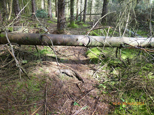
Typical problems through the forest south of Glan-y-gorse.
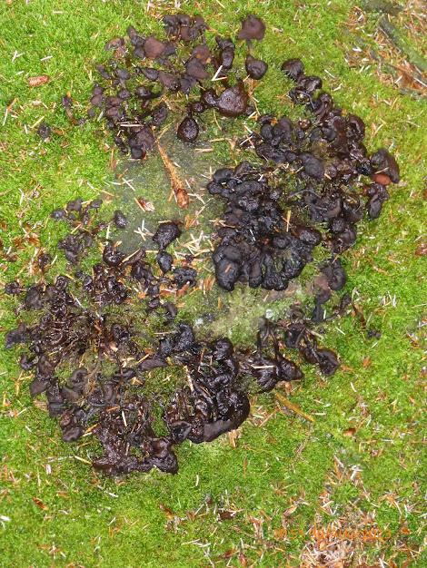
Fungi seen in the forest south of Glan-y-gorse.
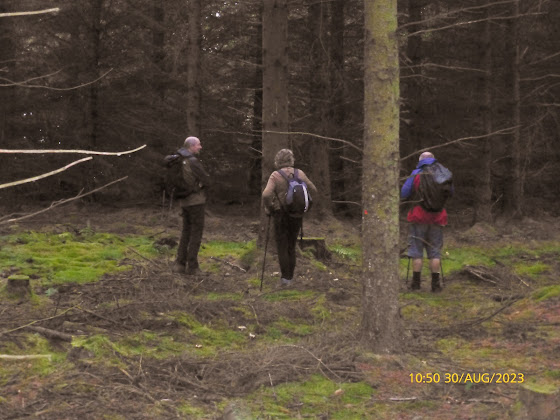
The only way to go is this way, even if we want to go in the opposite direction!
The same photo with a little more added light!
A different fungi seen in the forest south of Glan-y-gorse.

Is it or isn't it Moel Famau?
The view from our lunch spot, looking towarsds Melin-y-Wig.
About to leave our lunch spt near the two river gates.
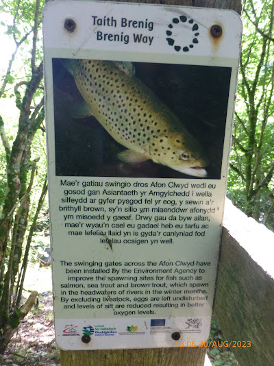
The reason for the river gates.
A training jeyt flies over the opposite side of the valley southwest of Derwen.
The preaching cross in the grounds of St. Mary's Church at Derwen.
St.Mary's Church, Derwen, still God's House.
Ffynnon Sarah.
A good view of the Clwydian Hills.
Walk Stats:
Distance: 8.7 miles. Climb: 1027’. (7.8 m.p.h. 839’)
Time: 4 hours 53 minutes. On the move walking average: 2.0 m.p.h. (2.1 m.p.h,)
Overall walk average: 1.8 m.p.h. (1.6 m.p.h.)
Temperature: At 16.7 (most of the walk) – 22.7 (at Derwen in the Sun) Celsius
Beaufort Wind force: 0 – 2. Mainly Calm /light air, but briefly reached a 7.7 m.p.h. light breeze.
Group: Martyn, Fran, Nigel and Ed.
The forecast for today kept changing, but all suggested it would be better in the afternoon. We arrived at the start with it raining, but only had to sit in the cars for a few minutes before it stopped. Rain was still a possibility in the morning, so some of us were still armed with our umbrellas!
At the start there was a short walk posted on the notice board, perhaps we should one day follow this route as an extension to our planned walk. The only part of this route we followed was the delightful path through the avenue of Beech trees.
As ever the challenge today would be path finding through the forest south of Glan-y-gors. Today was no exception, but Ed using his GPS with its map succeeded in getting us to the exit stile that we wanted.
As we descended the road towards Melin-y-Wig it started to rain, just enough for us to don waterproof jackets or use an umbrella. Thankfully it didn’t last and for the rest of the walk it was the Sun that made us feel it was a little on the warm side.
Just after passing through Melin-y-Wig we followed the path along the bank of the Afon Clwyd, and near two gates across the river, we stopped for lunch, taking advantage of fallen trees or the stile as perching spots.
At Glyn Mawr, much restoration of the cottages and outbuildings had been made and wild flowers made a delightful splash of colour next to two of the walls opposite the cottage. I should have taken a photo!
At Derwen we visited St. Mary’s Church, no longer used for services, but as the gate said still “God’s House”.
After visiting Ffynnon Sarah, we headed along the track towards the chicken farm and at the gate we all put our boots through the Quill disinfectant boot wash.
As we approached Braich, we were greeted by two children (and their mother) waving to us. Some of us waved back.
As we reached the road, it was good to see that a new gate had been installed and the hazards we had to negotiate last time were no longer there. Reporting problems to the local Rights of Way Officers can sometimes get good results.
Birds seen or heard today included: Black billed magpie, House martin, Barn swallow, Eurasian jay, House sparrow, Grey heron, Jackdaw, Rook, Carrion crow, Woodpigeon and Common buzzard.
Overall an enjoyable walk, despite the bad points being highlighted on my blog description of the walk!
After walk drinks were enjoyed at the Druids Inn at Llanferres, where Purple Moose’s Cwrw Eryri went down well, but Fran as the driver had to do with a glass of Coca Cola and a packet of crisps!

Monday, 28 August 2023

Walks and Dates August 2023


 Latest Information About Harris Hikers from 23rd March 2023.
After much discussion between group members, those present decided to follow DS’s suggestion that “Short walks with an option of a meal at a nearby venue” should take place on the fifth Wednesday in a month, and members of the group would take it in turns to plan the walk and venue.
There are only two such Wednesdays left in 2023.
 August 30th* and November 29th
*.
It was also agreed that Wednesday Walks should in the main be walks of around 8 miles with no more than about 1200’ of climb. If proposed walks exceed these suggestions routes should have obvious short cuts to reduce distance and / or climb involved.
It was also agreed that each month a different member of the group should plan the walk.
This walk should be for the Wednesday in the month and that would include the “Short Walk and Meal Option” on the fifth Wednesday.
In order to include that walk in the monthly “Dates and Walks Post", details of the walk need to be sent to me by 15th of the previous month.
Wherever possible I would like people to let me know of their intention to walk or not to walk by Monday afternoon/early evening prior to the walk on Wednesday. There isn’t an issue with last minute cancellations for any reason. This happens anyway when adverse weather is forecast at the last minute.
Where the “Short Walk and Meal” is concerned, the person planning the walk and meal should be contacted directly and informed of theirr intentions as soon as you have made your decision.
Suggestions for Wednesday Walks and Saturday Walks are always welcome.
Remember to let me know that you plan to walk so that it becomes easier to arrange car sharing. in addition it helps me to know how many route maps I need to bring and on special occasions how many pieces of fruit cake or treats will be needed.
Letting me know that you won't be walking is just as important otherwise I am left guessing as to how many maps to run off and invariably I end up printing too many!
Wednesday 2nd August 2023.
The Environs of Hawarden and Hawarden Park.
Distance: 4-5 miles. Climb: 440'.
Start: Tinkersdale Car Park, Hawarden. Grid ref: SJ315656.
At the fountain, take the A550 southward. The car park is on the left.
Leave Chester at 09-00.
This is a walk suggested by DS as a walk suitable for getting the legs going if you
haven't done much walking recently.
It is the same walk that we did twelve months ago, so most of the group will remember it.
Last time we exended the walk a little by going into the grounds of Hawarden Park.
Some of the paths can be quite muddy after rain.
Those planning to walk: Martyn, David S,
Those not walking: Mike, Sue and Michel, Ed, Nigel.
Saturday 5th August 2023.
No planned walk.
Weather forecast is horrendous.
Those planning to walk: Martyn,
Those not walking: Mike, .
Wednesday 9th August 2023.
An Alternative Ysceifiog, Lixwm and Nannerch Round.
Distance: 7-8 miles. Climb: 950'.
Start: Roadside parking next to the Play Area in Ysceifiog.Grid ref: SJ15217152.
Leave Chester at 09-00 a.m.
Those planning to walk: Martyn, David S, Ed .
Those not walking: Mike, Fran, Nigel, Sue and Michel 
This is another opportunity to use to use Ysceifiog Footpath 188, and support the  locals that have campaigned for years to get it recognised as a Right of Way.
This a shorter version of the walk I did with Nigel a few weeks ago.
Much of the walk is one we have done several times in the past, and starts by heading northward via Ysceifiog Lake towards Babell as far as Waen Isaf. after taking a path eastward  we will pick up a minor road southward towards Lixwm. Ysceifiog Footpath 188 is just West of Lixwm and goes past Tan-yr-onen and Llwyn-drain to Pen-ffynnon-ycyff.   Nannerch is our next objective where we pick up a track leading to Bryn Rug and a minor road past Ysceifiog Fisheries.
After carefully crossing the A541 we will return to Ysceifiog via Coed y Llan and Ysceifiog Church.
Saturday 12th August 2023.
Planned walk will be posted soon.
Those planning to walk: Martyn, Ed
Those not walking: Mike, .
Wednesday 16th August 2023.
A Great Orme Walk in Search of Siver studded blues!
Postponed until September.
Distance: 8 miles. It can be easily be shorted or extended on the day to suit the needs of the group.
Climb: 500'-1000', depending on the route we take.
Start at Llandudno West shore. Roadside parking near the boating lake. Grid ref: SH771820.
Leave Chester at 08-40 a.m.
Those planning to walk: Martyn,Ed, Nigel, Fran.
Those not walking: Mike. David S., Sue and Michel, .
We will probably start by heading up Marine Drive and taking the Monks' Path upto the plateau. Following the paths on the north west side of the Great Orme. After visiting the summit trig point we will probably head for Happy Valley for lunch. At lunch we can decide if we want to return to the West shore via the invalids' terrace or return to the summit and drop down the zig-zag steps. 
This another opportunty to look for the Silver studded blue.
We will probably miss out the trig point, unless any of the group wishes to use the facilities at the summit.
New walk for 16th August 2023.
A Linear Walk from Corwen to Llidiat-y-Parc via Moel Fferna.
Distance: 10 miles. Climb: 1500'.
Start: A long lay-by 1/4 mile West of Llidiart-y-Parc: SJ118433.
Leave Chester at 09-00 (08-15) if we decide to use the bus to Corwen from Llidiart-y-Parc.
This is a linear walk, so we will need to have sufficient cars to leave at least one at the start, and take everyone to Corwen, the start of the walk. The easiest option is to take enough cars to be able to leave at least one car in the layby and have sufficient cars to transport everyone to Corwen.
It is possible to use public transport, but that would probably mean leaving Chester at about 08-15 to make sure that we didn't miss the 09-45 bus to Corwen.
This walk is taken from Dave Berry's booklet " Walks Around the Berwyn Mountains and the Ceiriog Valley".
Those planning to walk: Martyn, Ed, Nigel, Fran . 
Those not walking: Mike, David S., Sue and Michel, .
The walk is described as a wlk for experienced walkers only. It features the North Berwyn Way to Moel Fferna. After following the River Dee past Llangar Church to Cynwyd, the route climbs steadily up a wooded valley and through a forest before crossing moorland to the top of Moel Fferna. Some of the routes up Moel Fferna have not been to our liking, so it will be interesting to explore this new route. On a good day the views from Moel Fferna can be be superb.
The descent of Moel Ferna to Llidiat-y-Parc is the most direct route, and one that we are familiar with, having followed it many times.
Saturday 19th August 2023.
Around Minera Mountain.
Postponed due to the weather forecast of gale force winds.
Distance: 7-8 miles. Climb: 1000'.
Start: Minera Lead Mine Centre Car park. grid ref: SJ276509.
Leave Chester at 09-00 a.m.
Those planning to walk: Martyn, 
Those not walking: Mike
This walk is a modified walk initially taken from Dave Berry's book "Walks Around Ruabon and Hope Mountain". The walk is described as being quite demanding, especially on the open access moorland. A walk for experienced walkers only.
We have done this walk several times now and haven't always found it easy finding the path from Ty Hir. This time we will miss out Ty Hir and the difficult boggy moorland part of the walk
Instead we will take the path on the west side of the large quarry that leads to the world's End to Minera Road.
After visiting the trig point on Esclusam Mountain, we will drop down onto the Fron Deg path over Minera Mountain.
At Fron Deg we will head norhward on a path that leads eventually to New Brighton and a path into the Minera Lead Mines Country Park.
Wednesday 23rd August 2023.
The Spinnies and the Penrhyn Castle Coastal Path
Distance: 6-7 miles. Climb: 500'.
Start: Large layby on the Tal-y-Bont to Bangor Road Grid ref: SH 6114 7104. This is east of the road that is signposted to The Spinnies Nature Reserve.
Leave Chester at 09-00.
Those planning to walk: Martyn, Ed .
Those not walking: Mike, Sue and Michel, Fran, David S. 
This walk will explore the recently opened Wales Coastal Path that goes through the grounds of Penrhyn Castle and the return route will probably be along the original coastal path route. 
Bring binoculars with you a we will probable call in at the The Spinnies Nature Reserve to see if the Kingfishers are around.
High tide is around 14-30, but it is only about 8.1 m, o mos of the waders will probably be a good way off shore by the time we get there.
If you are a National Trust Member bring your Membership Card with you in case we decide to go into Penrhyn Castle.
Saturday 27th August 2023.
Around Minera Mountain.
Postponed
Distance: 7-8 miles. Climb: 1000'.
Start: Minera Lead Mine Centre Car park. grid ref: SJ276509.
Leave Chester at 09-00 a.m.
Those planning to walk: Martyn, 
Those not walking: Mike
This walk is a modified walk initially taken from Dave Berry's book "Walks Around Ruabon and Hope Mountain". The walk is described as being quite demanding, especially on the open access moorland. A walk for experienced walkers only.
We have done this walk several times now and haven't always found it easy finding the path from Ty Hir. This time we will miss out Ty Hir and the difficult boggy moorland part of the walk.
Instead we will take the path on the west side of the large quarry that leads to the world's End to Minera Road.
After visiting the trig point on Esclusam Mountain, we will drop down onto the Fron Deg path over Minera Mountain.
At Fron Deg we will head norhward on a path that leads eventually to New Brighton and a path into the Minera Lead Mines Country Park.
Wednesday 30th August 2023*.
A Stamford Bridge, Plemstall, Little Barrow and Great Barrow Round.
Postponed until 29th November 2023.
New Walk.
Melin-y-Wig and Derwen.
Distance: 8 miles. Climb: 975'.
Start: Boncyn Foel-bach Forest Car Park Grid ref: SJ055520. This is on the B5105 Ruthin to Clawdd Newydd road.
Leave Chester at 09-00.
Those planning to walk: Martyn, Ed, Nigel, Fran, .
Those not walking: Mike, Sue and Michel, David S. 
This walk is taken from Lorna Jenner's book "Walks in the Vale of Clwyd".  I have only done this walk once before starting from this car park and that was more than 10 years ago. It is described as being a varied walk through forest, quiet lanes, including one that was used on a pilgrims' route and an attractive riverside path.
 Part of the route, particularly sections of the riverside path have in the past been rather boggy (Remembered from it being on walks starting from Melin-y-Wig). The section through the forest can be boggy too. The only other thing I remember about this walk is that the final section involves climbing out of the valley up to the car park - not the most ideal way to end a walk.  We may have to dip our boots in disinfectant as we go through th grounds of a chicken farm.

Saturday, 26 August 2023

Neston Railway Station to Shotton Railway Station 26th August 2023

Here comes the train.
 
The ticket!
View from the train as wse crossed Hawarden Bridge.
Neston Old Quay.
Denhall Quay.
A delightful spot to stop for refreshments and admire the view across the River Dee towards the Point of Ayr, but alas Ed didn't take the hint!
I think I need to have a sandwich board with this message on both sides!
No easy to see, but this aeroplane was heading for the Rhyl Air Show.
At least one distant view of Mol Famau was needed!!
Ignore the prop, we're heasding into God's own country.
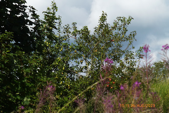
A good crop of apples and  pears, but not accessible to us!
The former HQ of John Summers Steelworks still undergoing restoration, but at least two new Welsh flags are flying high.
Not far to go now before a refreshing pint od real ale.
Walk Stats:
Distance: 7.6 miles. Climb: 138’.
Time: 3 hours 58 minutes. On the move walking average: 2.8 m.p.h.
Overall walk average: 2.5 m.p.h.
Temperature: At 19.2 – 21.0 Celsius
Beaufort Wind force: 0 – 3. Mainly light air/ light breeze, but as we arrived at the Harp Inn it briefly reached an 8.2 m.p.h. gentle breeze.
Group: Martyn and Ed.
The forecast for today in North Wales wasn’t looking particularly grim, so we abandoned our planned walk for an afternoon walk on the Wirral where there was some chance of not getting wet. Nevertheless we were still armed with our umbrellas!
The walk started with a train journey from Shotton to Neston and then walking back to Shotton.
Initially planned to catch the 12-03 train, but I made a slight mistake and caught the 11-55 bus at the top of my road. This meant it would be the 13-03 train that we needed to catch.
In turned out for the good, Ed was stuck n traffic on the A55 and wouldn’t make the 12-03 train easily, so that my mistake allowed him to go in the Central Hotel for lunch!
It also meant that we missed the rain and bright sun shine was more of an issue.
We arrived at Neston Station with a few spots of rain in the air, but it was a matter of minutes before they stopped.
Heading through Neston, we spotted a footpath that lead us almost in a straight line to the Old Quay where we joined the path heading back to the start of the Coastal Path.
The only disappointing part of this walk was the link path through the Deeside Industrial Park.
Birds seen or heard today included: Greylag goose, Canada goose, Little egret, Great Mallard, Blue tit, Great tit, Goldfinch, Long tailed tit, Black billed magpie, Eurasian jay, House sparrow, Herring gull, Pied wagtail, Woodpigeon and Common kestrel.
As we approached the Central Hotel in Shotton, my bunion started to play and even a coupe pints of Pheasantry Brewery’s Dancing Dragonfly didn’t help. Perhaps a pint of Ed’s favourite tipple, Titanic Brewery's Plum Porter,  would have been a better choice!
Hopefully my bunion will have calmed down by Wednesday!
Final bonus my bus home arrived 3 minutes early than the app suggested, but I still caught it!

Wednesday, 23 August 2023

The Spinnies and the Penrhyn Castle Coastal Path 23rd August 2023

A few of the Mute swans off shre at Aber Ogwen.
First views of Penrhyn Castle from the lane leading to The spinnies NR.
Alas no Kingfisher seen on our first visit to The Spinnies today.
Looking across the Aber Ogwen towards the Bath House and the Penrhyn Castle Coastal Path we would use later in the day.
We were so distrcted by The Cross that we missed the North Wales Path that we originally planned to use!
It amused me to think that this chapel was rebuilt in 1860, I think it has had a bit of t.l.c. since then.
The weir on Afon Ogwen near Felin Cochwillan.
The view from our lunch spot on the bridge over the Afon Cegin.
Lon Las (the old railway track) path leading to Bangor Docks.
Bangor docks.
The start (for us) of the Penrhyn Castle Coastal Path.
Gateway to the Penrhyn Castle Grounds/
Penrhy Castle from the recently opened Penrhyn Castle Coastal Path.
The Bath House from the recently opened Penrhyn Castle Coastal Path.
Little Egrets in aber Ogwen estuary.
Greylag and Mallard on the Aber Ogwen.
Is this ur besst view of The Bath house?
All that racket is the Greylag, we're mute!
Even more Mute swans heading to Aber Ogwen.

Walk Stats:
Distance: 8.1 miles. Climb: 479’.
Time: 4 hours 13 minutes. On the move walking average: 2.2 m.p.h.
Overall walk average: 1.9 m.p.h.
Temperature: At 19.8 – 22.0 Celsius
Beaufort Wind force: Not measured, but was so gentle not to noticed
Group: Martyn and Ed.
The forecast for today in North Wales wasn’t looking particularly good with a >30% chance of rain throughout the day. However with very little wind about, it was worth going ahead, knowing that if necessary umbrellas could help us stay dry.
We started the walk the Aber Ogwen car park calling in at The Spinnies NR before heading to Tal-y-Bont along minor roads.
Lunch was taken at the footbridge over the Afon Cegin, before joining Lon Las.
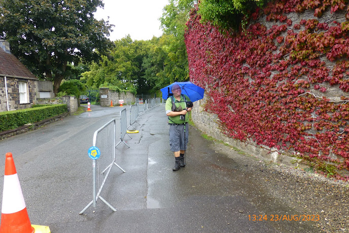
Rain was in the air on and off all day, but our umbrellas only came out after lunch s we followed the old railway track back to Bangor Docks.
We then followed the recently opened Coastal Path through the Penrhyn Castle grounds. Parts of the path seemed to still need improving as it didn’t quite match description and the enthusiasm displayed by one walker’s report in a local newspaper.
The highlight today was seeing >80 Mute swans on the sea off Aber Ogwen.
Our visit to The Spinnies didn’t give lasting views of Kingfishers, although Ed was convinced that he did see one. However a birder photographer gave us a good tip for seeing the Kingfishers at The Spinnies head for the main hide just on high tide.
Birds seen or heard today included: Mute swan, Oystercatcher, Eurasian curlew, Greylag goose, Little egret, Great white egret, Mallard, Blue tit, Great tit, Coal tit, Goldfinch, Long tailed tit, Moorhen, Little grebe, Rook, Jackdaw, Herring gull, Black headed gull, Great black blacked gull, Black billed magpie, Eurasian jay, House sparrow, Woodpigeon and Common buzzard.

Saturday, 19 August 2023

Around Chester Walls, The Greenway and More 19th August 2023

The start of our walk around the City walls.
Chester Weir from The Walls.
The view from the Lower Bridge Street where next time round my hat was blown off!
Watergate Tower.
Still quite busy on Eastgate Street.
Chester Roodee looking good.
A Mute swan family seen from our lunch spt at the canal basin near Telford's Warehouse.
Looking across the canal basin past our lunch spot (on the right).
The Greenway heading towards Newton Hollows.
The path through Newton Hollows.
Walk Stats:
Distance: 9.2 miles. Climb: 407’.
Time: 4 hours 0 minutes. On the move walking average: 2.9 m.p.h.
Overall walk average: 2, 4 m.p.h.
Temperature:  21.0 Celsius, felling like 24.0 Celsius
Beaufort Wind force: 0 – 4, mainly a gentle breeze, but occasionally gusting to a moderate breeze, enough to blow your hat off.
Group: Martyn and Ed.
The forecast for today in North Wales wasn’t looking good with rain and gale force winds on the cards. Chester seemed to be blessed with a much better weather, so at the last minute we decided to do a walk from Chester. I used the local bus and Ed used the train from Abergele.
We started the walk by going around the City Walls, before heading on the Riverside Path to pick up the Shropshire Union Canal by the Canal Basin at Telford’s Warehouse.
On the latter part of our walk we followed The Greenway as far as the Kingsway / Flookersbrook turn off, a section of the Greenway I hadn’t used before.
A first time bonus for me today was to follow the path through Newton Hollows.
The last part of the walk was along the Canal Towpath from Hoole Lane back to City Road and a refreshing pint of Acorn Chocco Porter at The Square Bottle. Gwynt y Draig Cider also went down well.