About Me

My photo
When? Started: 1993 Who? Started with staff and friends from U H S, Chester. Organiser: Martyn Harris We walk every Wednesday and Saturdays, New Years day and May Day. How many walk? Walks take place as long as there are at least 2 wanting to walk on that day. More walk on a Wednesday than on a Saturday. Most ever: 29. Current group size walking: 2-7 in mid-week and 2-4 on Saturday. Where do we walk? Saturday: Anywhere in North and Mid-Wales, Peak District, Shropshire and the Long Mynd and as far North as the Trough of Bowland. Thursday: Anywhere within about 40 miles of Chester. Type of walk: Distance: 6 – 14 miles (but usually under 10 miles). Climb: up to 4000’ (but usually very much less!). People involved on walks in 2024:- Martyn Harris, Fran Murphy, Sue and Michel Pelissier, Mike Dodd, David Savage,, Ed Meads, Nigel and Elaine Taylor, Winston Feather.

Sunday, 26 February 2023

Lon Las Ogwen, Tregarth and Moel y Ci 25th February 2023

Looking back along Lon Las Ogwen.
The Tregarth start of the Moel y Ci walk.
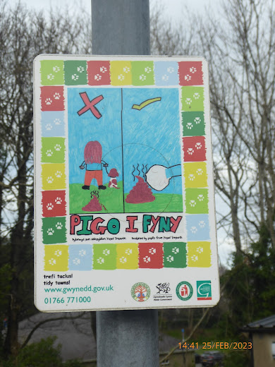
A colourful message on the lamp post in Tregarth.
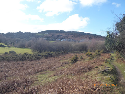
First view of Moel y Ci.
View over Sling towards Anglesey.
Gyrn, Llefn, Moel Faban and the foothills of the Carneddau.
A little snow on the Carneddau.
The first lambs seen on a walk this year. (South west of Y Parc and Sling).
Heading for the trig point on Moel y Ci.
The Carnedda from the trig point on Moel y Ci.
Yr Eifl on the Lleyn. Peninsula. (Seen from the north west slpes of Moel y Ci).
Another colourful message in Tregarth.
At least some dafodils are out in time for 1st March.
The Afon Ogwen, north of Halfway Bridge.
Striding out towardsFelin Cochwillan.
The first Primroses seen this year on a walk.
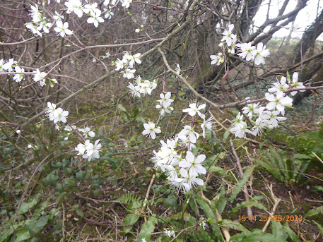
Blackthorn blossom starting to appear.
Walk stats: 
Distance: 12.5 miles. Climb: 1969'.
Time: 6 hours 30 minutes. On the move walking average: 2.2 m.p.h. Overall walk average: 1.9 m.p.h.
Temperature: Maximum - 7.2 Celsius. Minimum - 3.7 Celsius on Moel y Ci.
Beaufort Wind Force; Maximum - 3, a moderate breeze on Moel y Ci, but generlly just a light breeze.
Much of the walk was along tarmac, especially the Lon Las Ogwen walk, but at least most of it was not on roads used by cars.  Most of the Lon Las Ogwen walk had been visited before, but there were interesting section around Tregarth that that were new to us.
The main objective for today was Moel y Ci, a completely new area for me.  as we gained height the views became better and better, particularly towards the Carneddau with the high tops stil showing snow.  We also had good views towards the coast, including Yr Eifl on the Lleyn Peninsuls as we descended from the trig point on Moel y Ci.
it felt really cold om Moel Y Ci, where the cold north easerly wind ensured that we didn't ling for long at the trig point.
Lunch was taken in the shelter of a wall where the path down the north west slope of Moel y Ci met the bridleway / trackheading for Rallt Uchaf.
Birds seen or heard today included: Common buzzard, European robin, Canada goose, Grey heron, Mallard, Woodpigeom, Common blackbird,  Black billed magpie, Jackdaw, Carrion crow and Raven.
We arrived back at the cars, having had an enjoyable walk, the longest this year to date, both in terms of distance and time.
We decided to head straight for home rather than call in at a suitable hestelry for refreshments.









Thursday, 23 February 2023

Harris Hikers Walks and Dates February 2023


The Monthy Shorter Walk will still be on the last Wednesday of the month.
I am happy to receive suggestions for suitable short walks, particularly if they are free from stiles.
Suggestions for other Wednesday Walks are also welcome.
Remember to let me know that you plan to walk so that it becomes easier to arrange car sharing. in addition it helps me to know how many route maps I need to bring and on special occasions how many pieces of fruit cake or treats will be needed.
Wednesday 1st February 2023.
Gronant, Prestatyn, Talacre and The Point of Ayr.
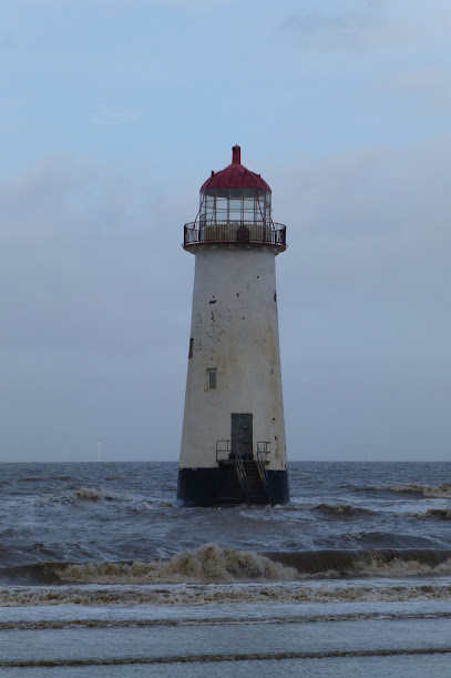
Point of Ayr Lighthouse on the last time we did this walk.
Distance: 9.2 miles. (Although there are plenty of opprtunities to make this walk shorter as this walk is like a a figure of eight walk.
Climb: 120'.
Start at Gronant Dunes Car Park on Shore Road: Grid Ref: SJ090837 This road off the A548, Moston Road and signposted to Presthaven Sands / Gronant Dunes.This is a new starting point.
Leave Chester at 09-00 a.m.
Those planning to walk: Martyn, Sue and Michel, Nigel, Fran, Mike. 
(Those not walking: Ed, David S)
High tide is at about 14-51, and is about 24.5' / 7.5 m. The route starts by heading north down Shore Road to Presthaven Sands where will first head west through the golf course to Prestatyn's Barkby Beach. We will then walk on the beach or follow the path along sthe top of the dunes as far a the Little Tern colony. After visiting the RSPB Viewpoint and Visitor Hut, we will probably continue along the beach Leave Chester at 09-00 a.m.
High tide is at about 14-51-00, and is about 24.5' / 7.5 m. The route starts by heading north down Shore Road to Presthaven Sands where will first head west through the golf course to Prestatyn's Barkby Beach. We will then walk on the beach or follow the path along sthe top of the dunes as far a the Little Tern colony. After visiting the RSPB Viewpoint and Visitor Hut, we will probably continue along the beach towards the Point of Ayr Lighthouse. Hopefuly we will find a suitable place to have lunch on the beach, unless we have walked fast enough to reach the picnic tables next path to the Point of Ayr RSPB hide. If time allows and everyone is willing, we will visit the RSPB Hide, h towards the Point of Ayr Lighthouse. Hopefuly we will find a suitable place to have lunch on the beach, unless we have walked fast enough to reach the picnic tables next path to the Point of Ayr RSPB hide. If time allows and everyone is willing, we will visit the RSPB Hide, before returning to Presthaven Sands through The Warren Nature Reserve.
Saturday 4th February 2023.
This walk will be replaced by the walk done by the rest of the group on 21st December 2022.
In search of Eddisbury Castle.
Llanfairfechan to Aber Ogwen and the Spinnies L.N.R.
Brent Geese on the shore near Traeth Lefan
Distance: 10-11 miles. Climb: 200'.
Start: Llanfairfechan Promenade / Coastal car Park. Grid ref: SH679754.
Leave Chester at 08-00 a.m.
Those planning to walk: Martyn, .
(Those not walking: Ed)
This is essentially a linear there and back walk, but if the tide allows we will walk along the beach on the return route from the Aber Ogwen pic-nic site (lunch spot the last time we did the walk). There should be plenty of birds to see on the coast, and we will probably visit at least one of the four bird hides on the route. I the past we have even seen a Kingfisher from the hide at The Spinies. Bring binoculars with you if you have them. High tide at about 10-36 a.m., 28.1 ' / 8.6 m.
Wednesday 8th February 2023.
A Walk from Llantysilio Green in Search of Snowdrops.
Snowdrops in the church grounds at Llantysilio Green.
Distance: 8 miles.Climb: 1300'.
Start: Llantysilio Green National Trust Car Park. Grid ref: SJ197433.
Leave Chester at 09-00. 
Those planning to walk: Martyn, Mike. Fran, Ed. 
(Those not walking: Sue and Michel, Nigel, David S.)
The walk starts by taking the path to St. Tysilio's Church, where hopefully the Snowdrops
will be in full bloom.
The route then takes past the Horseshoe Falls and along the Llangollen Canal towpath as
far as Llangollen.
At Llangollen the route climbs steadily northwards past Tirionia to join the Clwydian Way.
The Clwydian Way is the followed past Valley Crucis Abbey as far as Hendre.
Leaving the Cwydian Way the route descends to the main road which is followed South to
the Britannia Inn. At the Britannia Inn the path heading across Pen-y-bryn is taken until it
meets the Dee Valley Way. The Dee Valley Way is then followed South back to the start.
Saturday 11th February 2023
Clip-y-Orsedd and theThe Druid Circle.
Clip-y-Orsedd on the skyline.
Distance: 8-9 miles. Climb:2000'.
Start: Promenade Car park, Llanfairfechan. Turn right at cross roads traffic lights in centre of Llanfairfechan and follow Station Road down to the promenade. Grid ref:SH679754.
Leave Chester 8-30 a.m.
Those planning to walk: Martyn, Nigel, Mike, Fran, Robert, Ed. 
(Those not walking:)
This walk uses two walks from Dave Berry's book "Walks on the North Wales Coast." These two walks combine to make one of my favourite walks in this area as they explore the hills behind  Llanfairfechan and Penmaenmawr. We will visit the impressive Druids' Stone Circle, but on this occasion we will miss out Foel Lus.  On a good day we should get good views, especially towards the coast and Tal y Fan. We will only extend the walk as far as the Druids Circle.
Wednesday 15th February 2023.
Burton, Neston and Parkgate with  short Extension.
A possible hostery to visit for afterwalk refreshments.
Distance: 8-10 miles. (With plenty of opportunities to shorten the walk on the day if we decide that is what we want). Climb:215'.
Start: Roadside parking on Denhall Lane next to benches overlooking the marshes. Grid ref: SJ301747.
Leave Chester 9-00 a.m.
Those planning to walk: Martyn, Sue and Michel, David S., Ed, Mike,, Wendy . 
(Those not walking: Nigel , Fran.) 
The Burton circuit is taken from Jen Darling's book "Walks in West Cheshire and the Wirral". The extension will involve some road walking through Neston to link up with the Wirral Way and onto Parkgate. The return route will use coastal paths as much as possible and passes Neston Old Quay and Denhall Quay on the way back to Denhall Lane.
High tide is about 18-00. 7.5 m / 24.7'. If preferred we can always return along the Wirral Way rather than along the beach from Parkgate to Little Neston.
Saturday 18th February 2023.
Around Bosley Cloud.
The view from Bosley Cloud trig point.
Distance: 8- 9 miles. Climb:1200'.
Start: Lay-by on the A523, South of its junction with the A54. Grid ref: SJ917657.
Leave Chester at 08-30.
Those planning to walk: Martyn, . 
(Those not walking: .) 
This walk is taken from Jen Darling's book "Best Pub Walks in Cheshire", although we won't take her advice on the local hostelries! The walk takes us to the top of Bosley Cloud with its panoramic views over the Cheshire plain.. After visiting the trig point on Bosley Cloud, the walk heads West to meet up with the Macclesfield Canal, which we follow for an easy four mile stretch.
Wednesday 22nd February 2023.
Glasfryn and Gwysaney.
This is this months short walk followed by lunch for those that want to indulge.
Table booked for 12-15, so we will need to be pretty promp at setting off from the Glasfryn, idealy by about 09-45.
Gwysaney Hall - seen on route.
Distance: 5.1 miles. Climb: 360'.
Start: Glasfryn, Mold. Grid ref: SJ23986516 (Approximate Post Code CH7 6LR)
Leave Chester at 09-00 a.m.
Those planning to walk: Martyn, Mike, Fran, Nigel and Elaine, Sue.
(Those not walking: Michel, Wendy, Celia, Ed, David S)
If you plan to stop for lunch, please let me know by Monday evening and I will book a table.
The walk is the one that the Glafryn advertise and complete copies can be obtained on iFootpath,com.
The walk is described as involving challenging terrain, but I think that is a little exaggerating.
We have done this walk in the past, and if I remember correctly the sections through the woodlands can be boggy, but wouldn't describe it as being challenging.
The walk is decribed as taking you high into the surrounding hills. passing through the beautiful Gwysaney Estate before descending to the village of Soughton. It is a really rewarding walk taking you through classic Welsh hillsides and valleys.
Saturday 25th February 2023.
Llanarmon-yn-Ial, Eryrys and Moel y Gyw.
Looking down on the Pistyll Gwyn Quarry
Distance:8-10 miles; Climb:1500'.
Start:Pistyll Gwyn Quarry car park. 1 mile north of Llanarmon-yn-Ial. Grid ref: SJ189574.
Leave Chester at 9-00 a.m.
Those planning to walk: Martyn, Ed.
(Those not walking: Mike )
This walk uses two walks taken from Carl Roger's book "Walking in the Clwydian Hills". We have completed both walks before, but have never tried to link them together before. The Eryrys walk is described as exploring the lesser-known limestone hills separated from the main Clwydian ridge by the Alyn Valley. Views throughout the walk are superb! The second walk involves the ascent of Moel Gyw which also has superb views of the Clwydian Hills to both the north and the south.
The last time we did this walk in November 2015, we had to negotiate a path that was partially flooded in order to get to a footbridge over a river in spate. Hopefully at this time of the year it shouldn't be to bad underfoot. Last time out we reduced the walk to about 8 miles, so there is a good chance we will do the same today.

Wednesday, 22 February 2023

Glasfryn and Gwysaney Snowdrop Walk 22nd February 2023.

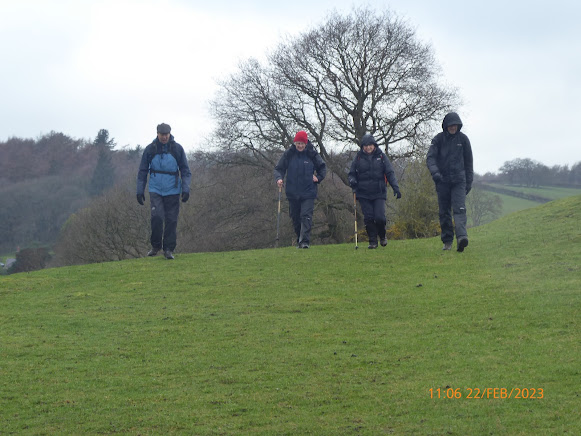
Ready to set off from the Glasfryn.
Looking across the field towards St., Mary's Church, Mold from the Glasfryn.
The west side of Gwysaney Hall.
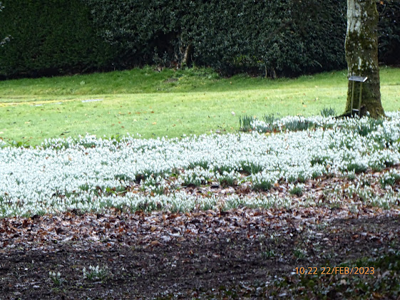
Snowdrops in the grounds of Gwysaney Hall.
Snowdrops next to the path leading through Ram Wood.
The view towards the Dee Estuary as we left Ram Wood heading for Quarry Farm.
Stretching out along Wat's Dyke Way.
Walk stats:
Distance: 5.2 miles. Climb: 489'.
Time: 2 hours 17 minutes. On the move walking average: 2.5 m.p.h. Overall walk average: 2.2 m.p.h.
Temperature: 5.5 Celsius on car thermometer as we arrived. Seemed a lot warmer than that for most of the walk.
Beaufort Wind Force: At most 2, just a light breeze, but we were well sheltered by the hedges on much of the walk.
Group: Martyn, Sue (unfortunaley Michel wasn't feeling at his best and stayed at home), Mikle, Fran, Nigel( elaine joined us at the Glasfryn for lunch).
The meal was booked from 12-15, so it was good that all those walking arrived on time and we were able to set off promptly at 09-45.
The weather forecast wasn't brilliant, but optimistically we hoped that light showers would be just that. Thankfully it was and the predicted winds of 15 m.p.h. winds never materialised. We even had short periods of sunshine.
Setting off along the lane towards Black Brook, gave good views towards Mold, and the bird of the day a Sparrowhawk hunting in an adjacent field towards the hedge line.
The quiet lane was pleasant enough, but the best part of the walk was through the groundsof Gwysaney Hall and the section along Wat's Dyke Way.
This provided us with our best sightings of Snowdrops this year, those in the grounds of Gwysaney Hall were magnicent, the photos taken don't do them justice.
The surprise of the day was on the Wat's Dyke Way as we neared the stile onto the Sychdyn Road. two sheep jumped over the fence infront of (at least 2' in the air and they were sheep notl Spring lambs). The farmer from the house next to track, said it happens often and suggested we stood close to one side of the path to allow the sheep to head back past us, rather than jump over the stile onto the road. thankfully did just that, and were were thanked for doing what he wanted us to do,
The route through the houses in Sychden was made easy by the detailed description given, and we manage to get back to the Glasfryn just before 12-00, in fact we had a brief stop for one or two to have a hot drink they had brought in the event they would  be allowed to do so!
Birds seen or heard today included: Greenfinch, Black billed magpie, Song thrush, Dunnock, Common pheasant, Rook, Goldfinch, Woodpigeon, Sparrowhawk and European robin.
Arriving back at the cars, Sue manage to trap her finger with the boot lid and spent much of the meal time with her fingers her fingers dipped in cold water.
The beer of choice today for most was Purple Moose's Snowdonia Ale, alas I was driving, so a pot of tea had to do!
Meals were ordered, but alas a message came back from the chef, my choice was no longer available.  I chose the belly pork, but when it arrive the "crackling" was so rubbery I couldn't even cut it! It came back, but it was no better, but at least the extra "cooking" meant the pork itself was well cooked. When I said I wasn't happy, the manage came out as explained the "crackling  skin" should of been removed before being serving! Belly pork without crispy crackling isn't worth having! I was offered a free dessert as a good will gesture, but I didn't take up the offer.  Although the rest of my meal was enjoyable, I won't be choosing "belly pork" at the Glasfryn again.
No-one else had any signifcant issues, although Nigel's gammon wasn't totally cooked to his liking. Most of the group still had room to enjoy a dessert.


Saturday, 18 February 2023

Bosley Cloud and Its Environs 1th February 2023

St Mary the Virgin Church, Bosley.
Snowdrops on the path adjacent to St Mary the Virgin Church, Bosley. 
St Mary the Virgin Church, Bosley, from the path on on its southern side.
Heading for Bosley Cloud.
Catkins another sign of Spring.
Bosley Cloud is getting closer!
Nearly at the trig point on Bosley Cloud.
At the trig point and toposcope on Bosley Cloud.
or
"I don't believe I think I can sere Moel Famau."
The way head along the Gritstone Trail.
A better view of Jodrell Bank telescope in the distance.
A few Canada geese (>50 in all) heading for the Macclesfiekl Canal.
The aquaduct is ahead with Sutton Common mast on the skyline, it's time for us to leave the towpath.
The canal aquaduct over the River Dane can just be made out through the trees.
An intertesting bench in the grounds of St Mary the Virgin, Bosley, but what happened on 17th July 2015?
Sadly it asks us to remember four workers who lost their lives in an explosion at a nearby Mill.
Walk stats: 
Distance: 9.1 miles. Climb: 1070.
Time: 4 hours 41 minutes. On the move walking average: 2.3 m.p.h. Overall walk average: 1.9 m.p.h.
Temperature: 11.7 to 14.32 Celsius.
Beaufort Wind Force. 2 / 3 Light to Gentle breeze, but for much of the walk we were sheltered from any prevailing winds.
Group: Martyn, Ed and Mike.
A good day for walking, quite warm and verry little rain on the forecast. In fact I didn't where a waterproof jacket throught the walk, others did!
hading for Bosley Cloud, the only thing of note were the Snowdrops and Catkins, remindng us that Spring is here.
the gentle climbup the east ridge of Bosley Cloud was marked out by a well defined path letting you know exactly where they wanted you to walk.
Having declined our usual lunch spot before reaching the Macclesfield Canal as  being too muddy, we eventually found an unexpected spot on the tow path, a set of canal planksthat we just about managed to perch on with legs tangling!
Mike and Ed had the best views, looking towards Bosley Cloud and being entertained by two horses one of which went too close to an electricfied fence and made a lot of noise ast ran off.
I had only a happy bush to look at, although In a way I did watch a farrier treating a horse.
After lunch we had the long stretch along the towpath of the Macclesfield Canal, easy going, but not a lot to distract us, although Bosley Cloud seemed to be following us!
Birds seen or heard included: Greenfinch, Bluetit, Great tit, European robin, woodpigeon, Black billed magpie, carrion crow, Rook, Jackdaw, Mallard, Canada goose, Wood nuthatch and Moorhen.
We arrived back at the car, having had a good walk and looking forward to some liquid refreshment at the Stamford Bridge Country Inn where Hyde's brews were on offer. Lowry Bitter and Original bitter were sampled (by me after getting home), A pot of tea was my tipple at the Stamford Bridge today!
I even arrived home i time to watch the Newcastle and Liverpool match.
A good day for ll, Liverpool, Chester and even Everton all won!


Wednesday, 15 February 2023

Burton and Neston 15th February 2023

The Friends of Hampston's Well have done a good job.
Hamston's Well marker stone.
Burton Quaker graves.
The new marker plaque at Burton Quaker Graves.
A few of the Burton Snowdrops on show.
(at their best between 3rd February and 17th February each year.
MD setting the pace again.
Moel Famau on the skyline as we head towards Neston Old Quay.
This s the second week running tha we have seen a Chinnook helicopter fly over.
Just a few of the Pink footed geese coming into roost in the Dee estuary marshes.
The Beluga XL 2 flew over as well.
Walk stats: 
Distance: 8.1 miles. Climb: 417'.
Time: 4 hours 0 minutes. On the move walking average: 2.5 m.p.h. Overall wal avrage: 2.0 m.p.h.
Temperature: 10.5 Celsius at lunch.
Beaufort Wind Force. 0 - 2. Mainly calm, but occasionally gusted to a light breeze 5.5 m.p.h.
Group: Martyn, Sue and Michel, David S, Mike, Wendy and Ed.
The forecast indicated that it would be largwely overcast, with drizzle around mid-day and the possiblity of some Sun later on. This turned out to be pretty accurate and approching lunch time we headed for Stanney Fields Park where we knew here were shelters of sort! Thankfully in the end we didn't need the cover.
As usual Burtion Woods paths wren't that easy to follow, but at least we ended up on Mill Lane(Burton) for the first time.
As we approached Mill Lane (Ness), MP realised somethng was missing and decided to return to the car to see if it was stll in the car. Thankfully it was and after having lunch in the dry of the car, they headed along the coastal pasth and met us as we arrive at The Harp.
Lots of birds were singing, so the list of birds seen or heard today was a little larger than it has been of late; Birds seen or heard today included: Common blackbird, Great spotted woodpecker, Carrion crow, Rook, Jackdaw, reenfinch, European robin, Black billed magpie, Great tit, Blue tit, Dunnock, Mallard, Tufted duck, Canada goose, Pink footed goose, Lapwing, Eurasian curlew,  House sparrow and Little egret.
Overall an enjoyable walk.
We headed to The Wheatsheaf at Raby, where BrimstageBrewery Trappers Hat, A Marble brewery bitter, an alchol free Guinnes and Titannic's Plum Porter were all enjoyed. Mind you at £5 a pint we had to say the Plum Porter was good!