About Me

My photo
When? Started: 1993 Who? Started with staff and friends from U H S, Chester. Organiser: Martyn Harris We walk every Wednesday and Saturdays, New Years day and May Day. How many walk? Walks take place as long as there are at least 2 wanting to walk on that day. More walk on a Wednesday than on a Saturday. Most ever: 29. Current group size walking: 2-7 in mid-week and 2-4 on Saturday. Where do we walk? Saturday: Anywhere in North and Mid-Wales, Peak District, Shropshire and the Long Mynd and as far North as the Trough of Bowland. Thursday: Anywhere within about 40 miles of Chester. Type of walk: Distance: 6 – 14 miles (but usually under 10 miles). Climb: up to 4000’ (but usually very much less!). People involved on walks in 2024:- Martyn Harris, Fran Murphy, Sue and Michel Pelissier, Mike Dodd, David Savage,, Ed Meads, Nigel and Elaine Taylor, Winston Feather.

Wednesday, 29 August 2018

Coed Ceunant and the River Clwyd 29th August 2018

Inside St Peter's Church (New), Llanbedr Dyffryn Clwyd.
Part of the 14th Century gravestone (now situated inside  St Peter's Church (New).
 St Peter's Church (New).
Old St Peter's Church.
Pond on the East side of Coed Ceunant.
Coed Ceunant and the Vale of Clwyd beyond.
Looking over the sheep to the Vale of Clwyd - are they admiring the view too?.
The old mill South west of Ash, leading to the River Clwyd.
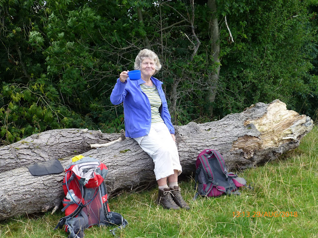
the view from my lunch spot, sitting on a fallen tree trunk.
Our lunch spot by the River Clwyd.
Looking across the River Clwyd towards the Clwydian Hills, from a point North of Ruthin Weir. 
Walk stats: Distance: 8.3 miles. Climb: 702'.
Time: 4 hours 17 minutes. On the Move walking average: 2.4 m.p.h. Overall walk average: 2.o m.p.h.
Group: Martyn and Wendy.
As we set off from Chester it was raining, and the forecast for Ruthin had changed, suggesting that it would be late morning before it would pass. Thankfully it stopped just as we turned into the Riverside Car park at Ruthin, The rest of the day was dry. No sunshine until lunchtime and a cool wind, perfect conditions for walking.
 We set off from the car park, and deviated slightly from the described route, and ended up exploring parts of Ruthin that I hadn't seen before, finding a Chatwins shop (locations always worth noting!).
 The next part of our route was round the back of Ruthin School, but major building work was going on, and we were unable to access the diversion marked, and ended up retracing our steps and following the main road as far as   St Peter's Church (New) at Llanbedre Dyffryn Clwyd.
 As Wendy hadn't seen the well known 14th Century gravestone associated with St. Peter's Church, we decided to seek it out. Thankfully the church was open as it had been relocated from the entrance to inside the church. It always lifts my spirits when I find a church open all day, every day of the week o welcome everyone.
 As we crossed the lower slopes of the Clwydian Hills, the tops of the hills cleared and the views in all directions got better and better, I fellow out with the local sheep, I took a tumble after stepping on sheep droppings. Not much damage done, except for a bruised arm and hip and very muddy SEAT TO MY SHORTS (thankfully I had a change of clothes back at the car).
 Lunch was eventually taken by the River  Clwyd, East of Plas-y-Ward farm. It was a bonus to find a couple of fallen tree trunks n which we could sit while we had lunch. Even better we were now blessed to be in the warm sunshine. Even better, as we had lunch, Wendy got a message from Ian, saying that he was safely at home recovering, after spending an hour and a half at the dentist!
 After lunch we only had a gentle stroll along the river bank to Ruthin, arriving at the car park just after 14-00.
 Birds seen or heard today included: House sparrow, Common blackbird, Winter wren, Jackdaw, Rook, Carrion crow, Common buzzard, Black-headed gull, Woodpigeon, Common pheasant and Grey wagtail.
  After walk drinks were enjoyed at The Druids Inn at Llanferers. Luckily we arrived there 15 minutes before it closed at 15-00.
 Overall a very enjoyable walk, despite the detour along the Mold Road to Llanbedre Dyffryn Clwyd.

Tuesday, 28 August 2018

Walks and Dates August 2018

Important update - 19th August 2018.
The walk on Wednesday 22nd August has been switched to Thursday 23rd August so that nyone from the Upton area can attend the funeral of Rev Norman Ryder the Wednesday.
Wednesday 1st August 2018.
Walk Cancelled.
The walk this week will now be tomorrow.
See below for details.
Thursday 2nd August 2018.
Whitchurch Walk 5 The Ash Brown Walk.
Distance: 8 miles. Climb: Not a lot.
Start: JubileePark, Car park Sherrymill Hill, Whitchurch SY13 1BN. Grid ref: SJ537416. 
Directions to the Jubilee Car Park:
On approaching Whitchurch on the A41, at the roundabout turn right, continuing on the A41 (Whitchurch by-pass), take first road on left Chemistry/Smallbrook Road and then take the next left . Smallbrook Road leads into Sherrymill Hill with the Jubilee Park on the right. 
Leave Chester 09-00 a.m.
This walk is described as a flat to undulating town, village, countryside walk featuring the Brown Moss. Problems encountered on previous Whitchurch walks are not part of this walk!
Saturday 4th August 2018.
Conwy Mountain and Around Maen Esgob and Craigfedwen
Distance: 8 miles. Climb:1447'.
Start: Long stay car park on the B5106 at Conwy. Pay and Display. Grid ref:SH781773.
Leave Chester 08-30 a.m.
The walk starts by heading through the castle walls and on the North Wales Coastal Path along the harbour as far as the secondary school. The North Wales Path is the followed over Conwy Mountain through Castell Caer Seion and onto the Sychnant Pass.
 The views from the Conwy Mountain Ridge can be superb, with the Great Orme in one direction and Tal y fan in the other, as well as good views towards Conwy castle and the Conwy Valley.
 After crossing the Sychnant Pass Road, the North Wales Path is once more folowed. At the point where there is a definite fork, it is possible to make a short there and back extension to visit the site of a monument. Returning to the North Wales Path, it is then followed along the East side of Maen Esgob as far as the head of the Fairy Glen. A path heading eastward then takes us past Llyn y wrach.

 Once the West side of Maen Esgob is reached, the main track is followed parallel to the stone wall towards Craigfedwen, where the footpath goes South of Waeny-fedwen and onto the minor road near Llechwedd. The route goes Northward on the road ad then takes the first path on the right which leads around Bryn-mawr to a minor access road. It is along this road that several large and/or interesting properties can be seen. at the T-junction, the route goes right and in a very short distance a broken kissing gate leads the way to a field path leading  to the Sychnant Pas Road at Mount Pleasant on the outskirts of Conwy. The Sychnant Pass Road  is then followed back to Conwy.
Wednesday 8th August 2018.
Bersham Iron Works and Ty Mawr Reservoir.
Distance: 9-10 miles. Climb: 1000'.
Start: Nant Mill Visitor Centre. Grid ref: SJ289501.
Leave Chester at 09-00 a.m.
This walk combines two walks from Dave Berry's book "Walks Around Ruabon Mountain and the Clywedog Valley and Hope Mountain".  The Bersham Iron Works Walk  walk explores the Clywedog Valley Trail, and includes Offa's Dyke . The Ty Mawr walk is a figure of eight walk that explores the attractive varied countryside South of the Clywedog Valley.
 Last time we did this walk in 2012, we encountered a very muddy section that David S. declared as a no go area! We will make a small diversion to avoid this section, rather than investigate it to see if things have improved.
Saturday 11th August 2018.
By the Tryweryn.
Distance: 7-8 miles. Climb: 1600'.
Start: National Whitewater Centre. Grid ref: SH882403.
Leave Chester at 08-30.
This walk is taken from Dave Berry's booklet "Walks around  Bala and Penllyn". It starts by following a delightful nature trail along the river towards Llyn Celyn as far as the Celyn Fish Trap.
The second part of the walk explores the upland pastures and moorland North  of the A4212.
Wednesday 15th August 2018.
Around Minera Mountain. 
Cancelled as it is to near the Llandegla moorland areas that have been on fire.
See below for the new walk.
Distance: 9-11 miles. Climb: 1000'.
Start: Minera Lead Mine Centre Car park. grid ref: SJ276509.
Leave Chester at 09-00 a.m.
This walk is taken from Dave Berry's book "Walks Around Ruabon and Hope Mountain". The walk is described as being quite demanding, especially on the open access moorland. A walk for experienced walkers only. This will be the third time that mot of us have done the walk, so we should be OK . Can be boggy underfoot as we found out in 2013 when we first did the walk,  Hopefully it won't be too bad at this time, especially as we have had very little rain of late. The last time we did this walk, it was very hot and we cut the walk short, we may decide to do the same this year.
Wednesday 15th August 2018.
Mynydd Marian.
Distance: 7-8 miles. Climb: 1000'.
Start: Llandulas Beach Car Park. Grid ref: SH907786.
Leave Chester at 09-00.

This walk is taken from Dave Berry's book, "Walks on the North Wales Coast". It combines an interesting section of the coast line with the attractive limestone countryside between, Old Colwyn, Llysfaen and Llandulas. This is one of my favourite walks at any time in the year, but I haven't done it in the Summer for quite a while.
Saturday 18th August 2018.
Moel y Garneddd.
Distance: 7-8 miles.
Climb: 1200'.
Start: Fronfeuno Snowdonia National Park Lakeside Car park Grid ref: SH917351.
Leave Chester 08-30 a.m.
This walk is taken from Dave Berry's booklet "Walks Around Y Bala and Penllyn". The walk explores the undulating countryside West of Bala. The route follows a a bridleway up to moorland, eventually crossing Moel y Garneddd at a height f 1170'. We can expect to see superb views as we cross the open moorland. The return route goes through attractive woodland. This is a walk for experienced walkers only and should not be attempted in poor visibility. Careful navigation is required.
Thursday 22nd August 2018.
Around Minera Mountain. 
Distance: 9 miles. Climb: 1000'.
Start: Minera Lead Mine Centre Car park. grid ref: SJ276509.
Leave Chester at 09-00 a.m.

This walk is taken from Dave Berry's book "Walks Around Ruabon and Hope Mountain". The walk is described as being quite demanding, especially on the open access moorland. A walk for experienced walkers only. This will be the third time that mot of us have done the walk, so we should be OK . Can be boggy underfoot as we found out in 2013 when we first did the walk,  Hopefully it won't be too bad at this time, especially as we have had very little rain of late. The last time we did this walk, it was very hot and we cut the walk short, we may decide to do the same this year.
Saturday 25th August 2018.
Under Moel Siabod.
Distance: 8 miles ;Climb: 1000+ .
Start: On the railway bridge, just North of Pont y Pant Station. Grid ref: SH754537.
Leave Chester 8-00 a.m.

This is another walk taken from Mike Burnett's book "Walks East of Snowdon". He describes it as a wild walk which crosses the high moorland to the East of Moel Siabod. Does that mean we can expect wet feet too! The walk apparently gives spectacular views of Moel Siabod and the Carneddau. The last time we did this walk, it could be derscribed as the wettest walk that we have ever done, and ended with us wading knee deep through water for about 30 minutes. Hopefully it won't be quite as wet this time.
Wednesday 29th August 2018.
Coed Ceunant and the River Clwyd with and extension to Rhewl.
Distance: 9-10 miles. Climb: 680'.
Start: Ruthin riverside car park (Pay and display). Grid ref:SJ121582.
Leave Chester 9-0 a.m.

This walks from Dave Berry's book "Walks In the Vale of Clwyd" that we have done several times before, but not since 2009. In the past we have linked them with other walks that take the mileage to about 13 miles, more than most of us want these days. He describes the walk as  one exploring varied countryside, with excellent views and visits the charming ruins of a Medieval church using field paths and some delightful bridleways between Ruthin and Llanbeddr Dyffryn-Clwyd. It explores the attractive lower slopes of the Clwydian's, including a lovely wooded area.
 The extension to Rhwl  follows the riverside path Northwards before heading towards Rhewl on quiet country lanes to Rhewl and back to the river where we again follow the riverside path, South to Ruthin.

Thursday, 23 August 2018

Around Minera Mountain 23rd August 2018.

The Minera Lead Mine Centre.
Part of the tree-lined path leading North west from the Minera Lead Mine Centre.
The Engine House glimpsed through the trees.
A bit smarter than the last time we went past.
The Minera Quarry - now a Nature Reserve.
The Clwydians from North of Ty Hir Farm.
Some of the many mares and their foals around Ty Hir Farm.
Minera Quarry from the South.
Looking North over Minera Quarry.
Selfie taken at the trig point on Esclusham Mountain. 
The Clwydians in the background with Moel Famau on the right.
The old lime kiln on Esclusham Mountain/Minera Mountain - my lunch spot.
Ty Mawr Reservoir from the path leading from the lime kiln to Fron-deg.
One of views from the "viewpoint" in the Minera Lead Mines Country Park.
Another of views from the "viewpoint" in the Minera Lead Mines Country Park.
Walk stats: Distance: 8.1 miles. Climb: 1152'.
Time: 4 hours 15 minutes. On the move walking average: 2.5 m.p.h. (2.7 m.p.h. om my newest GPS). Overall walk average: 1.9 m.p.h.
Group: Martyn
On Sunday, I was expecting there to be four of us on the walk today, but each day one person dropped out and by 08-45 today there was just me left. Not to be deterred, I decided to go ahead and walk on my own, at the same time investigate the parking situation for the Bersham Ironworks ready for the 8th September.
 I set off from the Minera Lead Mine Centre at about 09-45, hoping that no-one had decided to come on the walk, but hadn't informed me.
 It was a good day for walking, dry and pleasantly cool, especially when crossing the Minera Mountain just before lunch, but with very little sunshine and then only towards the end.
 I decided to take the described route to Ty Hir Farm, rather than the new route on the South east side of the quarry, and then take the path Southward past Park Farm. On hindsight, the better choice is the new route, as I encountered lots of wet ferns and sections that were really overgrown, and one plank footbridge was pretty slippy too!
 Ty Hir Farm would seem to be a stud farm, if the large number of mares and their foals is anything to go by.
  Initially I encountered only dog walkers, but as I approached the Minera - World's End Road, I did meet another solo walker undertaking a walk from the same start point as I had. He was a kindred spirit - another bus pass adventurer as well!
 The views from Minera Mountain were pretty good in all directions, but it wasn't obvious that the Llantysilio Mountain moorland was on fire again.
 Lunch was taken at the old lime kiln South of the trig-point on Esclusham Mountain, where I was able to shelter from the cool breeze and found a suitable stone on which to perch as I drank my soup.
  After lunch the cool breeze was on my back and assisted my progress, probably helping t increase my overall speed to one that is a little higher than usual.
 The last part of the route wasn't good, and on future occasions, I will investigate  route that heads to New Brighton via Brookfield Farm rather than The Wern.
 Birds  seen or heard today included: Woodpigeon, Black-billed magpie, Blue tit, Common chaffinch, Stonechat, Carrion crow, Goldfinch and House sparrow.
 he highlight of the day was seeing a Stoat run across the path only a few feet in front of me as I descended towards Fron-deg.
 Approach the Minera Lead Mining Centre, a waymark pointed towards a "viewpoint", which I thought would be worth visiting.  Getting there I wondered why I bothered!
 I arrived back at the car, having had a good walk, but legs still tingling from the several nettle stings encountered!
 After walk drinks were enjoyed when I got home - a few cups of tea with a drop of whisky added of course!

Saturday, 18 August 2018

Cilcain, Ffrith Mountain, Moel Famau, Moel Dywyll and Moel Llys-y-coed 18th August 2018

An early view looking South west towards Moel Famau.
Finger post ahead but no finger pointing in our direction!
Nearly back on track with a wall to follow and Moel Famau in sight.
The final approach to the Jubilee Tower on Moel Famau.
At the Jubilee Tower on Moel Famau.
Looking back to our route of ascent to the Jubilee Tower on Moel Famau.
On Offa's Dyke/Clwydian Way West of Moel Famau.
Moel Arthur as we stared to descend Moel Llys-y-coed.
Looking towards Moel Llys-y-coed from our lunch spot.
Looking South towards Moel Famau from the path East of Moel Llys-y-coed.
A couple of shire Shire horses near Gronfel.
Walk stats: Distance; 7.1 miles. Climb: 1933'.
Time: 4 hours 17 minutes. On the move walking average: 2.1 m.p.h. (2.4 m.p.h. on my newest GPS). Overall walking average: 1.6 m.p.h.
Group: Martyn and Celia.
this wasn't the original planned walk, but Mike needed to be back in Chester by 18-00, so the Bala walk wasn't really an option, a more local walk was needed.
This was almost perfect walking weather, pleasantly warm, cloud cover in the morning, sunshine after mid-day and stiff cooling breeze most of the time, but not one that made you rush to put a fleece on.
 Distant views in the morning were good, but somewhat "hazy/murky", but got better as the day progressed.
 We arrived at the Jubilee Tower at about 11-00, too early for lunch, but we did stop long enough to have a coffee or drink.
 we ended up having lunch at the col between Moel Llys-y-coed and Moel Arthur.
 Several times today we were entertained by twisting and turning Ravens, but other birds were few and far between.
 Birds seen or heard today included: Raven, Common buzzard, Barn swallow, Meadow pipit, Woodpigeon and Goldfinch.
 Surprisingly we saw quite a few runners heading for Moel Famau as we descended towards Moel Arthur but a local the Britannia In n at Halkyn informed us that the Annual Race from Cilcain to Moel Famau was to the place on the next Bank Holiday Monday, just two weeks away.
  Although a shorter walk than usual, it ticked all the right boxes and the path from the col between Moel Arthur and Moel Llys-y-coed across the flanks of the latter to the road at Gronfoel was well worth doing.
 Overall an enjoyable walk shortened by missing out the unpleasant farmers experience at Crug Farm, and capped with a superb pint of Lees at the Britannia Inn at Halkyn.
 The only downside was that Celia thought that the  1800' plus climb was a little too much of a challenge to risk at the present stage of her fitness recovery.

Wednesday, 15 August 2018

Mynydd Marian 15th August 2018

Looking towards the Great Orme from slopes above Llanddulas Golf Course.
Looking towards the coast from the path near the Conwu Brewery.
Looking towards the Great Orme from Mynydd Marian.
looking towards Abergele from  Mynydd Marian.
 The best lunch spot out we could find that was out of the wind.
Contrasting weather - rain inland, sunshine on the coast.
Craig y Forwyn - our next objective.
Garth Gogof/Rhyd y Foel from Craig y Forwyn.
Llanddulas landfill Quarry to the West of Craig y Forwyn.
An impressive font inside St. Cynbryd's Church, Llanddulas.
Art work produced by the children from St. Cynbryd's Church, Llanddulas.
Walk stats: Distance: 8.1 miles (8.2 miles on my newest GPS). Climb: 1348'.
Time: 4 hours 11 minutes. On the move walking average: 2.4 m.p.h. (2.7 m.p.h. on my newest GPS).
Overall walk average: 1.9 m.p.h.
Group: Martyn, Wendy an Ed.
This was a good place to walk today, with rain forecast coming in from the South west but not before about 16-00, temperature in the high teens but with as strong cooling breeze.
 The walk started along the coastal path towards Colwyn Bay, and at one point it was like walking in a corridor flanked by Buddleia trees, still displaying flowers, but not attracting many insects that we could see. All along the coast we had good views towards the Great Orme as we did later on as we climbed above the golf course on the way to Mynydd Marian.
 We even found a pair of walking boots by one of the gates, not what you expect on a path in the middle of the countryside.
 There are several benches across the top of Mynydd Marian, and we fully expected to make use of one of them at lunch time. Unfortunately these were all facing the incoming breeze that had at this point become quite strong and somewhat cooling, so we headed for Llysfaen, where we made use of a stone shelter by the bus stop.
 We could see rain clouds skirting around us to the East, but thankfully they stayed there and after lunch we were once more walking in warm sunshine.
 As we approached Craig y Forwyn, we decided to take the path over he top, rather than follow the main path hat went below the cliffs.
 Crossing Craig y Forwyn, we had particularly goo views across the valley towards Garth Gogof/Rhyd y Foel and o course in the opposite direction towards the Llanddulas Landfill Quarry, still in use, but some attempts at landscaping had been  started.
 The path over the top of Craig y Forwyn used to follow the fence all the way across until a stony track was met that led down to the road. However at the kissing gate a new path had been created, so we decided to follow it. Most of the path was pretty good, and will be even better once it has really become established, but two of us slipped on slab of stone covered in "moss", only Ed escaped the indignity of being dumped on your bottom! Thankfully no-one was hurt.
 Arriving at Llanddulas we noticed that St Cynbryd's Church was open, so we decided to look inside, It was well worth the visit and a bonus on the walk today.
 Birds seen or heard today included: Oystercatcher, Eurasian curlew, Great cormorant, Herring gull, Great black back gull, Barn swallow, Goldfinch, House sparrow, Common blackbird, Woodpigeon and Common kestrel.
 We arrived back at the cars quite early, but having a a very enjoyable walk and ending still dry and with relatively clean boots.
 After walk drinks were enjoyed at the Britannia Inn at Pentre Halkyn, where the Lees Bitter tasted particularly good,

Saturday, 11 August 2018

By the Tryweryn 11th August 2018

The Afon Tryweryn  West of the main Visitor Centre.
A Dipper on the banks of the Afon Tryweryn.
The nearest view of the Llyn Cely Dam tyhat we had just West of the Fish Trap.
Craig y Garn from near the Fish Trap.
The track lading to Ysgubur Bwlch-graiaog.
The view from our lunch spot near Ffridd Bwlch-graianod.
The footbridge - found at last!
The path is there somewhere and we thought our close encounters with head high ferns was over for the day omce we reached the footbridge!
Escaping from wilderness into the unknown, but at least it was a genuine footpath.
The Afon Treweryn from ridge East of the upper car park.
Walk stats: Distance: 8.1 miles (8.3 miles on newest GPS). Climb: 1143'.
Time :  hours 45 minutes. On the move walking average: 2.0 m.p.h (2.6 m.p.h. on newest GPS).Overall walk average: 1.4 m.p.h.
Group: Martyn and Roger.
This was a walk that I have wanted to do for a long time, but the described walk was a little short, so paths on the OS map made extending bit to head for Nant Hir and Bwlch Graianog would be a good option.
 Our walk started by following the Nature Trail as far as the Afon Treweryn Fish Trap. This was a delightful wooded footpath along the East bank of the Afon Treweryn. It wasn't long before we saw a couple of Dippers, always special treat to see.
 The start of our climb North east from Tyn-y-bont, didn't go well just after crossing a stile into boggy terrain, I got tangled in a hidden piece of wire and ended up kneeling in the mud and was helped out by kind walker following behind. I emerged, pride hurt and a bent Leki, but nothing worse. 
 The route to Nant Hir was soon none existent and we were crossing what could be very wet terrain, but thankfully not today.
 Often doubt in  mind made us stop and check that we were on the right track, but our morning difficulties were easy compared with what we were to face after lunch.
 Lunch was taken near Bwlch Graianog, where we had good views of Arrenig Fawr.
 Our descent from Bwlch Graianog wan't easy, a fairly clear path descending through Heather at first, soon disappeared in the head high Bracken. We then had a tortuous descent to he Afon Hesgyn, but thankfully we found the footbridge.
 Unfortunately more Bracken hid the way ahead again.
 Once again we were on pathless terrain, and eventually arrived at the path that the described route had used on the ascent. 
 We followed this and then took a "short cut"  that led us back to Tyn-y-bont and back to the White Water Centre.
 Rather than take the road, we crossed the footbridge over the Afon Treweryn and followed the path on the West side of the river and retraced our steps using the path through the wood back to the car.
 Overall a good and enjoyable, but more challenging walk than we had expected.
 Birds seen or heard included: Dipper, Common buzzard, Barn swallow, Common chaffinch, Pied wagtail, Meadow pipit and House sparrow.
 The weather today, was good for walking not to hot and a pleasant breeze as well. The only rain we experienced was just after arriving back at the car and on the way home.