About Me

My photo
When? Started: 1993 Who? Started with staff and friends from U H S, Chester. Organiser: Martyn Harris We walk every Wednesday and Saturdays, New Years day and May Day. How many walk? Walks take place as long as there are at least 2 wanting to walk on that day. More walk on a Wednesday than on a Saturday. Most ever: 29. Current group size walking: 2-7 in mid-week and 2-4 on Saturday. Where do we walk? Saturday: Anywhere in North and Mid-Wales, Peak District, Shropshire and the Long Mynd and as far North as the Trough of Bowland. Thursday: Anywhere within about 40 miles of Chester. Type of walk: Distance: 6 – 14 miles (but usually under 10 miles). Climb: up to 4000’ (but usually very much less!). People involved on walks in 2024:- Martyn Harris, Fran Murphy, Sue and Michel Pelissier, Mike Dodd, David Savage,, Ed Meads, Nigel and Elaine Taylor, Winston Feather.

Thursday, 30 March 2017

A Short Pentre-celyn Round 20th March 2017

Nearly there!
or
Who's that in the distance making a come back?
Celia of course.
Two of the smallest lambs that we have seen this year.
On Offa's Dyke Footpath heading Northwards with Moel Famau in the distance.
The two new boys on Offa's Dyke Footpath.
Our first sighting of Bluebells this year.
Primroses in abundance.
Butterbur ?
Looks like there will be a proper stile here soon.
Walk stats: Distance: 7.2 miles. Climb: 1309'.
Time: 4 hours 33 minutes. On the move walking average: 2.0 m.p.h. Overall walk average: 1.5 m.p.h.
Group: Martyn, Celia, Jim, Mal Pulford, Sue and Michel.
It looked like being one of those days waterproofs on then waterproofs off, but at least we knew that it wasn't going to be cold. In fact there was only about 30 minutes overall where it was really beneficial to be wearing waterproofs. The Vale of Clwyd and further west seemed to be getting more of the rain than we were.
 The first couple of miles was a steady climb up from Pentre-celyn up to Offa's Dyke Footpath, East of Pant Myharan.
 On the approach to the masts we saw lots of lambs, but two were so tiny that they could stand underneath the ewe and take their feed.
 We normally divert of the path and visit the cairn on Mole y Plas, but someone who shall remain nameless gave me such a withering look at the suggestion that I quickly changed my mind and we stayed on the Offa's Dyke Path.
 Finding somewhere to stop for lunch wasn't easy today as we needed to get out of the wind, but we eventually found a spot half way down the track leading to Bryn-Isaf Farm and the Sinet.
 Thankfully at this time, the wind eased and the Sun came out again. 
 This lane was a haven for lots of Spring flowers including a few Bluebells. This is probably the earliest that I have seen any in flower.
 Skylarks singing and Meadow pipits parachuting down were also reminder of Spring is here. The bird of the day was undoubtedly a Red kite.
 Michel persuaded us to take the path from Pentre Goch, assuring us that difficulties encountered in the past no longer applied. He was nearly right in that new stiles were lying on the ground nearby and hopefully will soon be in place.
The last woodland that we went through is apparently part of a new Nature Reserve according to the notice below.

Birds seen or heard today included: Common chaffinch, Common blackbird, Common pheasant, Common buzzard, Blue tit, Great tit, Pied wagtail, Great spotted woodpecker, Woodpigeon, Jackdaw, Carrion crow, Red kite, Winter wren, House sparrow and Common starling.
 We arrived back at the car, having had a good walk that felt a little longer than the 7.2 miles that it was.
 After walk drinks were enjoyed at the Glasfryn, Mold, where Purple Moose's Snowdonia Ale and a brew fro the Rudgate brewery went down well.

Sunday, 26 March 2017

Beaumaris and Penmon 25th March 2017

Looking across the Menai Straits towards Snowdonia from Beaumaris.
"So a 11 mile walk isn't enough the?"
Beaumaris Castle from the North east.
Brent geese on the shore between Beaumaris and Penmon.
The church at Penmon priory.
The dovecot at Penmon priory.
Penmon Lighthouse and Puffin Island.
The view from the beach at our lunch spot.
Looking towards Snowdonia.
Our first Primroses of the year.
Celendine everywhere.
Snowdonia from a point East of Glan-yr-afon on the way to Llangoed.
A delightful woodland path through beds o Ramsons.
Just to prove one Ramson in flower.
Beaumaris castle from the West.
Walk stats: Distance: 11.5 miles. Climb: 858'.
Time: 5 hours 57 minutes. On the move walkm ing average: 2.3 m.p.h. Overall walk average: 1.9 m.p.h.
Group: Martyn and Mike.
We arrived at Beaumaris to bright sunshine, so we had sun hats at the ready. We decided to seek out local public toilets before we headed for the coast. e fond them, but alas the were locked and on returning six hours later they were still locked - not exactly what you would expect in a tourist attraction like Beaumaris!
 As we set of along the Coastal path, we had our first views of Snowdonia, looking magnificent with its peaks still decked in snow.
 The tide was in, so we were forced to take the high tide route as we left Beaumaris, but were able to walk along the beach about a mile in to the walk.
 Walking on pebbles isn't easy, but watching the birds on the water edge distracted us and allowed frequent beaks and our feet to recover. The most noteable bird we saw was the Brent goose.
 Along the coast we were exposed to the cool North easterly wind, making hat retention difficult, but at least did mean that we ere in no danger of overheating!
 We had lunch at Penmon, but had to shelter from the wind by getting behind some rocks, but with the Sun on us it made a very warm and pleasant place to be for 30 minutes or so!
 After lunch we continued Westward along the Coastal Path a another couple of miles, at times using narrow country lanes. Everywhere we went, the hedgerows were masses of flowering Celandine and a few Primroses too.
 Birds seen or heard today included: Common blackbird, House sparrow, Jackdaw, Herring gull, Great black-backed gull, Common redshank, Common buzzard, Common pheasant, Eurasian curlew, Brent goose, Greylag goose, Canada goose, Little egret, Dunnock, Oystercatcher, Collared dove, Mallard, Woodpigeon, Blue tit, Shelduck and Great tit.
 We arrived back at the car, having had a good long walk with superb views all day and lots of Spring flowers to see as a bonus.
 After walk drinks were enjoyed at the Bluebell Inn at Halkyn where one of the Herefordshire ciders o off went down well.

Thursday, 23 March 2017

Coed-y-Felin, Moel Ffagnallt and Moel-y-Gaer 23rd March 2017

The start of our walk at Coed-y-Felin.
An unusual inscription for a stone located on a woodland path.
The delightful woodland path through Coed-y-Felin.
Red fungi in Coed-y-Felin.
Wood anemone in flower in Coed-y-Felin.
Most people take a dog for a walk!
Looking South towards the Clwydians from the road heading to Moel-y-Crio.
At the Millennium Cairn on Moel Ffagnallt.
More brightly coloured fungi.
On the ramparts of Moel-y-Gaer - climbing over.
Rhosesmor and the Dee estuary fro the ramparts of Moel-y-Gaer.
Walk stats: Distance: 8.8 miles. Climb: 1172'.
Time: 4 hours 56 minutes. On the move walking average: 2.3 m.p.h. Overall walk average: 1.8 m.p.h.
Group: Martyn, Jim, David S. and Roger.
This was an unusual walk in that if the route planning lived up to expectation, then it would be "stile free". Thankfully it was, but two of the group went off route and enjoyed the delights of climbing three stiles.
 The weather was pretty good, mainly pleasant and sunny, but occasionally letting you know that a cool North easterly wind was around too.
 The views today we pretty good, although looking towards the Clwydian Hills, Moel Fammau seemed to be in a sort of mist all day.
 We met up with a friendly dog walker that ribbed Roger about his Tilley.  I thought that was bit unusual for that sort of comment to be made by a complete stranger, but he turned out to be a member of the Clwyd Clipper just like Roger.
 Lunch was taken, sheltering from the wind behind the wall of the old school in Rhes-y-Cae, quite pleasant as we were in warm sunshine. It was at this point that I decided to abandon my Paramo jacket and walk in a short sleeved shirt for the rest of the day. I should have been wearing shorts too.
 The last part of the walk was along a track that we hadn't used before, so it was good to add a little bit more to our knowledge of this part of "our local patch".
 Birds seen or heard today included: common blackbird, Blue tit, Great tit, Common chaffinch, Goldfinch, Woodpigeon, Carrion crow, Jackdaw, Greenfinch, House sparrow, Black-billed magpie, Winter wren, House sparrow, Meadow pipit and Common buzzard.
 After walk drinks were enjoyed at the Blue Bell Inn at Halkyn, where Blue Bell Bitter was enjoyed by two of the group and I enjoyed one of the three real ciders on offer.
 Overall a very enjoyable walk, despite much of it being on tarmac!

Sunday, 19 March 2017

A Ceiriog Trail - Pontricket-Tregeiriog-Pont-y-Melbion 18th March 2017

Looking West from Pontricket towards Tregeiriog at the start of the walk.
One of eleven stiles - this one not easy if you have legs shorter than Mike!
Looking West towards Tregeiriog.
Looking South towards the village of Tregeiriog.
At the cairn  East of Rhyd Caledwynt.
Heading along the Upper Ceriog Trail to Ty-du.
Looking across the Teirw valley from Ty'n-y-pistill.
A young lamb hiding in the trees.
A delightful path contouring around the hillside on the way to Pont-y-Melbion.
Back at Pontricket - looking East.
Walk stats: Distance: 8.5 miles. Climb: 1700'. 
Time: 5 hours 17 minutes. On the move walking average: 2.1 m.p.h. Overall walk average: 1.6 m.p.h.
Group: Martyn and Mike.
I switched the walk from the Peak District as the forecast for the Ceiriog Valley gave us a chance of a walk without getting to wet. It would also enable me to see how many stiles we would have to cross and whether they were easy or not.
The first part of the walk had several awkward stiles, so will probably not feature again. The main part of the walk did have a couple of awkward stiles as well.
 We set off from the Pontricket lay-by in warm sunshine, congratulating ourselves that we had switched walks. However we did get light rain accompanied by strong wind, but at least it wasn't strong enough to require waterproof trousers to warn.
 The open moorland was pretty exposed and this was where we had the worst of the weather, offering us no suitable shelter spots for lunch. However we did hear Skylarks singing, Lapwings displaying and several Eurasian curlew calling too.
 Lunch was delayed until nearly 13-30, the first opportunity we found where we could sit with alittle protection from the wind (the rain had stopped by now).
 Sections of the walk from Ty'n-y-pistill were delightful, with superb views along the Teirw Valley  with Craig y Gelli and Craig y Pandy on the North side.
 We arrived back at the car, having had a good walk, more challenging than we had expected. Probably in future the extension to Tregeiriog will be missed out, making th walk a little shorter.
 Birds seen or heard today included: Common blackbird, Common pheasant, Common buzzard, Common chaffinch, Blue tit, Gtreat tit, Skylark, Dipper, Eurasian curlew, Chiffchaff, Black-billed magpie,Woodpigeon, Dipper, Pied wagtail, Pied wagtail, Jackdaw, Wood nuthatch, European robin and possibly a Goldcrest calling from the top of a the trees..
 After walk drinks were enjoyed at the Pant-yr-Ochain, where Purple Moose's Snowdonia Ale went down well, even if the price did not!

Walks and Dates March 2017

Updated 19th March 2017. 
The Walk for Thursday 23rd March has been changed.
Thursday 2nd March
Caer Drewyn, Pen-y-Pigyn and and on to Cynwyd
Distance: 8 miles; Climb:1120'.
Start: Corwen centre car park next to the Public Convenience. Grid Ref: SJ080435.
Leave Chester 9-00 a.m.
This walk combines to walks from Dave Berry's book "Walks Around Llangollen and the Dee Valley".
The first part of the walk climbs South out of Corwen to the viewpoint and mast on Pen-y-Pygyn, where we should get some good views  over the Dee Valley.
 We will probably have lunch near Llangar Church, when we will decide if we want to complete the section towards Cynwyd.
 The visit of Caer Drewyn is described as enchanting and the second walk as being a delightful walk through the wooded hillside above Corwen and concludes with lovely walk alongside the River Dee.
 Lat time we attempted this walk, torrential rain set in just after lunch and we went straght back to the Corwen after having lunch at Llangar Church. Hopefully the weather will be kinder to us this year.
Saturday 4th March 2017.
Around Anglezarke Reservoir and More.
Distance: 8-11 miles. Climb: 800!
Start:Car park and picnic site, Rivington Park Lower Barn. Grid ref: SD628138.
Leave Chester 8-30 a.m.
This walk is based on a walk from Terry Marsh's book "Fifty Classic Walks in Lancashire". His part of the walk is described as being on generally good paths and tracks, but can be muddy! The extensions will result in the whole walk going past 5 reservoirs. It will probably be worthwhile bringing binoculars with you.
The route includes White Coppice and Healey Nab.
Thursday 9th March 2017.
Moore Nature Reserve and Appleton Reservoir.
Distance: 10 miles; Climb:400'
Start:car park at Moore Nature Reserve, Lapwing Lane, Moore. Grid ref:SJ577855.
After exploring the Moore Nature Reserve we will head South and explore to make explore the Appleton reservoir and Hillcliffe areas before returning along the canal to Moore. The overall walk will be about 10 miles.
Saturday 11th March 2017.
A Coastal walk from Llanfairfechan to Aber Ogwen and the Spinnies L.N.R. 
Distance: 10-11 miles. Climb: 200'.
Start: Llanfairfechan Promenade / Coastal car Park. Grid ref: SH679754.
Leave Chester at 07-45 a.m. (Saltney at 08-00 a.m.)
This is essentially a linear there and back walk, but if the tide allows we will walk along the beach on the return route from the Aber Ogwen pic-nic site (lunch spot the last time we did the walk). There should be plenty of birds to see on the coast, and we will probably visit at least one of the four bird hides on the route. Bring binoculars with you if you have them.  High tide at about 10-00 a.m., quite a big one at 30.3 ' / 9.2 m.
Thursday 16th March 2017.
Berwyn Halt, Horseshoe Falls, Valley Crucis Abbey ad Coed Hyrdydyn.
Distance: 9 miles. Climb: 1500'.
Start: Llantysilio Green Car Park. Pay and Display (Free to National Trust Members, so don't forget to display badge or Membership Card).
Grid ref: SJ198433.
Leave Chester 9-00 a.m.
To get to the car park, take the A542 Llangollen to Ruthin road. After about 1.5 miles turn left on to the B5103 towards Corwen and Rhewl. After half a mile keep straight on to find the car park on the left hand side. PC block also present, hopefully they will be open this time.
This walk combines two walks taken from Dave Berry's book "Walks Around Llangollen and the Dee Valley". At Llantysilio Green the walk heads for Valle Crucis Abbey across Coed Hyrddyn and heads North before returning to Llantysilio Church The second part of the walk starts with a stroll along the canal to Llangollen before by rising from the River Dee and meanders around a wooded spur above the valley, giving superb views over Llangollen. The walk then drops down to Berwyn Halt, over the river with good views of the Chain Bridge and up the road to the Llantysilio Green Car Park. A scenic walk with excellent views.
Saturday 18th March 2017.
Revidge and Ecton Hill.
Distance: 10-12 miles; Climb:1600'.
Start: Hulme End Car park (Pay and Display) . Grid Ref: SK103592.
Leave Chester 8-00 a.m.
This walk combines two walks from Mark Richard's book "White Peak Walks -Southern Dales". We have done these walks many times under many different weather conditions and conditions underfoot. In fact the Ecton Hill walk relives in our memory as one of the muddiest walks ever, but we now know how to avoid it! These two varied walks allow us to enjoy good views from the tops of Revidge and Ecton Hills finish with a pleasant stroll along the Manifold Valley.
We will probably shorten the walk at some stage to bring it down to about 10 miles.
Thursday 23 March 2017.
Another Pontricket Walk (F and E) Postponed.
having completed this walk last Saturday, I have decided that this walk is one to do in Summer weather conditions.
 I will put this walk on again later in the year, probably in June or July.
Distance: 9 miles; Climb:1600'
Start: Pontricket, Layby, Grid ref: SJ186343.
Leave Chester at 09-00 a.m.

The main Coedyglyn Uchaf walk is described as the highs and lows of the Teirw Valley.  The 6 miles walk as described starts from Pandy, but we will start from Pontricket extending the walk a little. Hopefully we will have the time and energy to extend the walk to include the Pontricket - Tregeiriod loop. this will bring the total distance of the walk to about 9 miles.
New Walk for Thursday 23rd March 2017.
Coed-y-Felin, Moel Ffagnalt and Moel-y-Gaer.
Distance: 9-10 miles. Climb: 1400'.
Start: Coed-y-Felin, Hendre. Grid ref: SJ196678.
Leave Chester at 09-00.
This walk combines two walks taken from Dave berry's booklet " Walks Around Holywell and Halkyn Mountain.
It is a few years since we ast walked from this from Coed-y-Felin. The main walk explores the varied countryide between the Wheeler Valley and and Halkyn Mountain, whilst the extenions explores Moel Ffagnalt and the area around Rhes-y-cae.Weather pemitting we can expect good views from both Moel Ffagnallt and Moel-y-Gaer.
Saturday 25th March 2017.
Beaumaris and Penmon.
Distance:13 miles. Climb: 800'.
Start: The car park on the left just past Beaumaris Castle. Grid ref: SH609762.
Leave Chester 8-00a.m.
This walk combines one walk from Carl Roger's book "Coastal Walks Around Anglesey - Volume 1" with a walk from his book "Coastal Walks Around Anglesey - Volume 2" .  We enjoyed these walk when we last did it in March 2007.  High tide is at 08-30,  and is only 8.3 m (27.7') so hopefully it will be possible to walk along the beach for the first part of the walk.  This is a good and varied walk, passing Penmon Priory and the site of Castell Aberlleiniog.
 We will probably shorten the walk after reaching Penmon, where we will probably have lunch.
Thursday 30th March 2017.
A Clwydian Trio.
Distance: 9 miles; Climb:1900' '.
Start: Pentre-celyn car park . Grid ref: SJ150534.
The car parking area is on the left adjacent to the sign for Pentre-celyn, just off the B5429.
Leave Chester 9-00 a.m.
This is another walk by Debbie Hamilton and is taken from the "Walking" magazine. This walk includes the section of Offa's Dyke Path goes near Moel y Plas, Moel Gyw, Moel Llanfair and Boncyn y Waen-grogen. Her walk starts from Llanfair Dyffryn Clwyd, but we will start at Pentre Celyn about half a mile beyond Graigfechan.

Thursday, 16 March 2017

Berwyn Halt, Horseshoe Falls, Coed Hyrddyn and Valle Crucis 16th March 2017

The Horseshoe Falls as we left the Llantysilio Green Car Park.
Llantysilio Church - Snowdrops not at their best, Daffodils much better.
Trapped trees on the Horseshoe Falls.
One of several notices displayed along the Llangollen Canal.
Male Goosander on the River Dee.
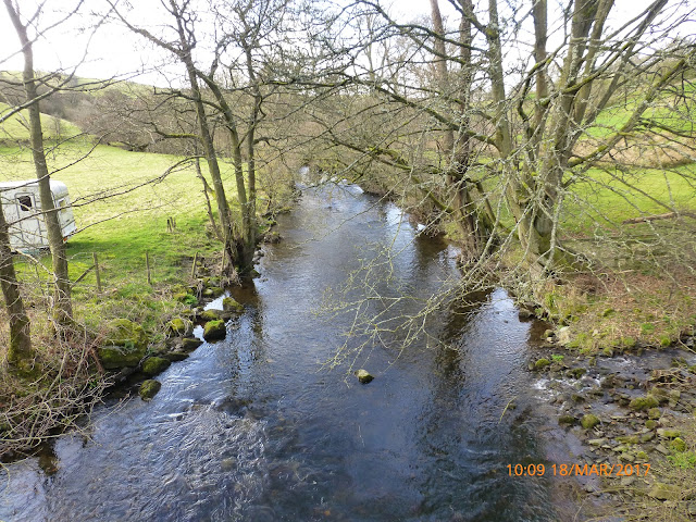
The easy part of the walk.
The River Dee from Llangollen.
A male Mandarin Duck on the Dee at Llangollen.
Looking across the Dee valley towards the Eglwyseg Escarpments.
The River Dee looking East from the Chainbridge.
Dinas Bran from the path contouring around Coed Hyrddyn.
"When is it my turn?"
Walking along the Clwydian Way.
Coed Hyrddyn (Velvet Hill) and the Llantysilio Mountains from the Clwydian Way.

Valle Crucis Abbey from the Clwydian Way.
The path around the Eastern side of Coed Hyrddyn.
Walk stats: Distance: 9.1 miles. Climb: 1483'.
Time: 5 hours 7 minutes. On the move walking average: 2.3 m.p.h. Overall walk average: 1.8 m.p.h.
Group: Martyn, Jim, Phil, David S., Roger, Sue and Dave P.
This turned out to be a better day than forecast weather wise. It was much warmer and Sunnier than expected and we only had brief encounters with a cool wind and that was mainly as we ha lunch!
 We started by heading for Llantysilio Church, hoping that the Snowdrops would still be in flower, alas they weren't but the bright yellow Daffodils did their best to compensate.
 The river was still quite high and there was still much evidence of tree trunks and debris trapped on the Horseshoe Falls.
 Following the gentle stroll along the towpath in to langollen, we had our first climb of the day as we headed for Bryniau-bach and Bryniau-mawr on he way to Berwyn Halt.
 Lunch was taken at Llantysilio Green, where we took advantage of available the pic-nic  tables, even though we couldn't find one that was sheltered from the at times quite strong wind.
 Having completed five miles at lunch, three of the group decided that was far enough for them and set off for home. The rest of us decided to head for Valle Crucis Abbey via Coed Hyrddyn and explore part of the Clwydian way before returning to the cars.
 Some of the views today were superb, especially along the Dee Valley, parts of Trevor Rocks and the Eglwyseg Escarpments and the Llantysilio Mountains.
 No Snowdrops, but Celandine were out and blossom was appearing on some of the trees.
 Birds seen or heard today included: Blue tit, Great tit, Common blackbird, Dunnock, Mallard, a pair of Goosander, a pair of Mandarin, Grey wagtail, Common buzzard, Common pheasant, Common chaffinch, Wood nuthatch, Woodpigeon, Black-billed magpie, Eurasian jay, Carrion crow and Jackdaw.
 Overall a very enjoyable walk. After walk drinks were enjoyed at the Pant-yr-Ochain at Gresford. Castle Rock's Stout and Purple Moose's Snowdonia Ale both went down well..